Mountain Walks – 2017
Click on any image to see a larger version
4-5 Jan 2017 –
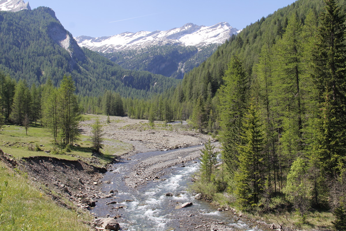
New England National Park, West of Dorrigo NSW
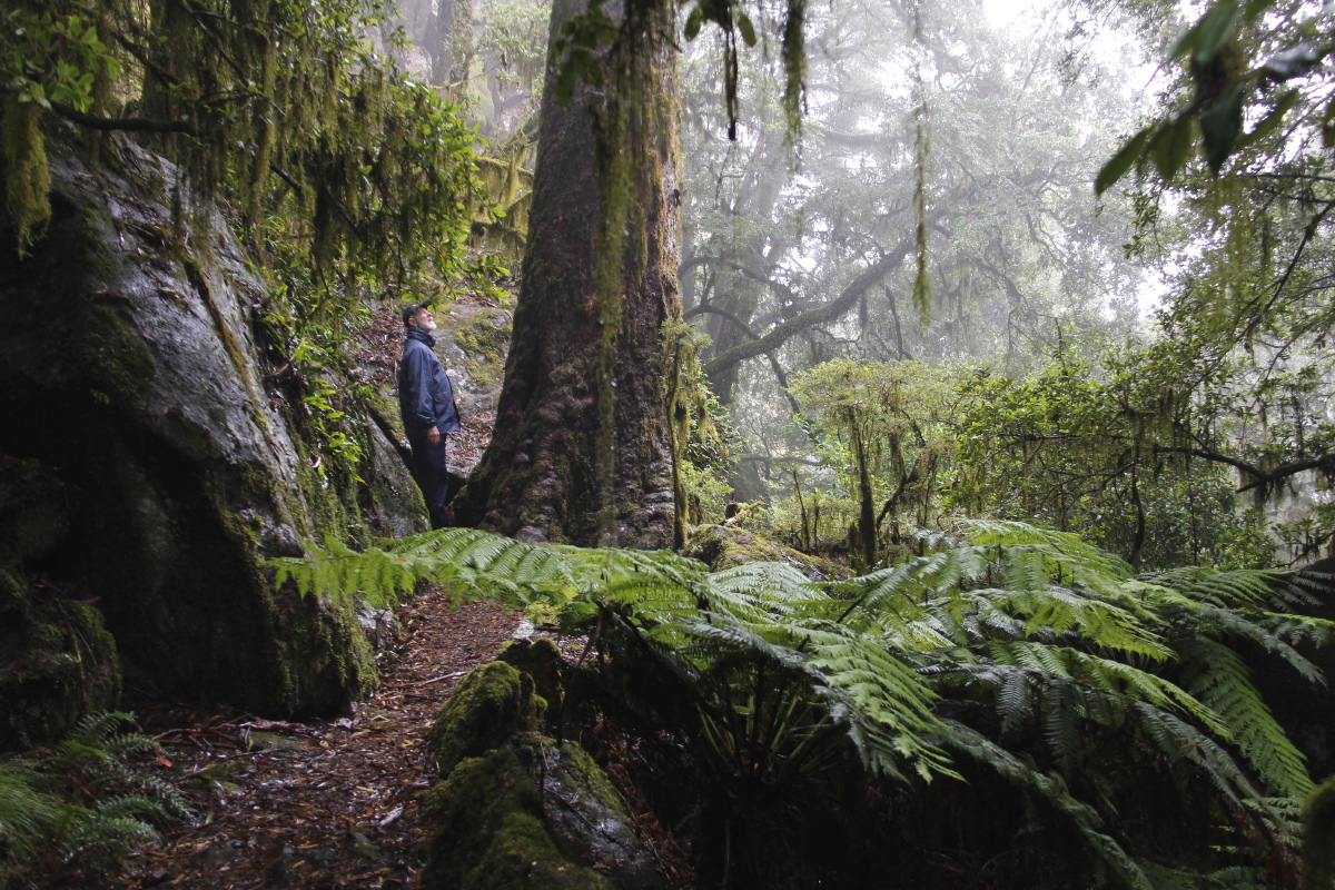
A quick 3-night / 2-walk visit to Gondwana warm temperate rainforest, on the
escarpment, at 1250-1550m, organised by Linda's sister, Georgie and Margaret.
We stayed at Tom's
Cabin (centre of the second map), and walked to both Point Lookout (top-left)
and Wright's Lookout (top-right). It rained much of the
time, and misted all of it. Which are perfect conditions for the location.
|
|
|
|
The Park is west of Coffs Harbour
via Bellingen, Dorrigo and Ebor |
The Lyrebird Walk is on
the outer side of the escarpment,
mostly beneath the cliffs |
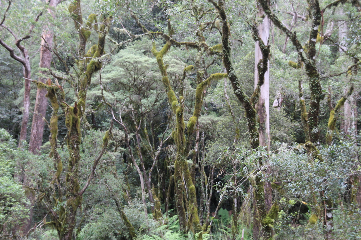
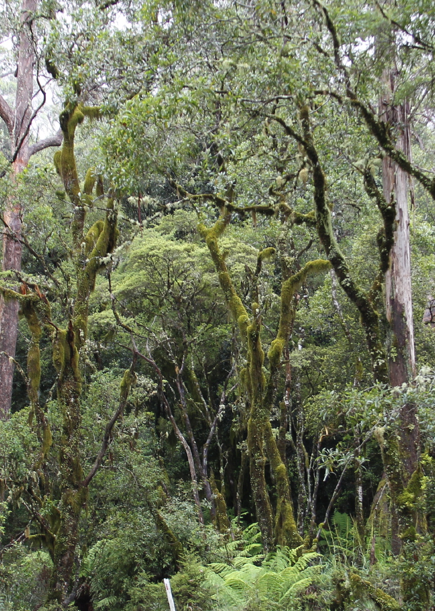
Mossy trees, outside
the cabin we'd hired |
And a closer view |
|
|
|
|
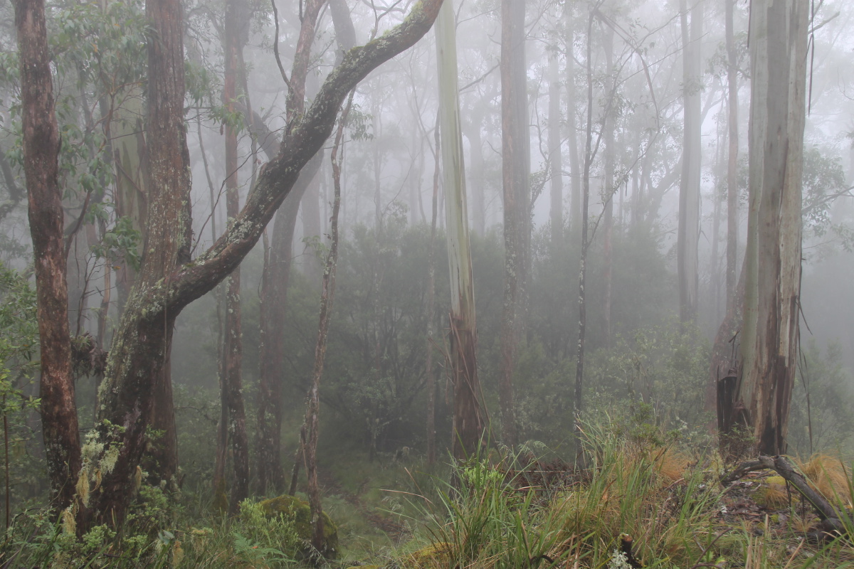
Wet sclerophyll forest ... |
... just above the escarpment |
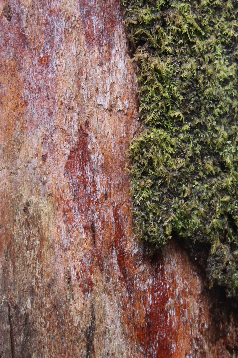
Lush trunk moss |
Even the small plants
form a forest |
|
|
|
|
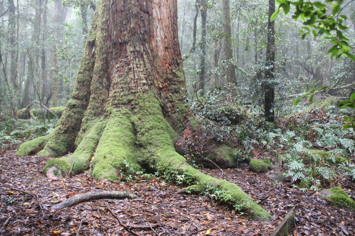
A standing giant |
A fallen giant |
Moss and track |
Moss and roots |
|
|
|
|
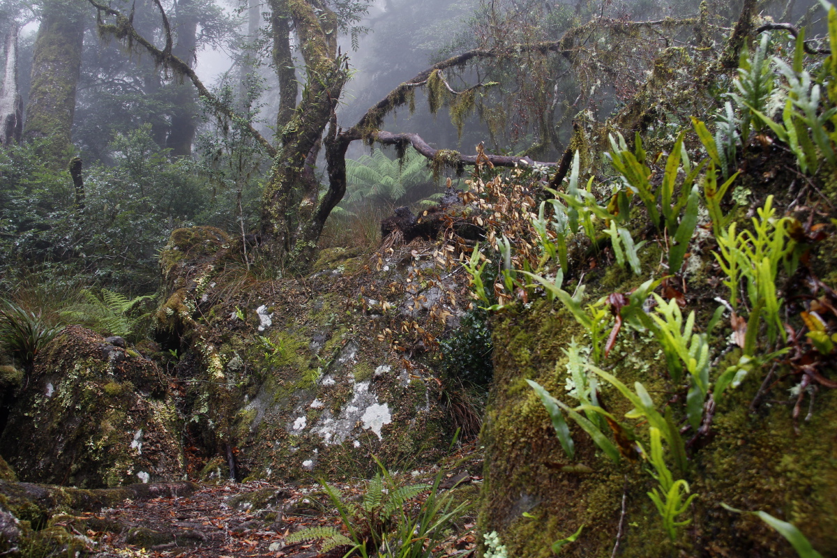
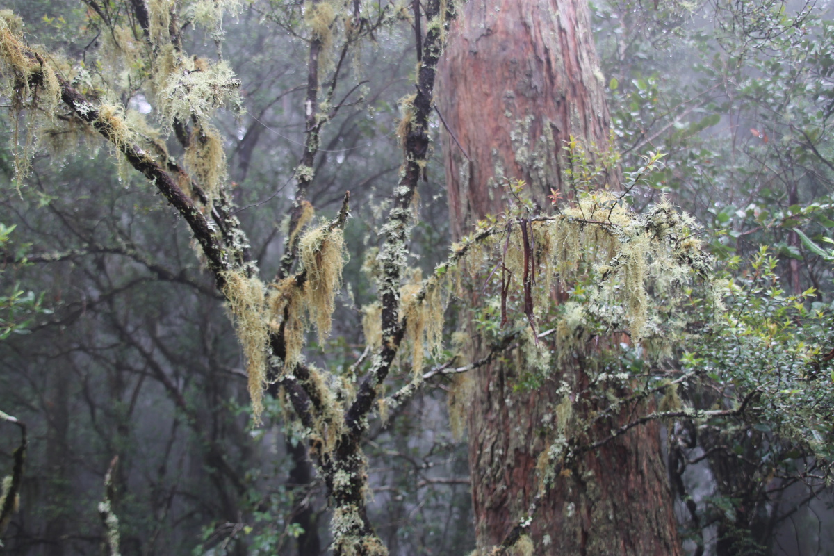
Rocks and friends |
Lichens in abundance |
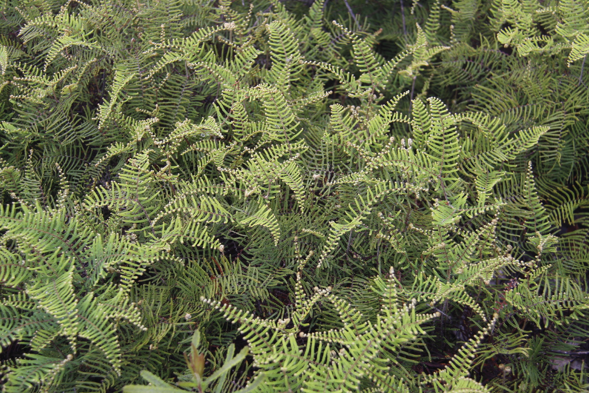
Many ferns, Coral
Fern the prettiest |
With a Juncus species |
|
|
|
|
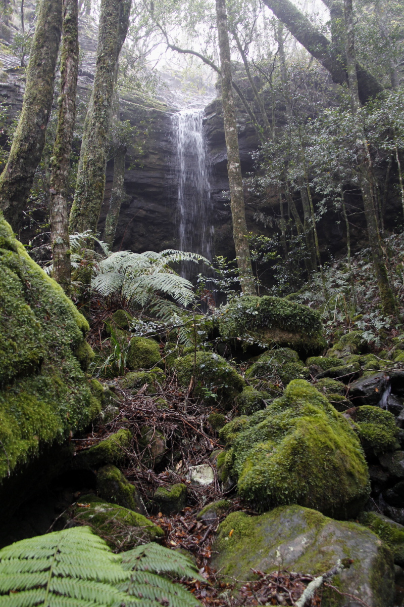
One of several waterfalls
along that section
of the escarpment |
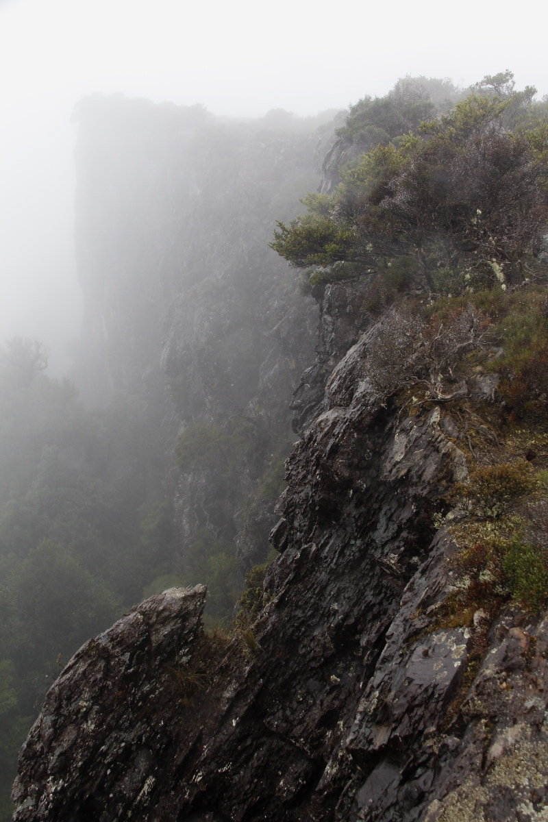
A 'view' from
above the lip |
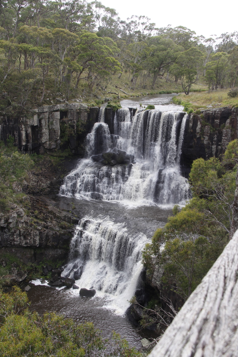
Ebor Falls,
north of the Park,
on the way home |
The view out Georgie
and Margie's front
window at Mylestom |
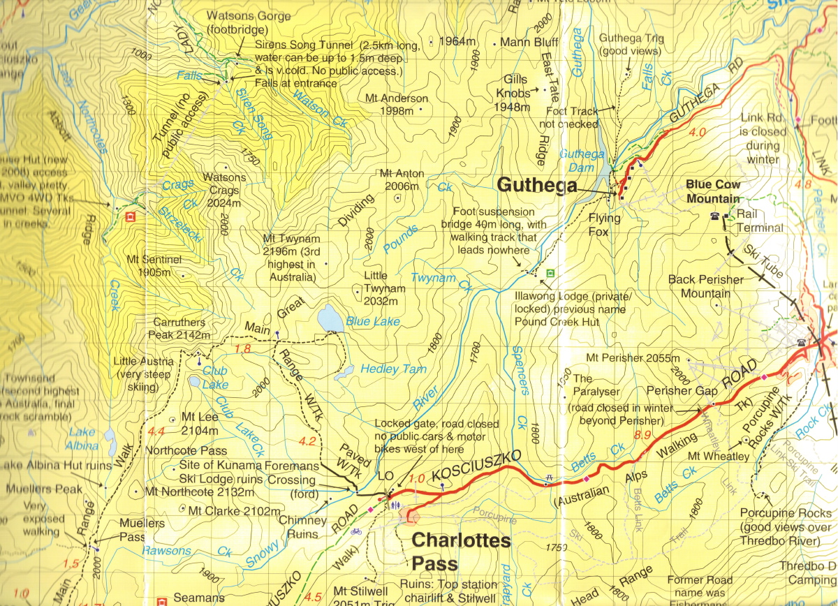
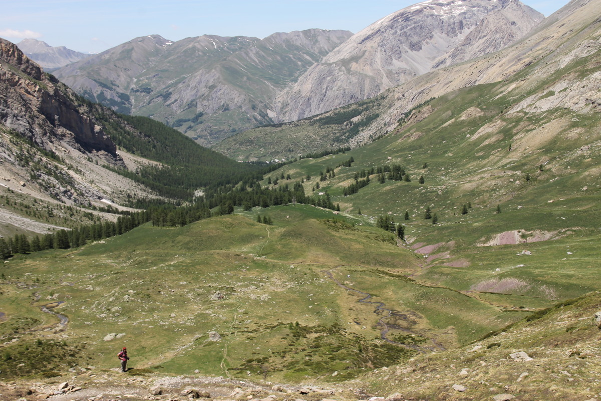
17-18 Feb 2017 – The Main Range, Snowy Mts NSW
Two days of short walks at the top of the Alps – the Rams Heads and
Blue Lake / Hedley Tarn – preparing for Linda's walks for
Aust Native Plants Society walks in Summer 2017-18
I've also included preparatory notes for a huge walk that we haven't done, Hannells Spur Walk.
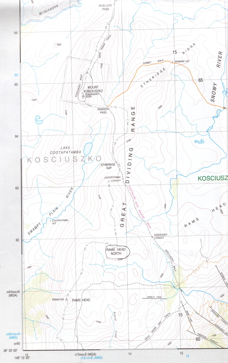
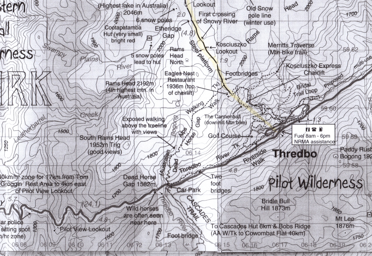
Fri 17 Feb 17 – The Rams Heads – 6km, c.250m
(1930-2140m)
From the top of the Thredbo chairlift, 600m N along Thredbo-Kosciusko track,
200m W on the Dead Horse Gap track, then NW up the waterline. Then to the E
of Rams Head North, NW, then E over the ridge, and diagonally down to Kosciusko
Lookout.
|
|
|
|
The 1:25000 map |
A 1:50000
commercial map |
|
The Ramshead, above
the Chairlift |
|
|
|
|
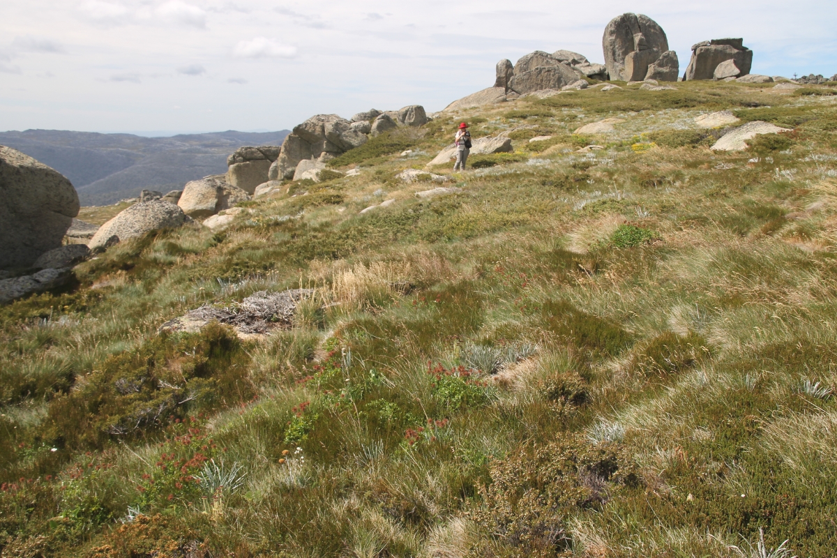
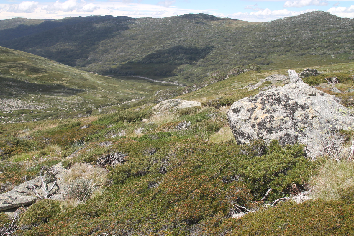
Up the herbfields
beneath the range |
Alpine heathland |
Along the range |
Admiring rocks
and vegetation |
|
|
|
|
Plenty of weathered
rock features |
And of variations
in vegetation |
Another Ramshead |
On the exposed feldmark,
50kph winds,
looking S to Vic |
|
|
|
|
Looking across
to Kosciusko,
100m above us |
A photogenic peak
in the Ramshead range |
Dropping back down
to the Koscisuko track |
Looping back,
above Thredbo valley,
beneath threatening skies |
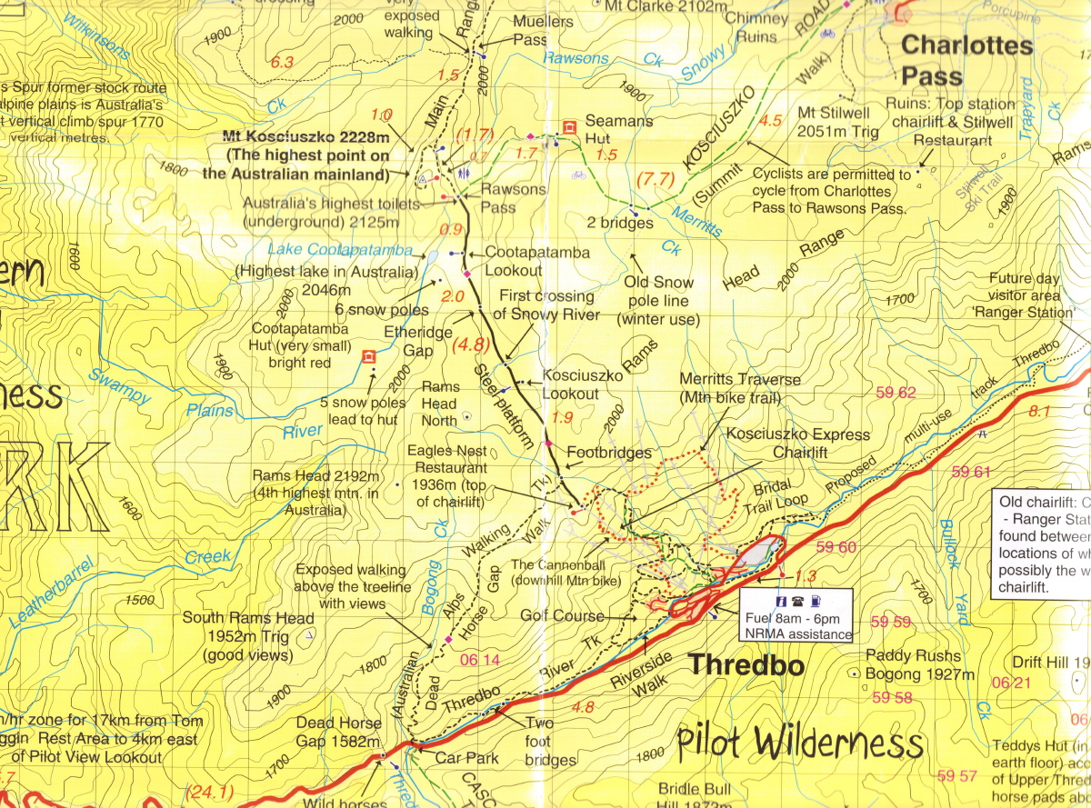
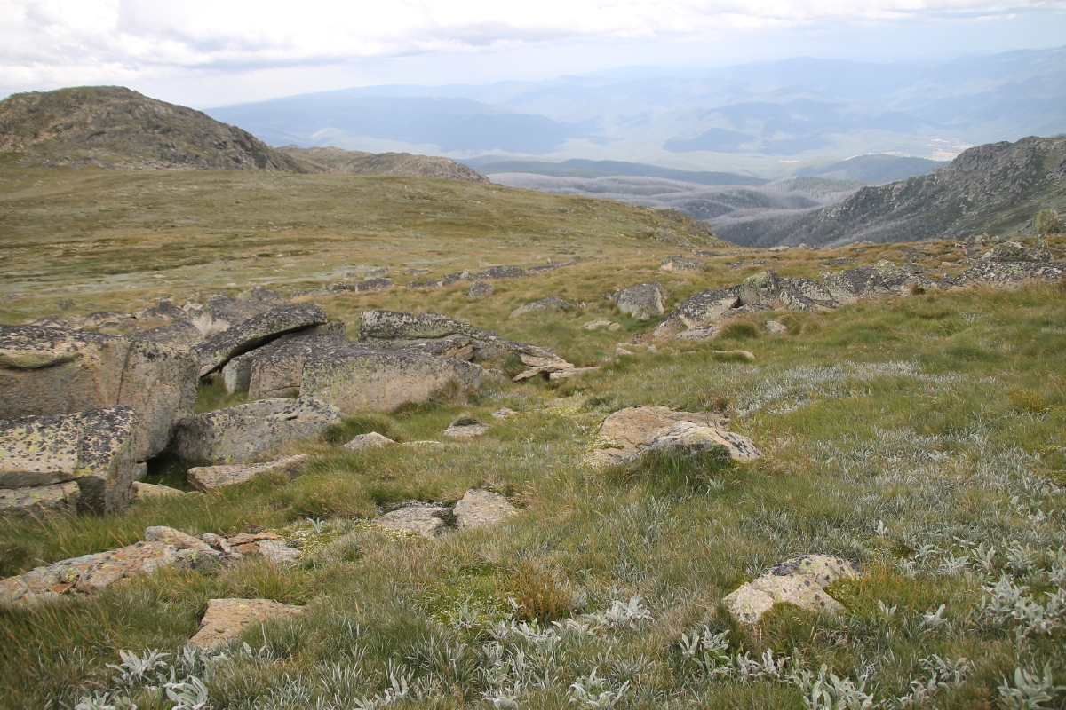
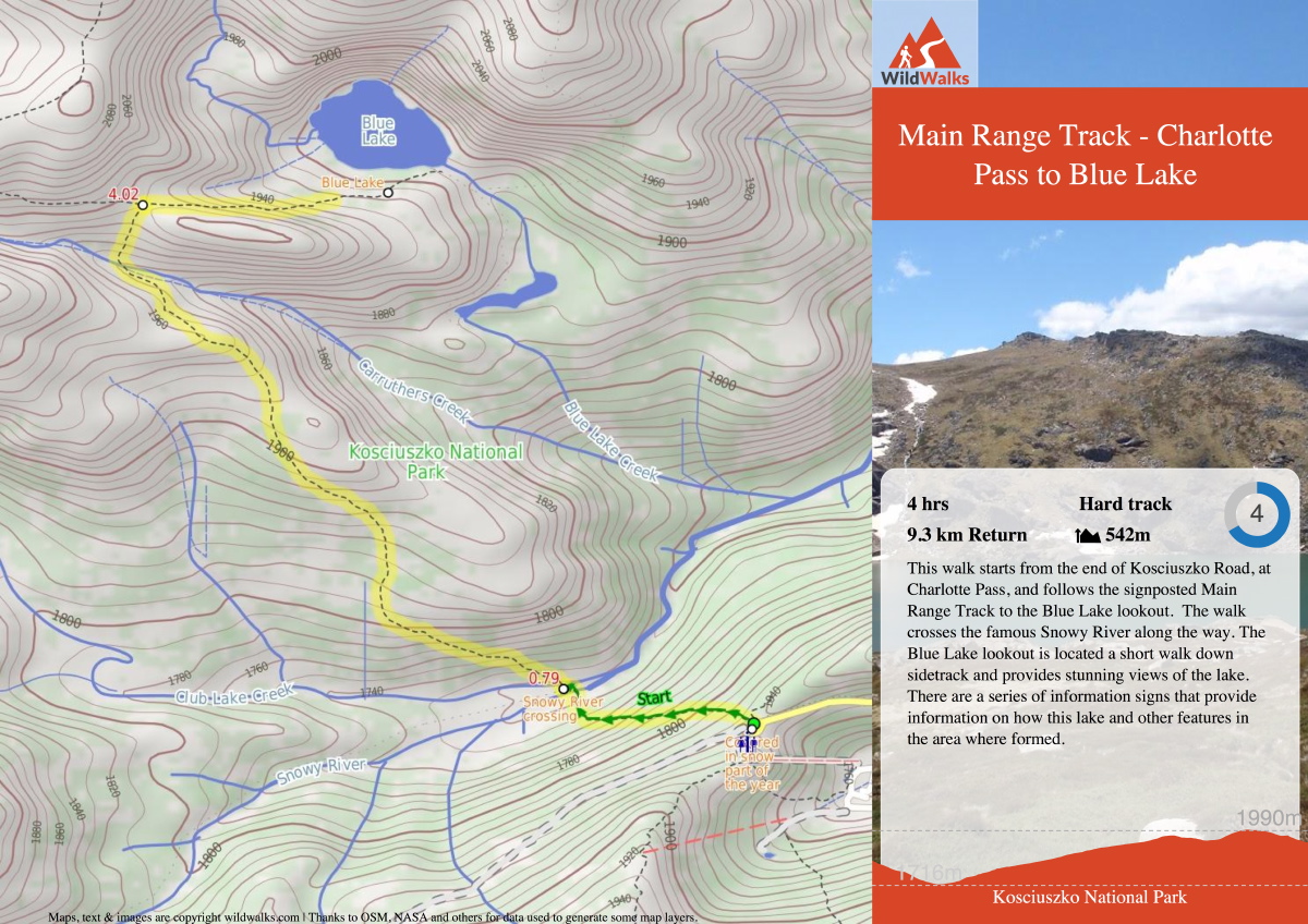
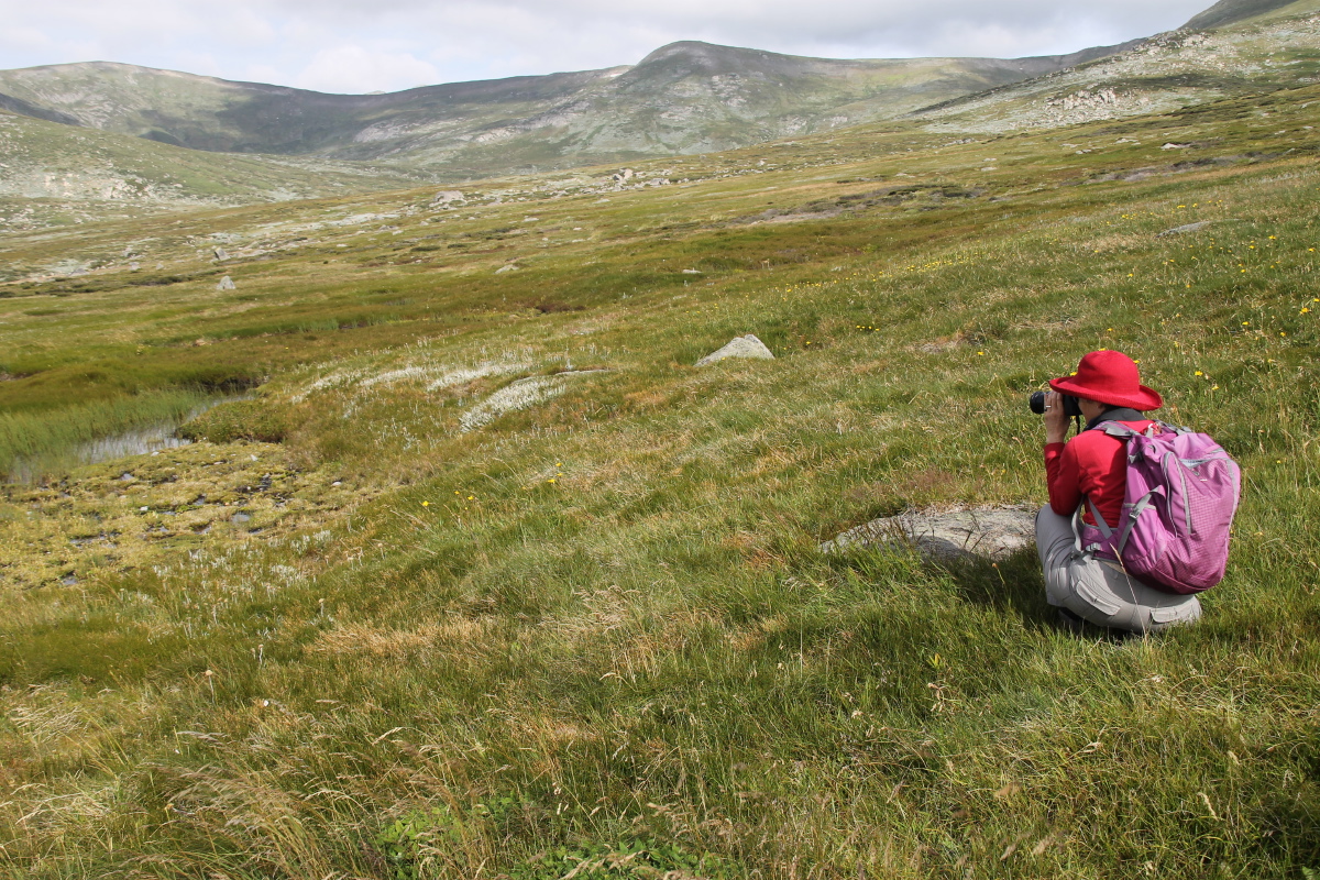
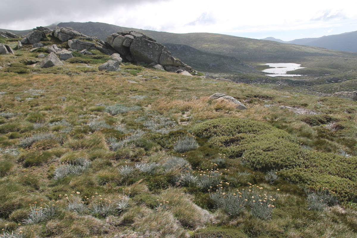
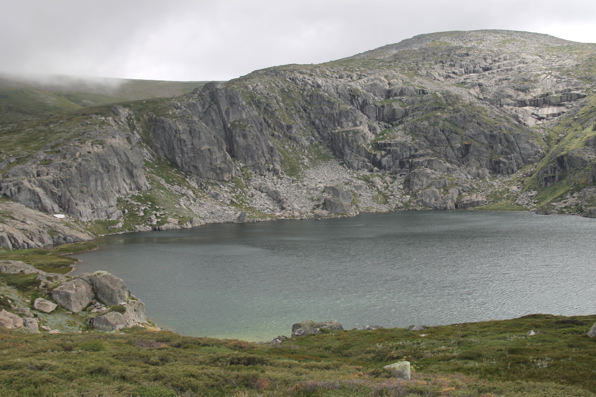
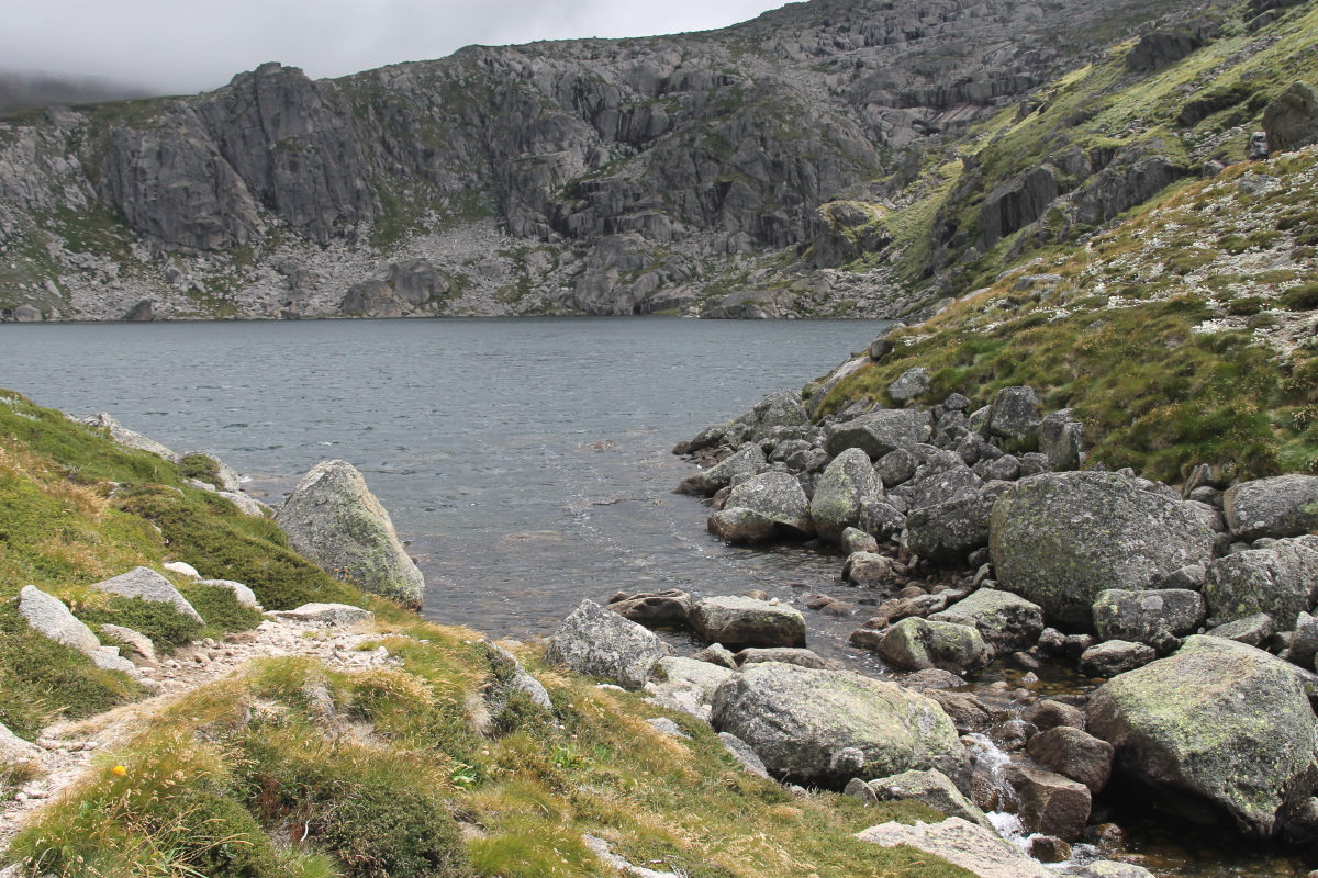
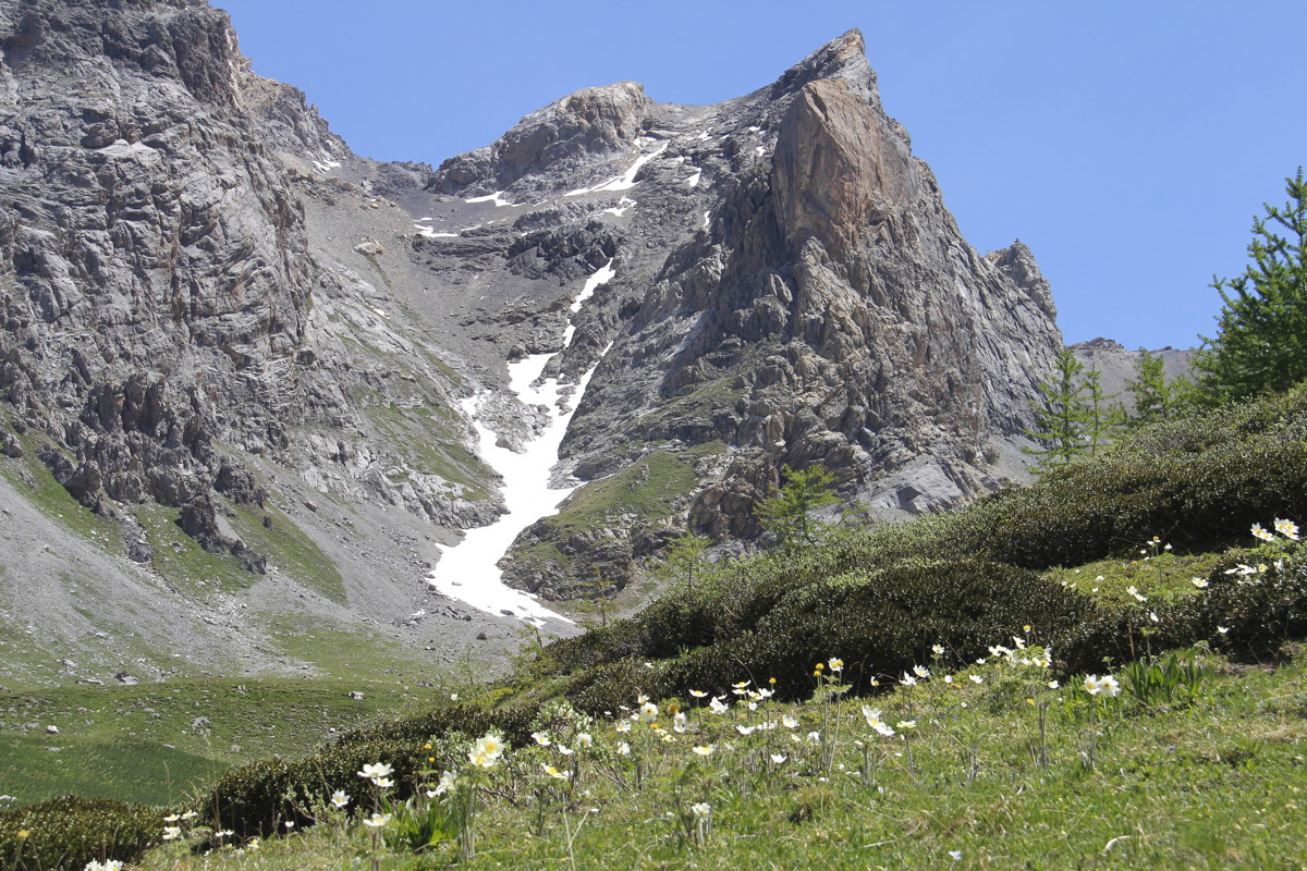
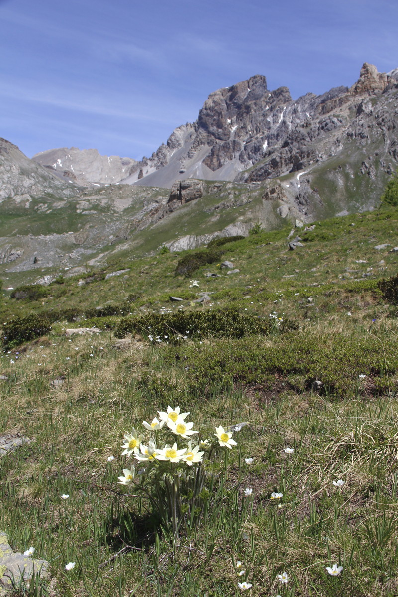
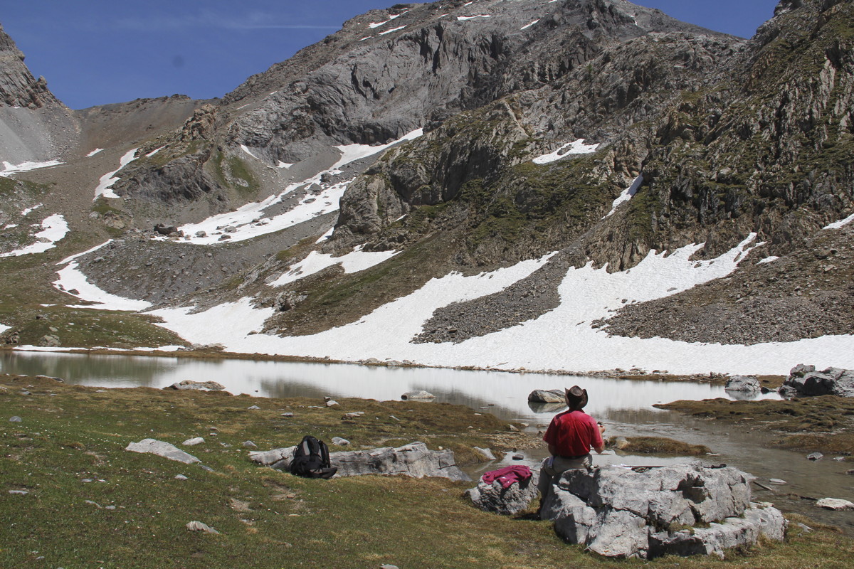
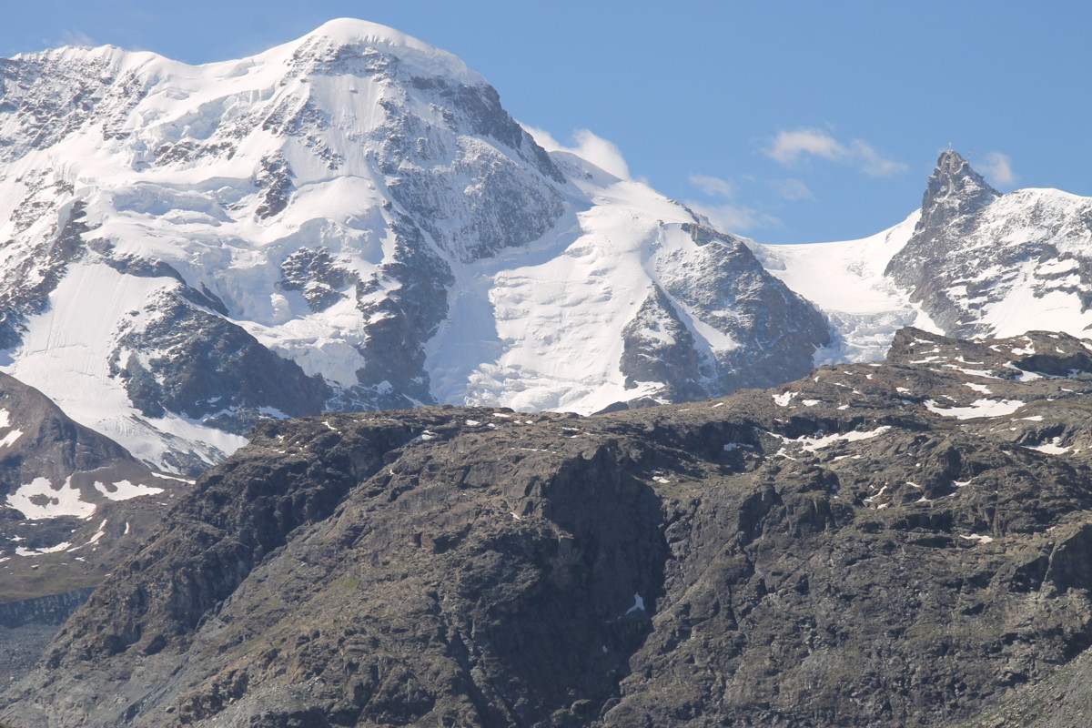
Sat 18 Feb 17 – Blue Lake, Hedley Tarn – 9km,
c.500m (xxxx-1990m)
From Charlotte's Pass, W along the Main Range Track steeply down to the Snowy
River crossing, NW 4km until the Blue Lake Walk, then down to Blue Lake. Then
S and SW using an unofficial track to Hedley Tarn, lunch, then off-track SW
across Carruthers Creek, SSE diagonally up the ridge, then SW to rejoin the
Main Range Track c.1km above the river.
|
|
|
|
The 1:25000 map |
A 1:50000
commercial map |
WildWalks' map |
|
|
|
|
|
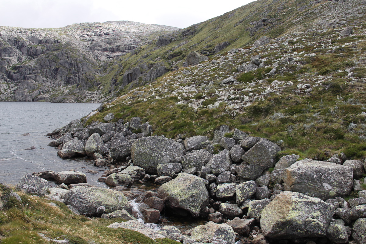
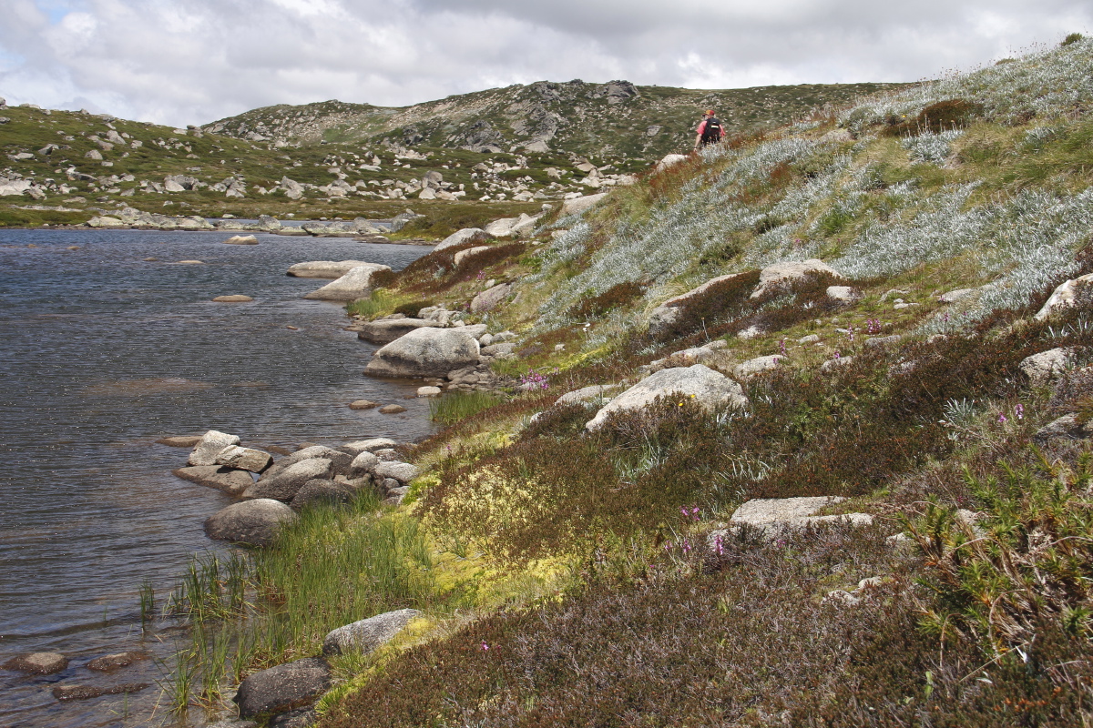
Below Charlotte's Pass;
Clark, Townsend,
Carruthers, Blue Lake Peak |
The Snowy River,
moderate summer level |
Mt Carruthers |
Hedley Tarn, looking
E from the
Main Ridge Path |
|
|
|
|
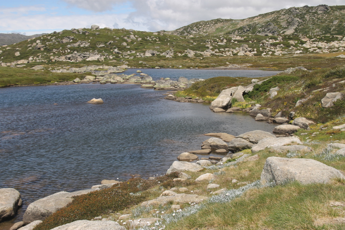
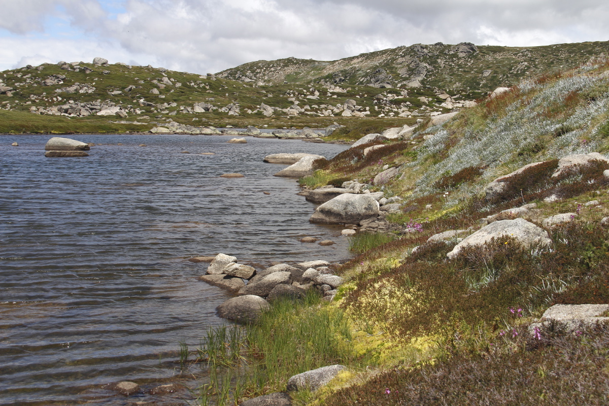
Blue Lake, best
moraine lake in Oz
west end ... |
.. centre ... |
... east end ... |
... and flowers |
|
|
|
|
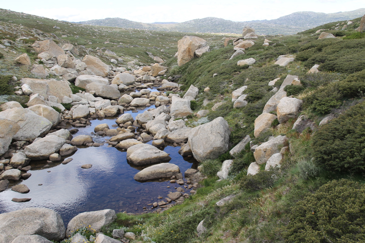
Blue Lake Ck,
just below the lake |
Further down,
towards Hedley Tarn |
The very photogenic Tarn ... |
... again ... |
|
|
|
|
... and again ... |
... and from
the lunch-spot |
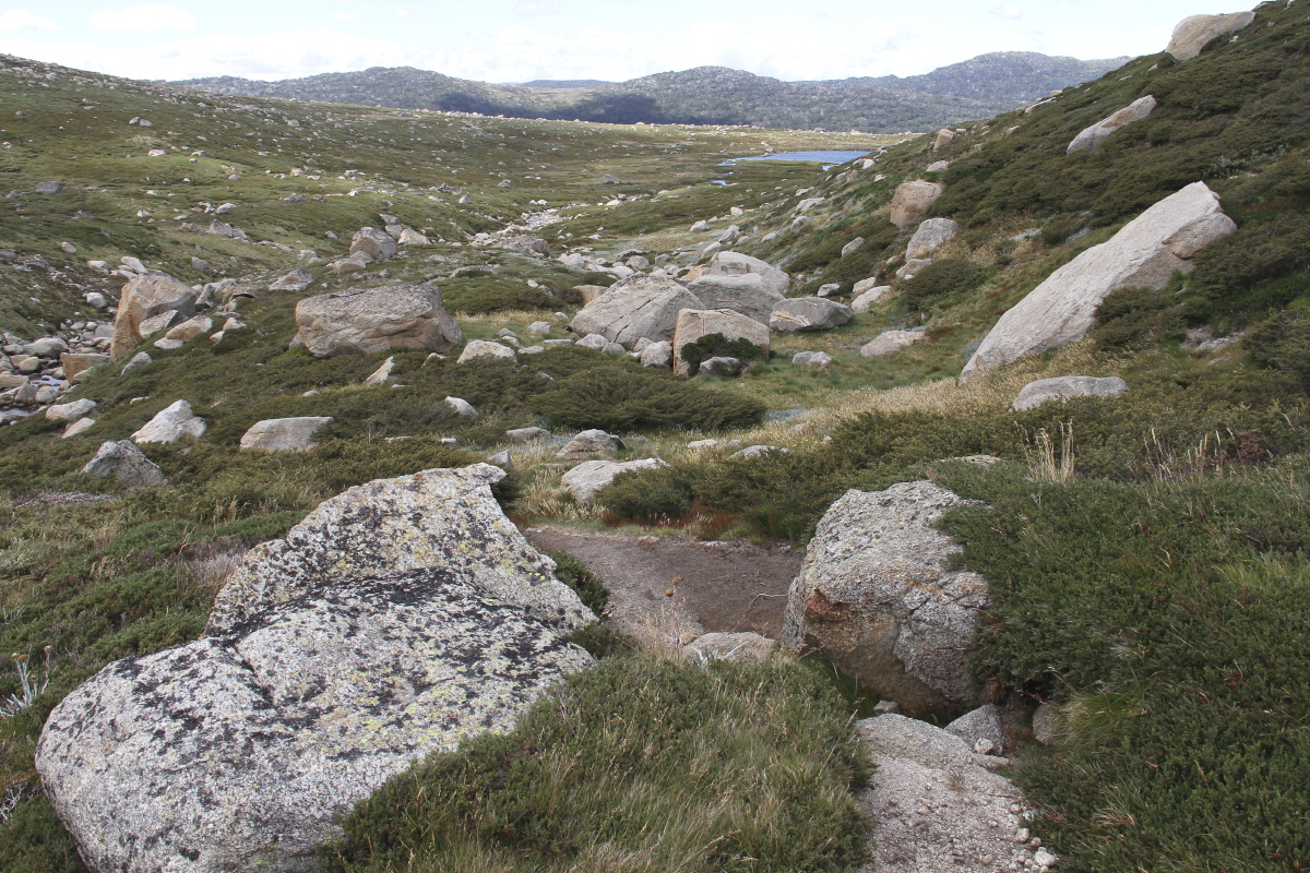
At Carruthers Ck |
And looking up it |
|
|
|
|
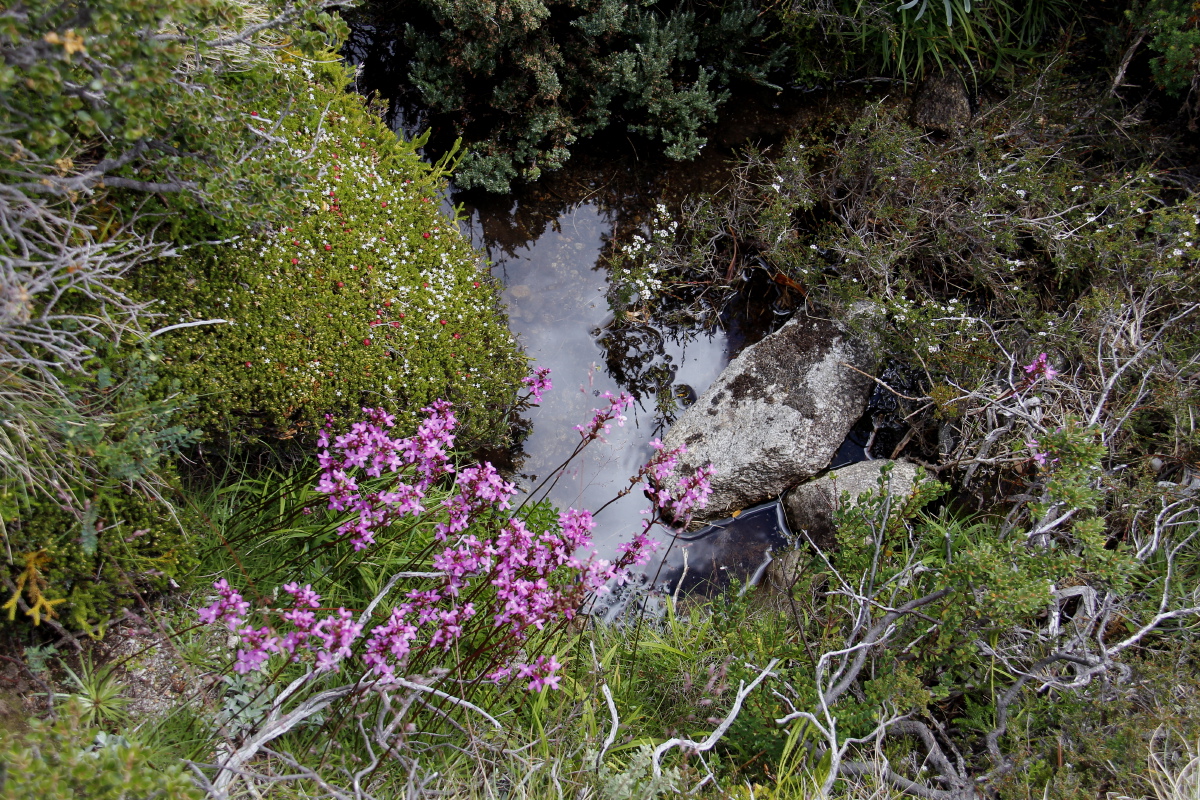
Looking up a waterline
to the ridge to the W |
And the pool at the
photographer's feet |
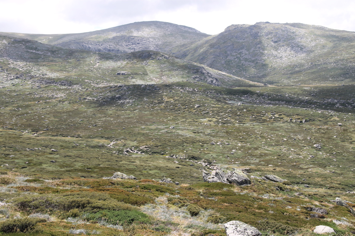
Looking N from the
ridge, Twynam above
the Lake, Hedley
just visible on right |
Looking E from the
ridge, over the Snowy,
Mt Guthrie high right |
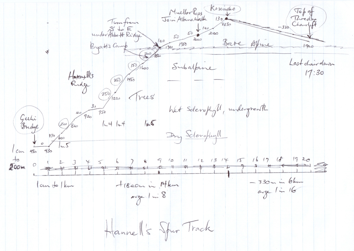
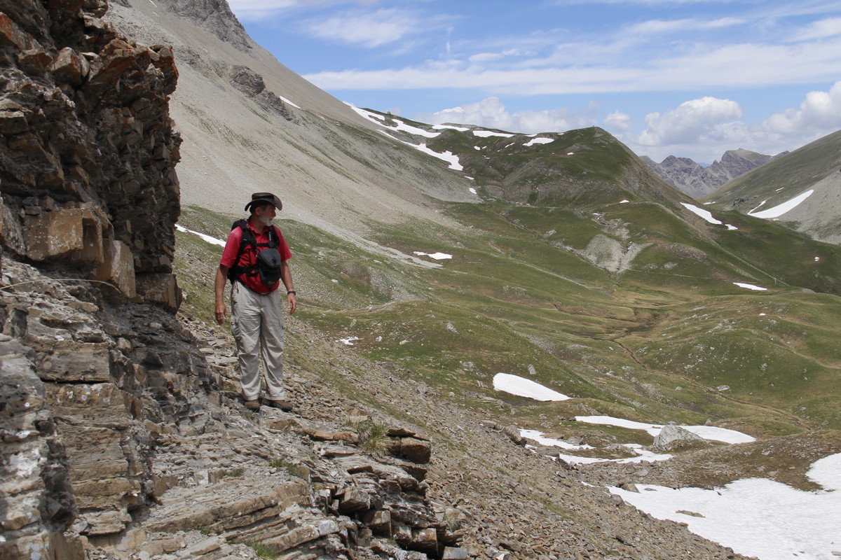
Hannells Spur Track – So Far a Dream, not a Reality
This is the highest vertical path on mainland Australia, from Geehi Bridge
+1800m / 14km up to Kosciusko, -300m / 6km to the top of the Thredbo chair-lift,
and a further -600m / 5 or 10km to Thredbo Village. Allow 12 hours.
The problem is that the first 2/3rds up to join the Main Range Track isn't marked, and half of that is dense undergrowth.
To add to the mystique, it's the track Strzlecki took when he became
the first whitie to reach the summit in 1840.
Some reports suggest he did up and back in a day – which is dubious. Others
mention a camp-site up high, possibly with a late-night return on the second day.
It's definitely only for seasoned and organised walkers, and requires a very long day or a night on the mountain.
Don't forget that it's a serious mountain-range that makes its own weather, and full warm-and-dry kit is essential.
And you need to car-pool at Geehi and Thredbo, or spend a night in Thredbo
and thumb a ride back to the car.
|
|
|
|
|
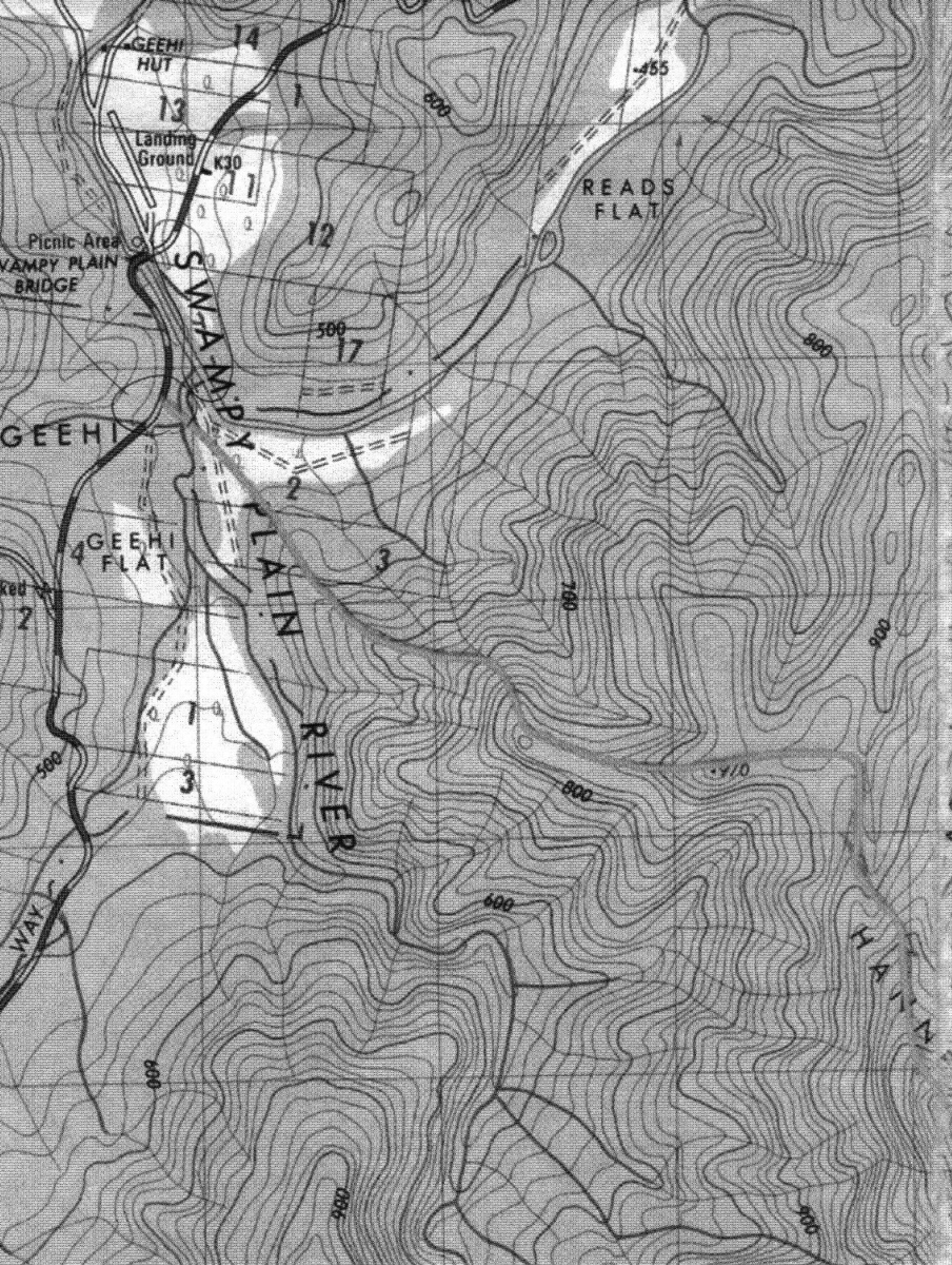
Start at Geehi Bridge,
which is along Alpine Way
beyond Dead Horse Gap.
Angle up the spur, then the
Main Ridge Track to Koszi,
then the Thredbo Track to
the top of the lift |
The 1:25,000 segment for
the first 4km to the Spur |
The 1:25,000 segment for
the unmarked steep part |
A 1:50,000 of
the first half |
A 1:50,000 of
the much-travelled second half.
The Thredbo lift
closes too early,
so it's 10km down the
Dead Horse Gap Track
or 5km down the ski-slopes |
Europe – 1 June to 4 Jul 2017
Roger was (modestly) crook for 6 weeks until shortly before we left Australia,
and Linda also for 2 weeks. So we arrived without the same degree of preparation
for walking that we've had in previous years. (This was a particular problem
for Roger, because each year he has to gear up from a low base). That's the
primary excuse for us starting with mere 550m-700m walks, and only getting back
to 1000m walks for the last 2 of 12 (although increasing age might not be completely
irrelevant – the total of 120km and just under 7km vertical
looks a bit puny compared with the 185km and 12km vertical
that we did in the 2016 epic.
1 Jun 2017 – Flumet – 4.5km, +/-300m
Last year, after flying from Canberra to Zürich and driving south past
Chamonix into the French Alps, we walked from our Chambres d'Hotes up about
250m, to shake away the jet-lag cobwebs. This year, we drove the car up to the
same height above the same B&B, and walked the remaining 300m to the top
of the ridge, La Crête du Sciozier, 1650m. You sleep well after 42 hours
bed-to-bed, including a 5-hour / 380km drive through the Alps and a 300m walk,
followed by dinner and a glass or two.
We've included a couple of shots taken the following morning from 50m above
the B&B – because Le Mont Blanc was visible in the morning, whereas
it wasn't the previous afternoon. (This was followed by 6 days touring in the
Avignon triangle plus 2 days of driving, hence the break before the next walk).
|
|
|
|
N to the valley,
halfway up |
The slopes opposite |
From the Crête ... |
... N up the valley |
|
|
|
|
La Crête from below
in the morning light |
The valley from
the Chambres |
Le Mont Blanc |
The valley |
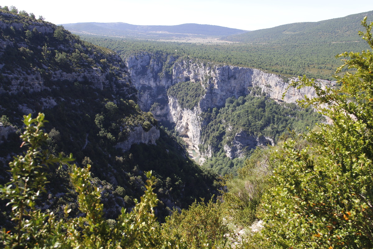
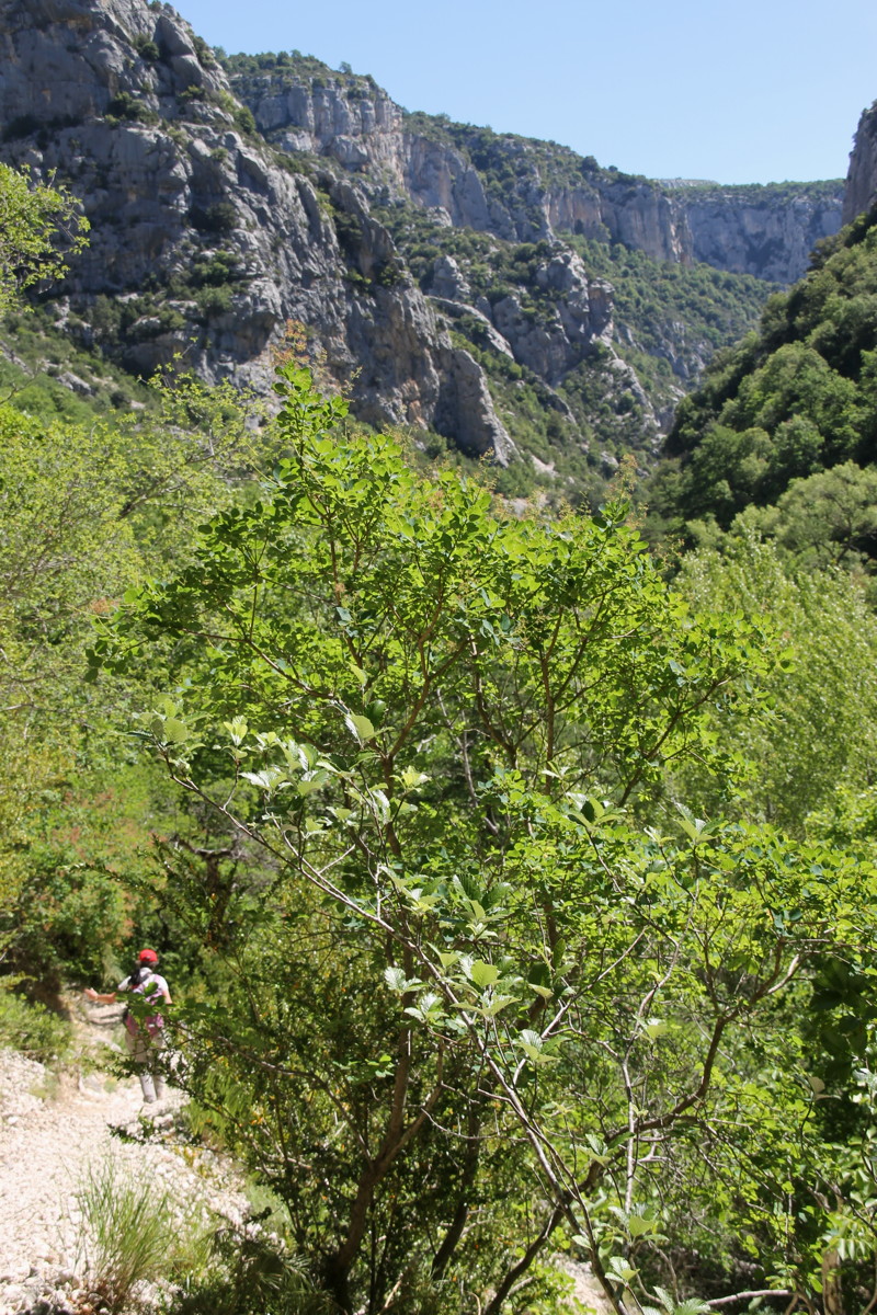
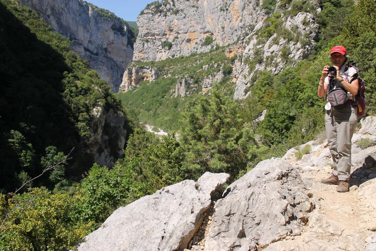
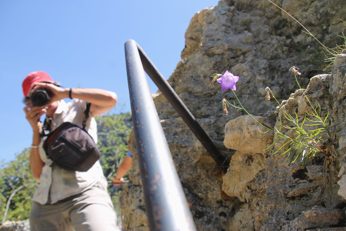
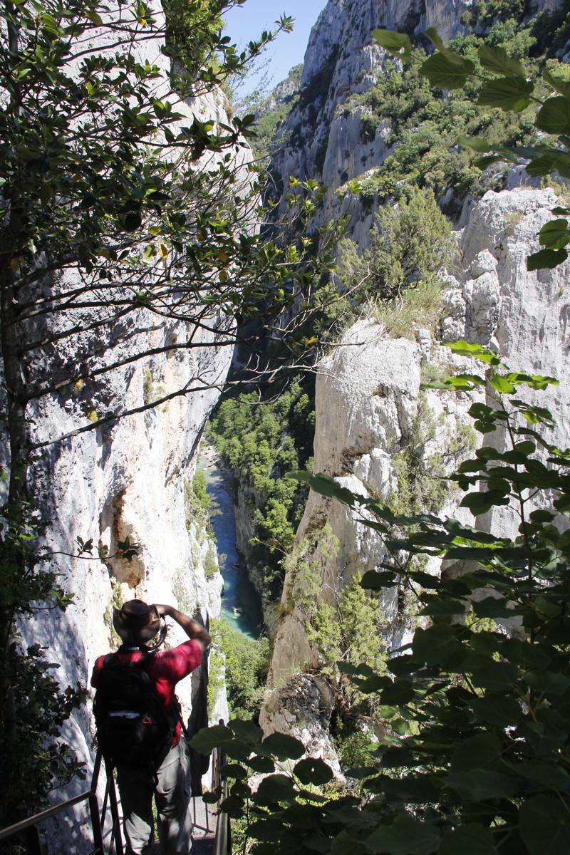
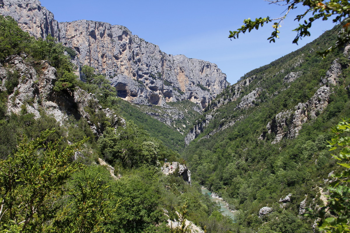
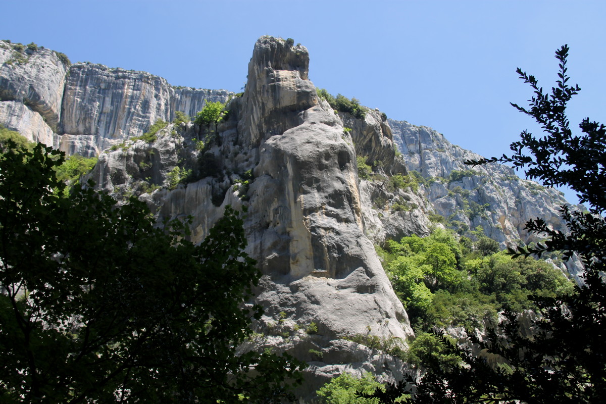
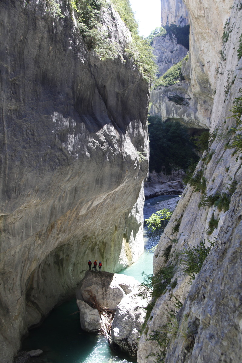
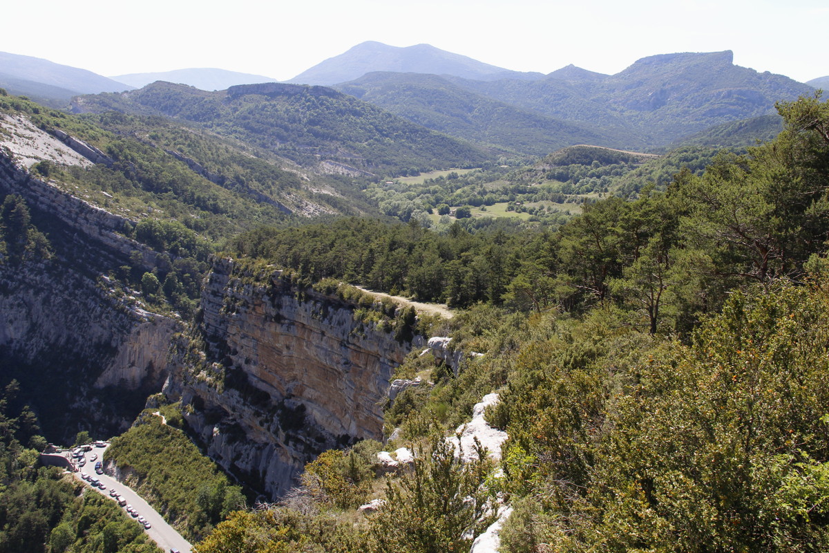
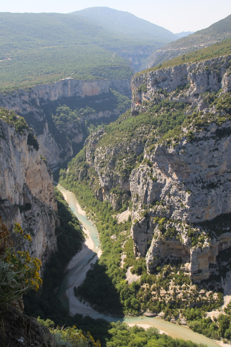
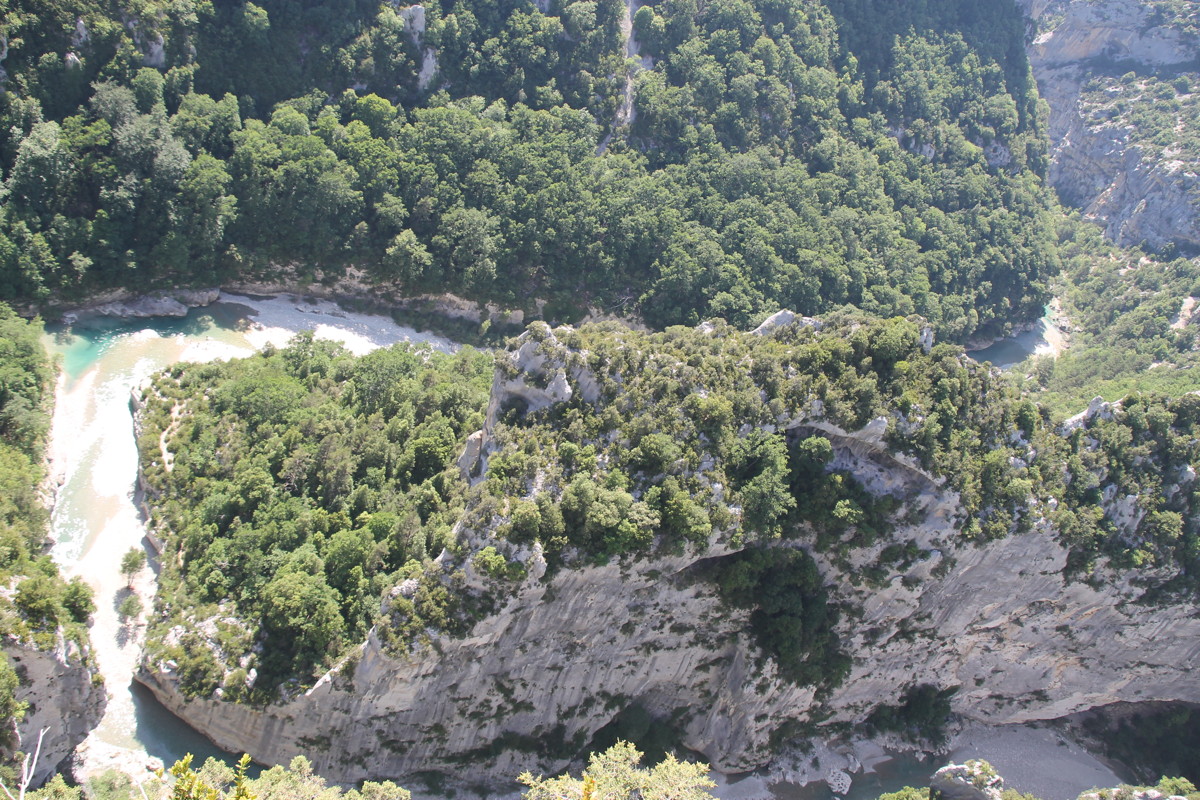
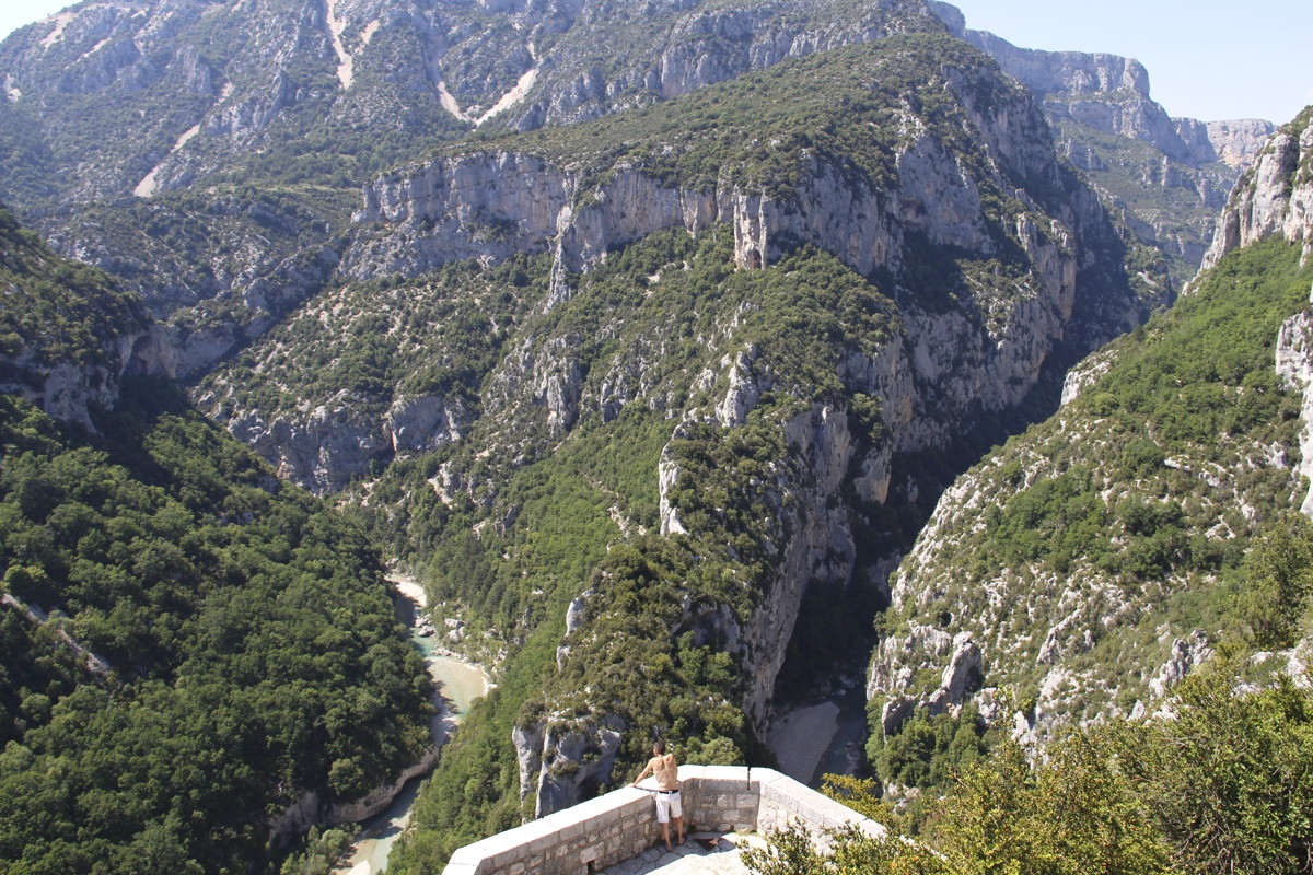
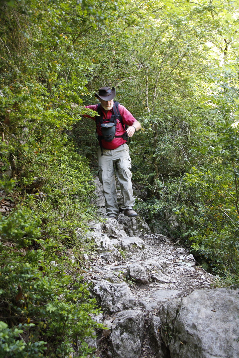
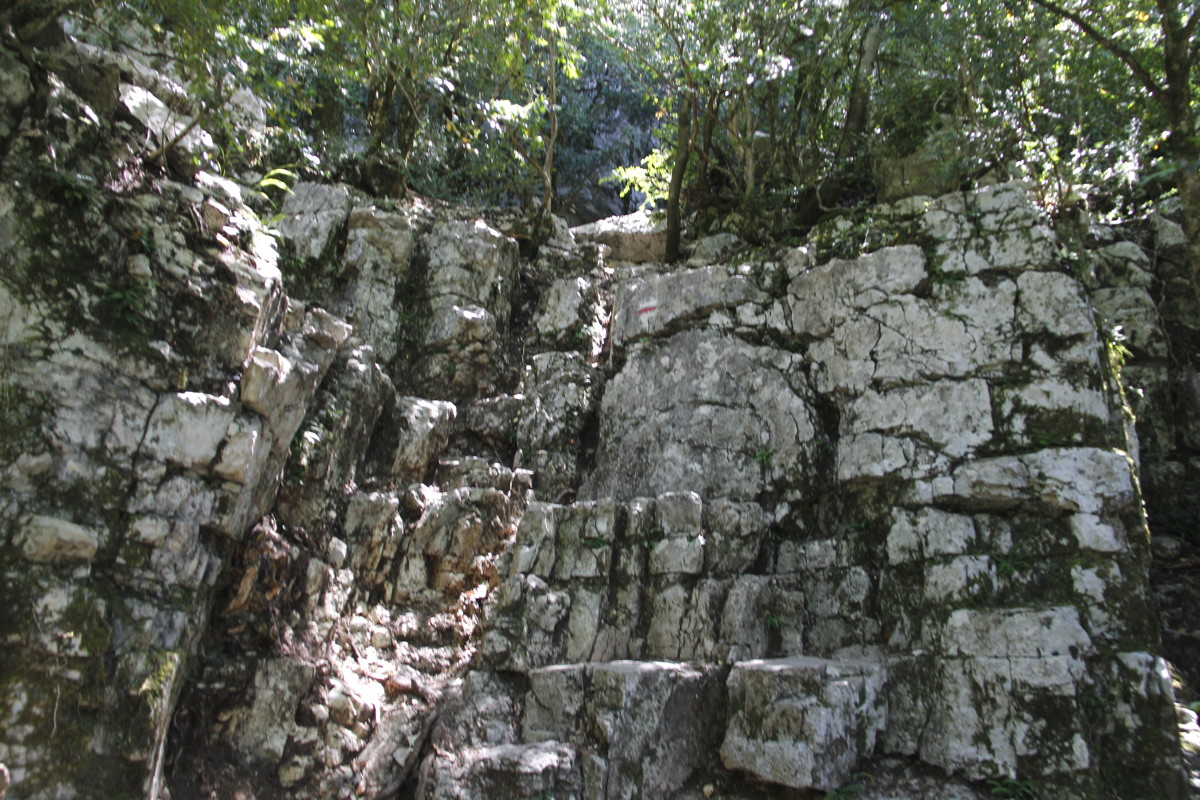
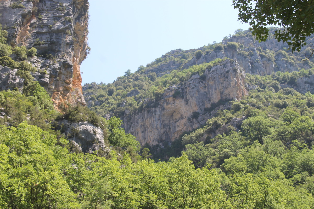
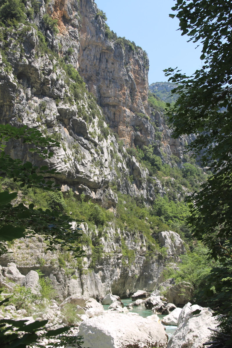
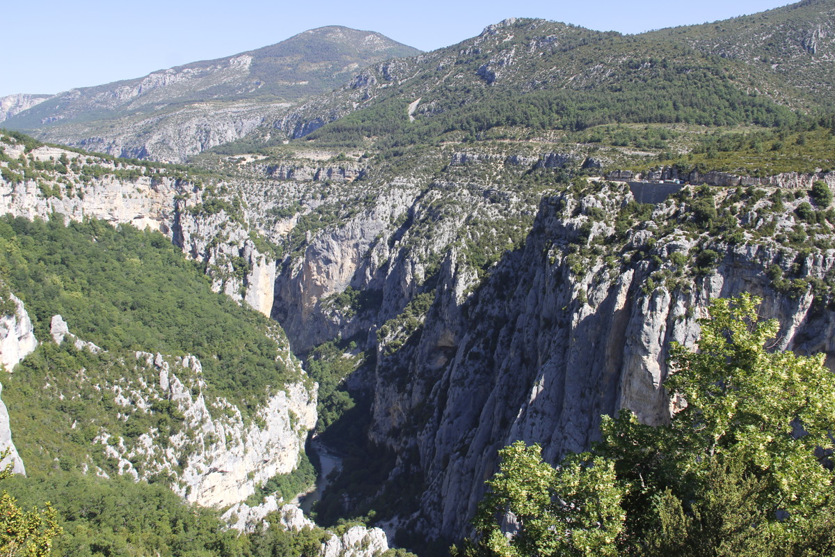
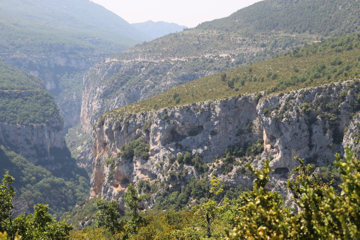
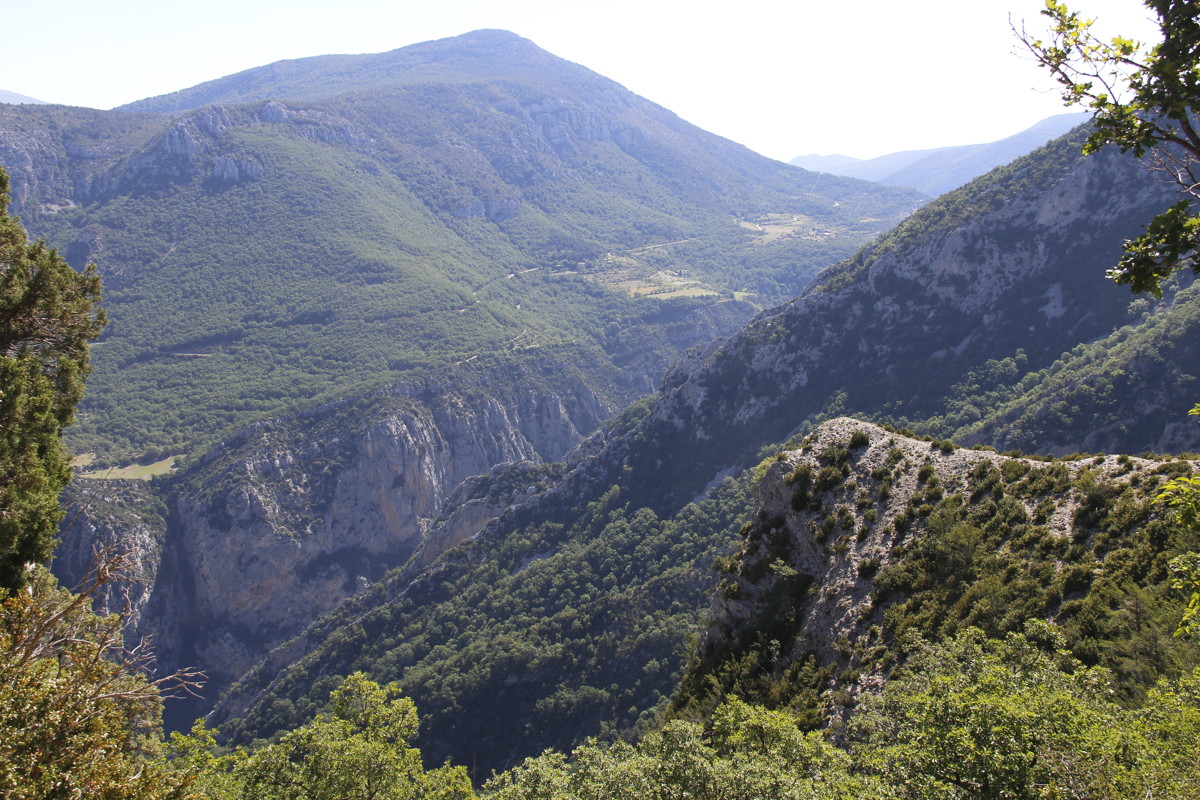
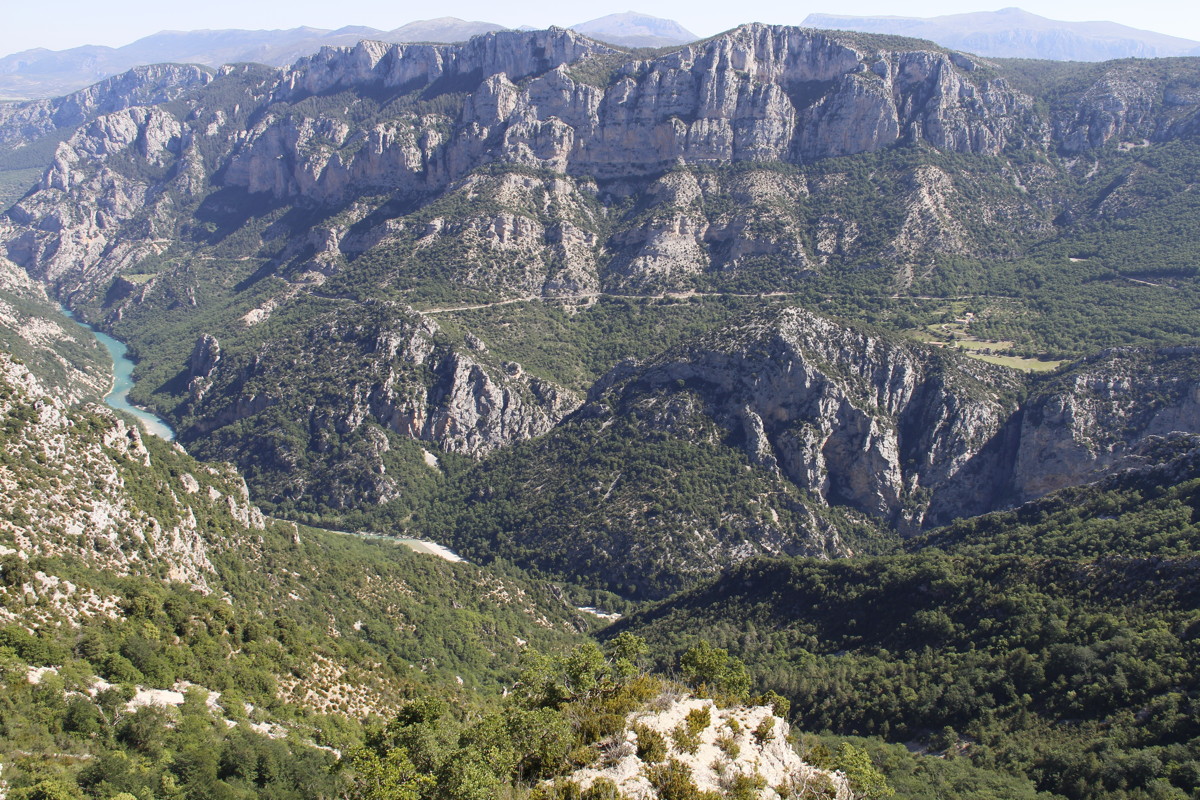
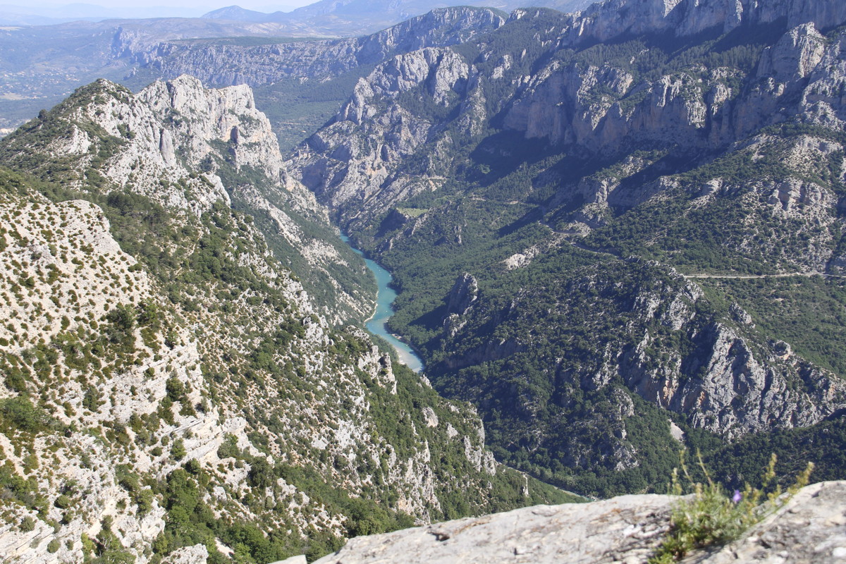
10 Jun 2017 – Gorges du Verdon – 1. Martel
Track, 14km, -680m, +560m
The gorge is just SW of Moustiers-Sainte-Marie, 150km East of Avignon. It's
easily the best gorge we've found in Europe, far more striking than the Tarn
Gorge.
There are choices, but we prioritised the Martel walk, established at the beginning
of the 20th century. It includes not only improved path, but also a couple of
tunnels and a long stairway. We did it south to north (Maline to Point Sublime),
to keep the strong midday and afternoon sun at our backs. The climb back out
was tiring thanks to it being our first walk for the season, and the sun having
taken its toll.
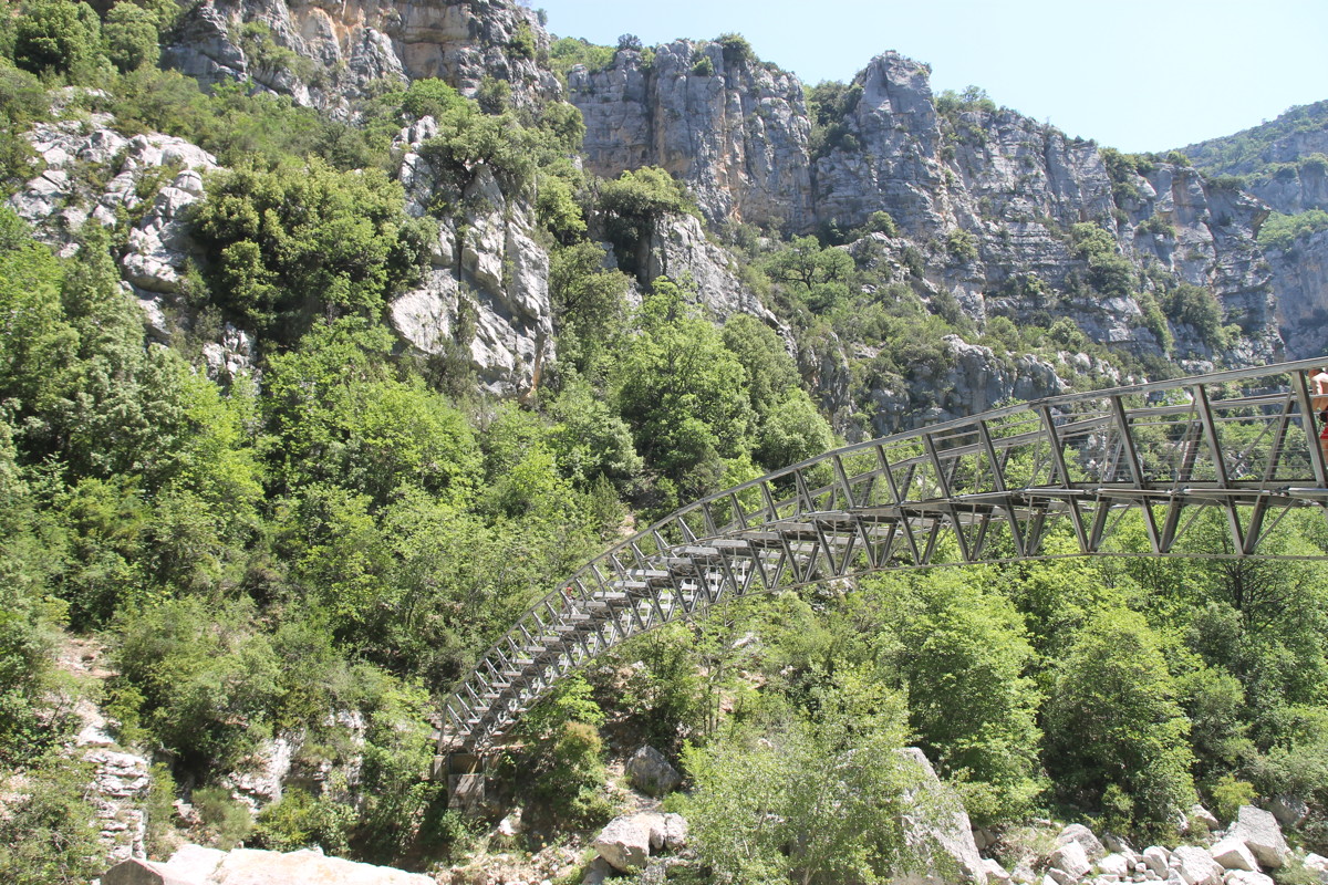
This is a great walk; but not one to do in July-August.
It requires logistical planning, as it's a one-way walk. (There's one bus in
the morning and one in the evening, for EUR 6 p.p. – and we caught the
16:30 back okay. Or order a cab for EUR 33, or car-pool). The final set of 4
photos was taken the following day, from the road above and to the SE.
|
|
|
|
From near the start,
at Maline |
Part-way down
the 250m drop |
At the gorge floor |
Cliffs and path,
looking north |
|
|
|
|
Cliffs and path,
looking back south |
Campanula, on the
wall of a viewpoint ... |
... and the making
of the photo |
The canyon walls |
|
|
|
|
Bréche Imbert's
120m stairway |
The canyon walls |
The wall
at walk's end |
The ogre above the tunnel
(but called Le Duc) |
|
|
|
|
Looking back south |
Water adventures |
After the 180m climb
out to Point Sublime |
The calm above |
|
|
|
|
Looking E towards the
Maline end of the Martel |
The tight bend, as
the gorge switches
from N-to-S to W-to-E |
The Martel stairs
are on the northern
(right-hand-side) slope |
A closer view of
the section with
the Martel stairs |
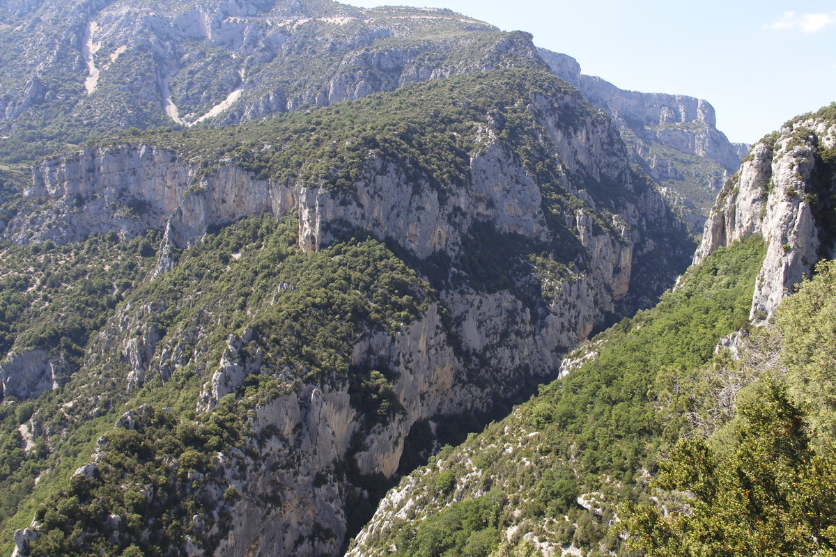
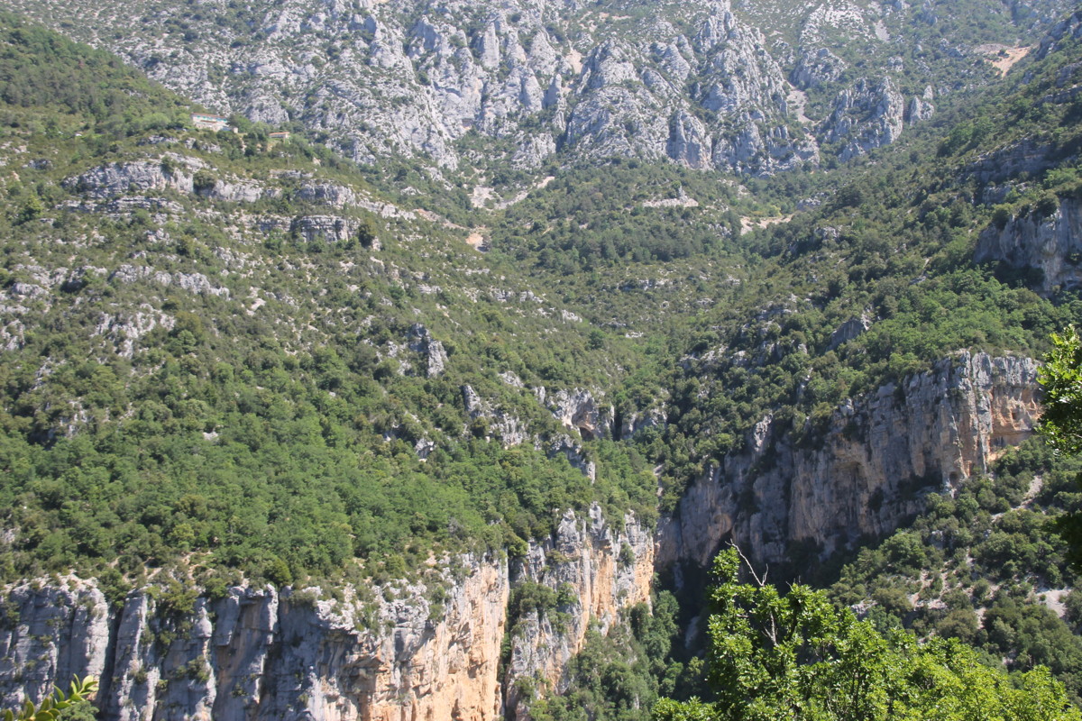
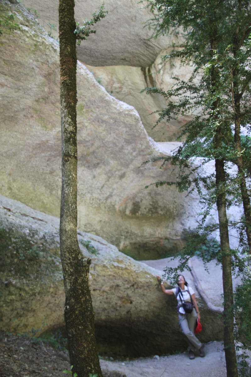
11 Jun 2017 – Gorges du Verdon – 2. Imbut
Track, 7km, -/+ 300m
This track starts on the opposite side of the gorge to the Martel Track (i.e.
the southern side), and you walk downstream rather than upstream. The day was
very hot, and despite the presence of tree-cover for most of the walk, we wilted.
It's a good walk, but very much a secondary choice to Martel. (Our next choice
would be the cliff-top walk on the northern side). The first two sets of 4 photos
are from the Imbut walk itself. As a bonus, we've included shots from the drive
along the southern side, above the Imbut part of the Gorge (second last set
of 4), and at the mouth of the Gorge, below the Imbut section (last 4).
|
|
|
|
At the top (Cavalier),
looking across at
the beginning of
the Martel walk |
The steps down ... |
... which required care |
The walls above |
|
|
|
|
The only bridge,
to the Maline side |
At the floor,
looking upstream |
The limestone waters |
The water-carved
lower walls |
|
|
|
|
Looking W towards
the Imbut reach |
1km N and W of
the previous photo.
Note vehicles on
the road (centre-right) |
From a bit further W |
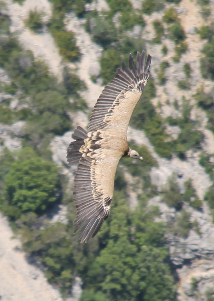
Vulture, from above |
|
|
|
|
Looking NE,
towards Maline |
Looking at the
northern road to
Maline and Sublime Pt |
Looking E towards
the gorge mouth |
The gorge mouth |
Val d'Ubaye
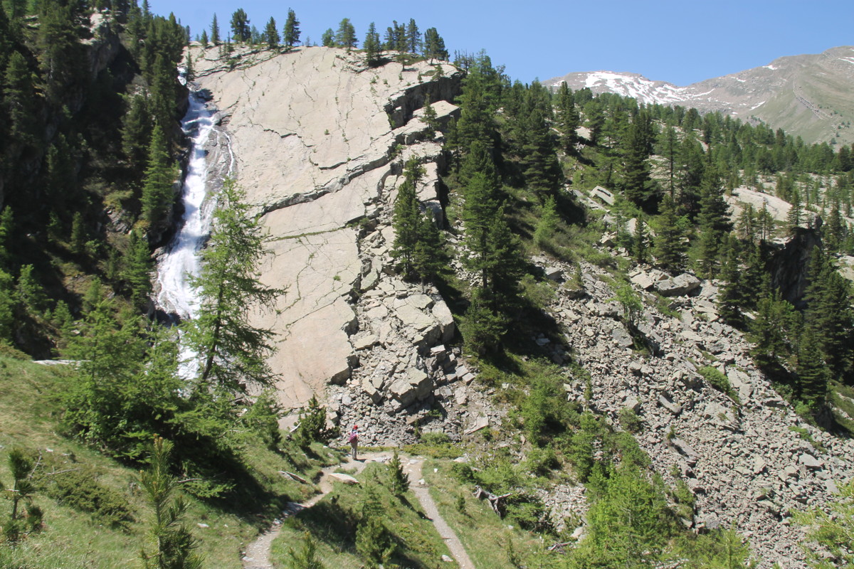
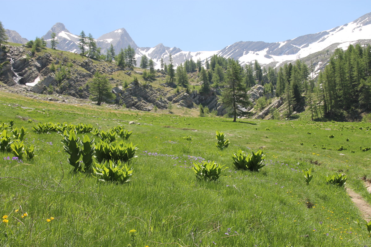
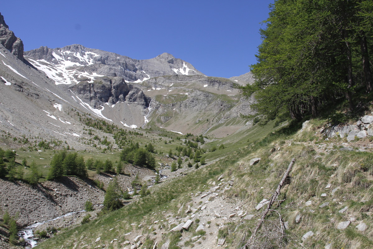
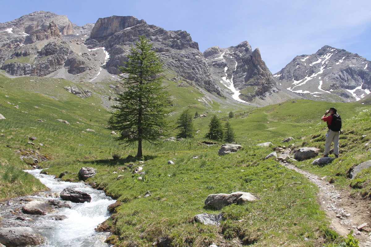
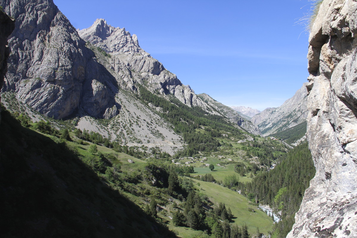
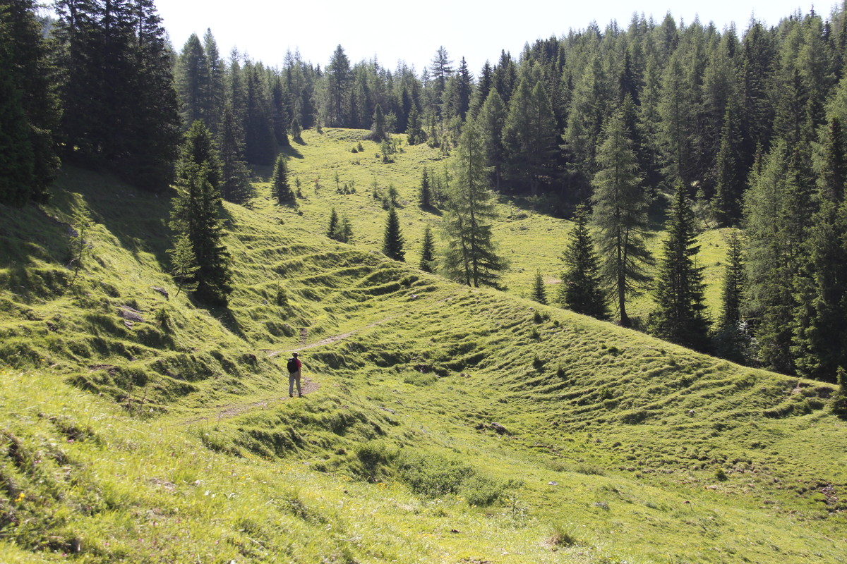
13 Jun 2017 – 1. Les Eaux Tortes, 16km, +/- 700m (1640-2300m)
Les Means is in the Val d'Ubaye (130km north of Nice, mountains and deep valleys
all the way). The river cuts deeply and steeply into high limestone mountain
ranges. We'd originally intended our first walk to be a section of the 9-day,
high-altitude valley loop-walk (GR56), high in the bowl on the south-facing
slopes. But the scorching sunshine and 30+ valley temperatures put us off that
idea.
We instead picked out a section of the GR56 on the southern side (and hence
a bit less sun-exposed), beginning high up opposite our Chambres d'Hotes at
Les Means / Meolans, and walking southwards up the range. The target was a maraise,
i.e. an alpine morass / shallow lake, at 2250m (a bit higher than Kosciusko).
The tree-line is about 2100m here, rather than the 1800m level we're used to
in the Swiss Alps. The start-point was difficult to find (in a steep-sided mountain
valley?!), and the early part was a long section of four-wheel-drive track through
larches – although with some good flowers around. But after that came
a forested wall with waterfalls. In the cirque above, glaciated rocks surround
the lake. Apart from the final section back to the car, it was a very good walk.
Aside: I've finally worked out that the official French maps are made in Paris
by the federal bureaucracy, and their location-names and features don't correspond
in the slightest with regional and local names. Added to that, the federal map-makers
seem to be incompetent at interpreting aerial photography and putting sensible
symbols on maps. In short, the signs and place-names at ground level, and the symbols
and place-names on maps, are at odds with one another. (Australian, British, Swiss
and Austrian 1:25,000 maps are all far more reliable guides than those in France,
or of course Italy). Fortunately, the higher you go, the more
usable the signs become. Presumably the alpine clubs know that too many people
will die unless they invest their available resources in the uppermost, dangerous
levels.
|
|
|
|
Map of the walk,
south of Meolans |
At the start,
looking up the track |
After the (too-)long
flat, a waterfall |
Back down the stream
towards the start-point |
|
|
|
|
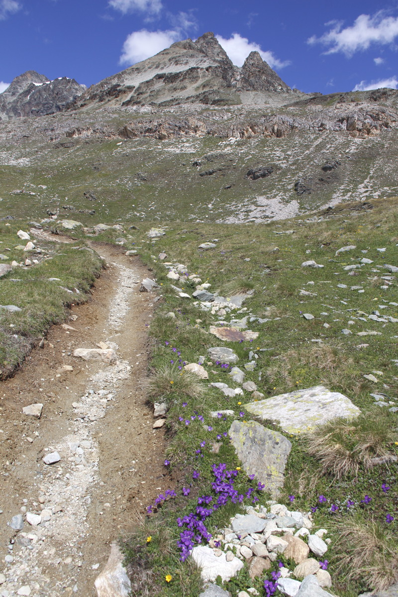
Alpine Grassland |
Water-exposed and
water-worn rocks |
Still water |
The stream, on
an upper shelf |
|
|
|
|
Les Eaux Tortes, a
maraise / shallow lake
at 2250m |
The stream, cirque, and
2900m Grande Seolan |
Maraise with gentians |
The stream again,
down in the valley |
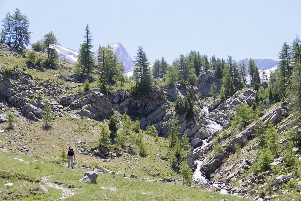
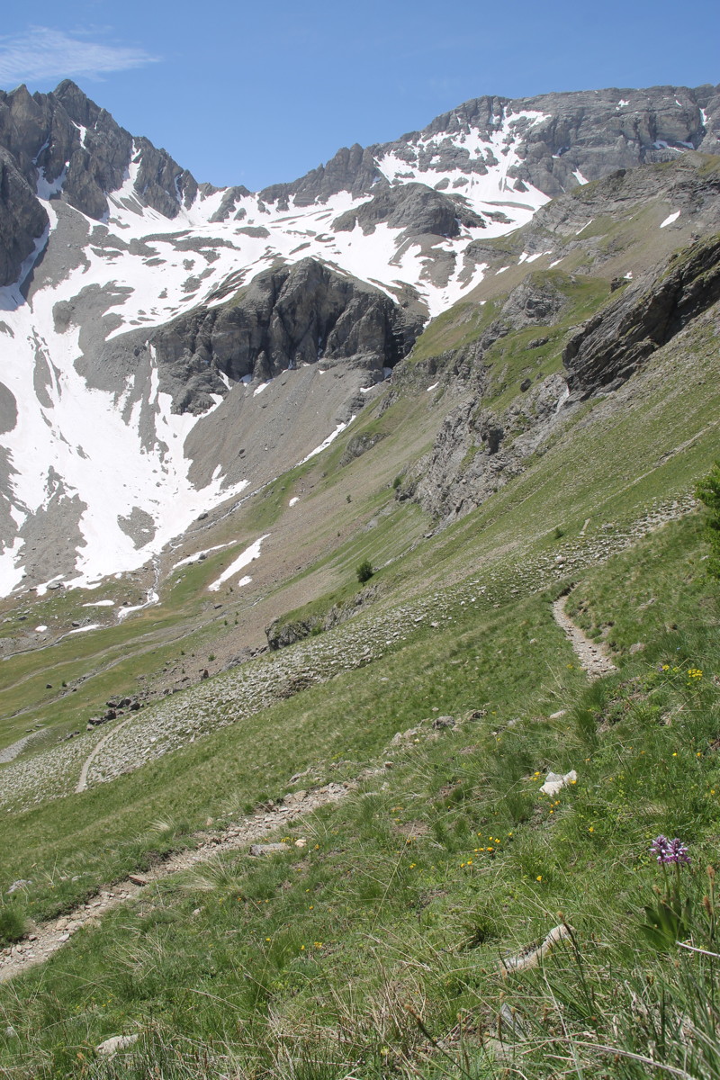
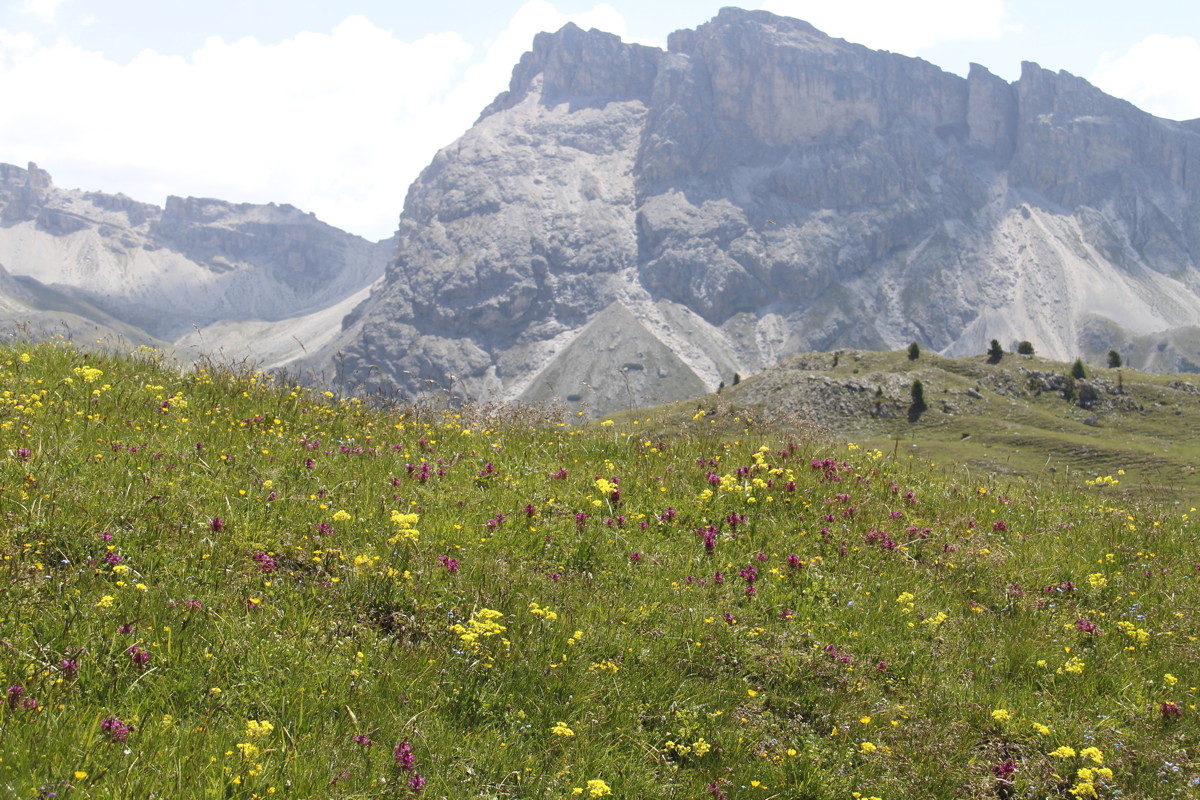
15 Jun 2017 – 2. Col des Esbelicusses, 9km, +/-
475m (2060-2500m)
The season was well-advanced considering the date, and we'd discovered that
the forests go up to 2200m, and the 'alpine meadow' level that we look for hardly
even exists here. So we picked out a high walk that promised flowers. This one
starts halfway between Bayasse and Col de la Cayolle, about 40km south of Barcelonette.
We walked westwards up a side-valley, from 2063m to a small pass with a big
name at 2500m. We intended to continue westwards up to the Petit Col de Talon
at 2678m. But the inadequate markings on tracks and junctions meant that we
missed a turn back on ourselves and ended up swinging south instead, beneath
great walls, finally ending up on snow-covered scree.
But the point of this walk was flowers, rather than fitness or views (which
we got as a bonus). And boy did we hit the jackpot. We counted 85 different
species, of which Linda could nominate the genus of almost all and the species-name
of many (and even Roger could name a good third of the genera). The first 50
minutes was excruciatingly slow (c.1km), because we stopped a great many times,
identifying 50 species, and photographing many of them. About a dozen will be
new additions to our alpine flowers gallery (even though
we've already reached almost 500 species).
|
|
|
|
|
The Lower Valley |
With much flower-looking |
The upper valley ... |
|
|
|
|
... with orchid,
low right |
Upper valley |
Into rocks and snow |
At the upper extent,
looking down |
16 Jun 2017 – 3. Col de Vallonnet, 11km, +/- 640m
(1900-2524m)
For our final walk in the Alpes Maritimes, we again sought to avoid the many
high, dry and rocky options. But we needed height, because it was clear that,
in this early and hot summer, the flowers were at 2000-2500m. We also looked
for areas that weren't south-facing and hence sun-drenched and scorching by
2pm.
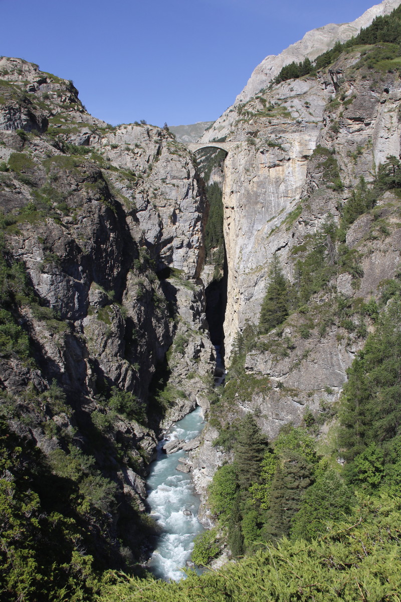
We settled on an obscure valley close to the Italian border, starting from
the remote and tiny village of Fouillouse at 1900m, and walking up to the Col
de Vallonnet. The drive up to the village features a stone bridge from the 1890s
that's suspended 108m above the torrent of the upper Ubaye.
The flowers were pretty good, but this time it was primarily 'a good walk',
with a decent track, half a dozen 3000m peaks with varying rock-forms, and a
nice little tarn at the pass. It included the closest thing to an alp we've
seen in this area – a hanging valley with mainly alpine grassland, in
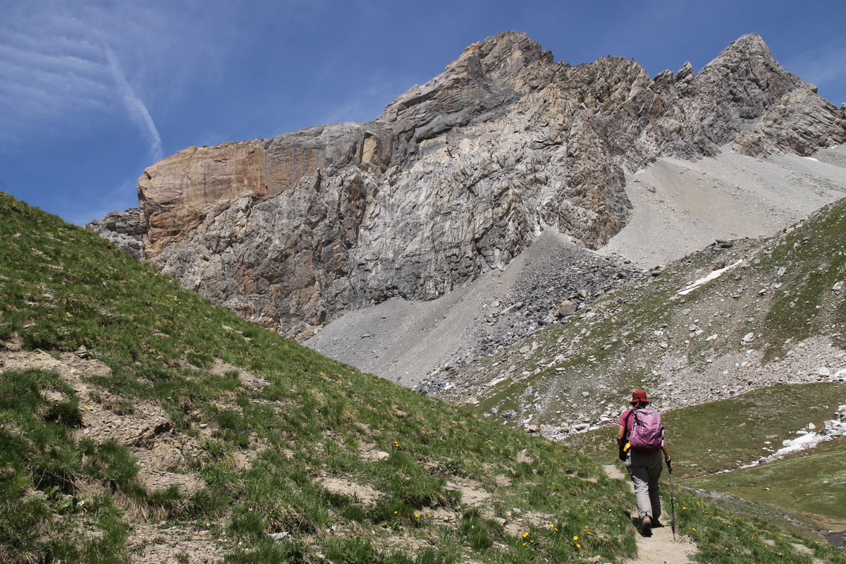
this case at about 2200m. Oh, and remarkably, Linda found her first-ever Edelweiss.
|
|
|
|
The high village
of Fouillouse |
Rising up
the valley |
Near a rushing stream,
beneath 3000m walls |
With alternate views
of flowers and rocks |
|
|
|
|
A bunch of pasques
and deep-hued stone |
Rising up the face
at the end of the valley |
At the top of the Col
looking SE into Italy |
Lunch beside the tarn |
|
|
|
|
Back via a
loop-path ... |
... beneath
colourful rock |
The narrowness of the peak |
Linda's first Edelweiss
beside the track |
|
|
|
|
The view SW from
the Le Chatelet Bridge |
The bridge from
the road to the NE ... |
... and closer up |
The bridge and
torrent from the SW |
The Dolomites
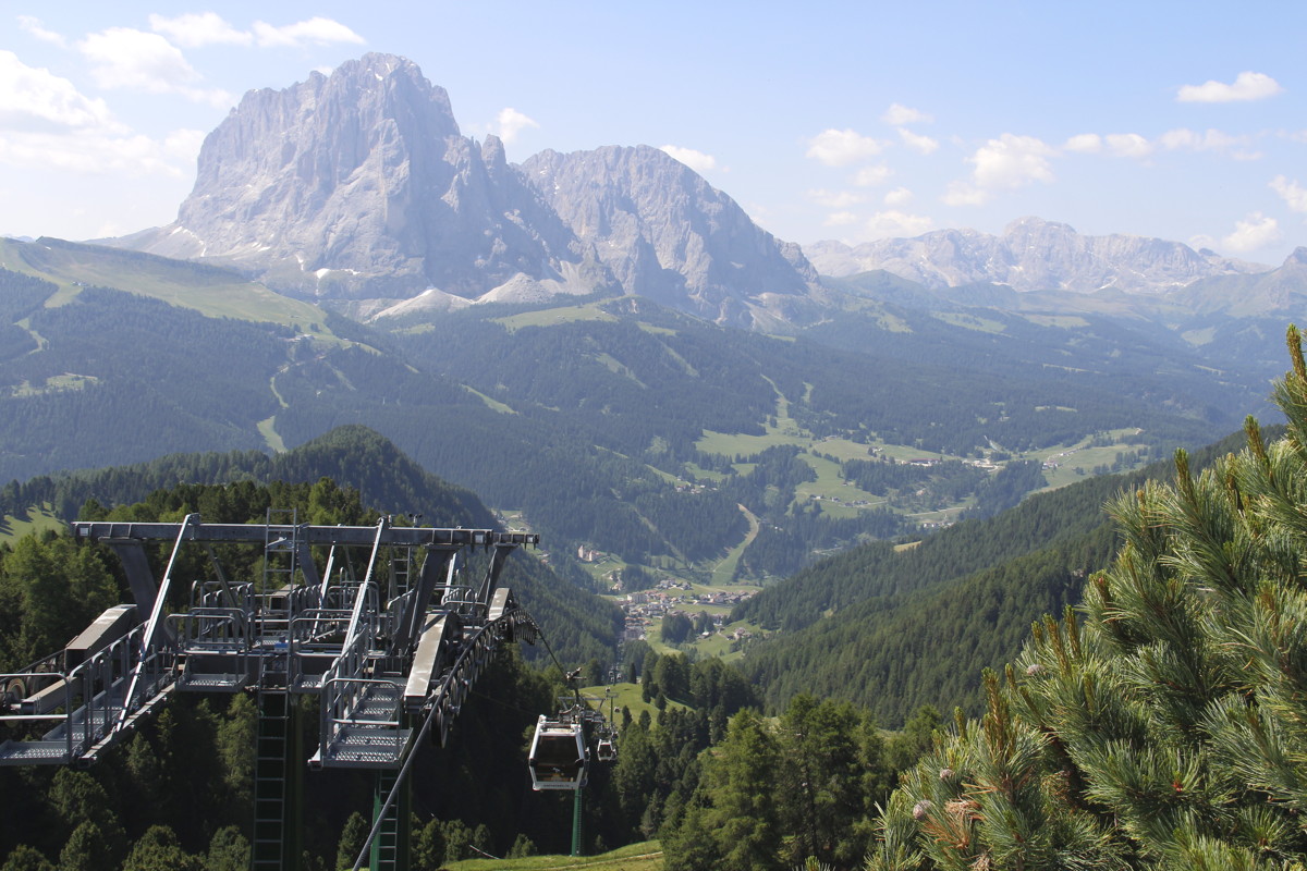
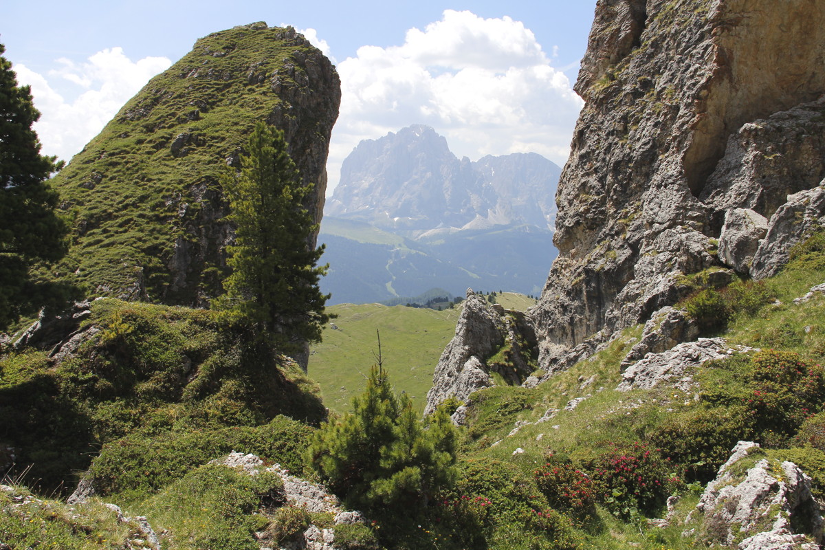
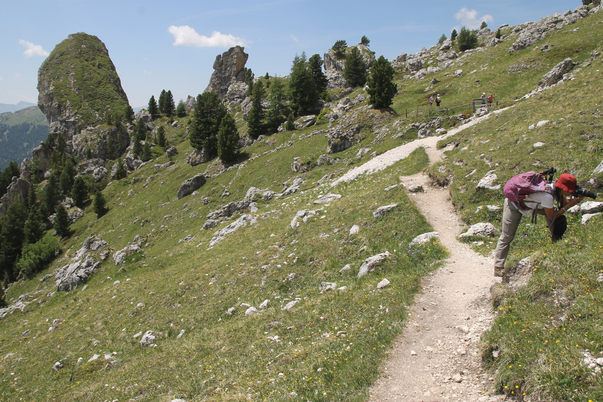
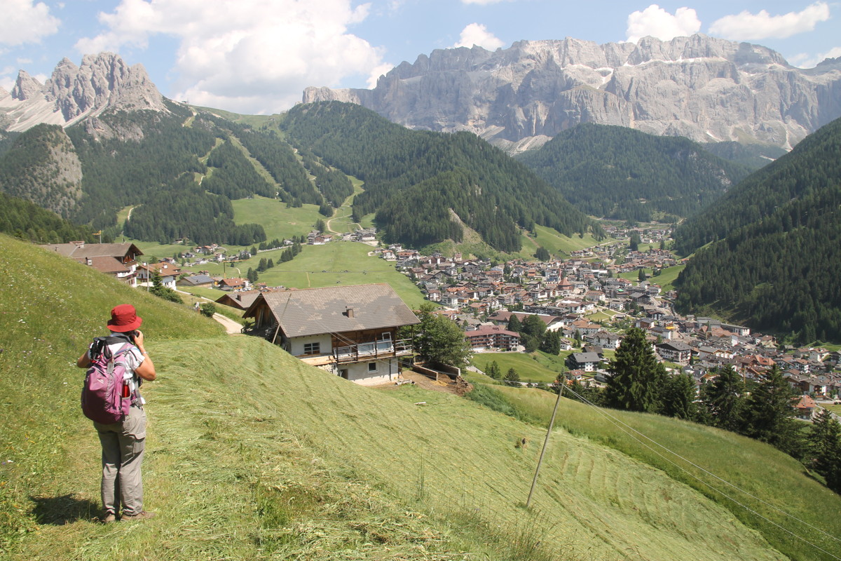
22 Jun 2017 – 1. Odle Range, 10km, +300m / - 800m
(1550-2300m)
This walk on the northern side of Val Gardena wasn't ideal for Roger's knees,
because we took the Col Raider gondola (between Wolkenstein and St Christina)
up to 2100m, and then walked up, around a bowl and down, rather than walking
up and lifting down.
The views up at the Odle range above us, and south to the Sassa Luongo massif were
striking, and we found a characterful rock-fall area for lunch. The flowers were
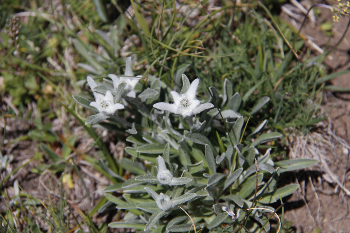
again good, with half-a-dozen new species, incl. Roger's first Edelweiss. They're
out early, and in some places in profusion, due to the early summer.
|
|
|
|
Sasso Luongo to the S,
seen from the top
of the gondola |
The Odle Range
to the N and
directly above us |
Upwards and
eastwards |
The area offers
calendar shots |
|
|
|
|
Sasso Luongo,
from the lunch-spot |
One shot and ... |
... the reverse shot |
Looking back W at
the lunchtime rock-fall |
|
|
|
|
This pass to the E
was an option
that we didn't take |
The fields just
above the tree-line |
E to crags and return
leg of our first
Dolomites walk in 1999 |
Wolkenstein
and the Sella |
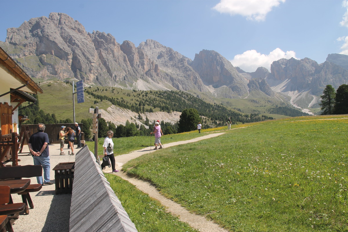
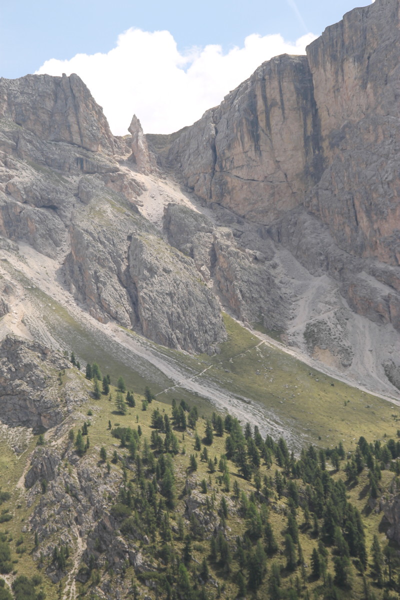
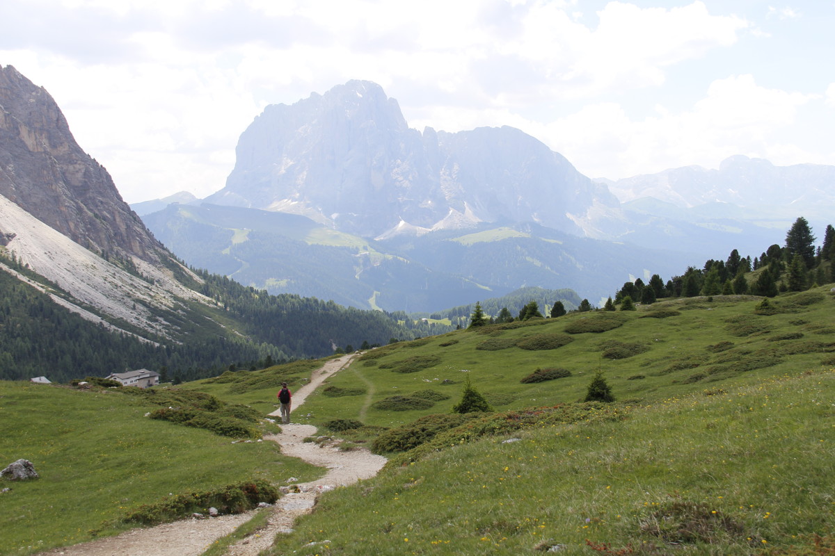
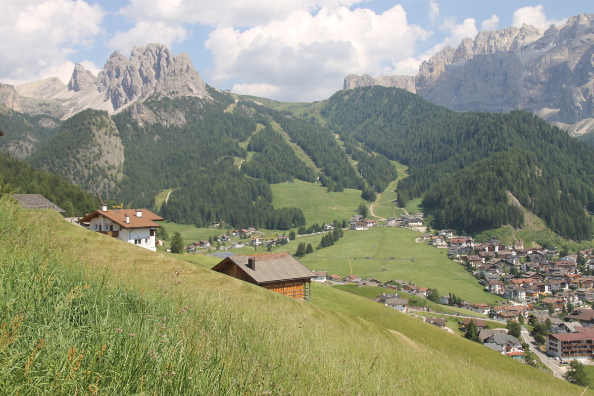
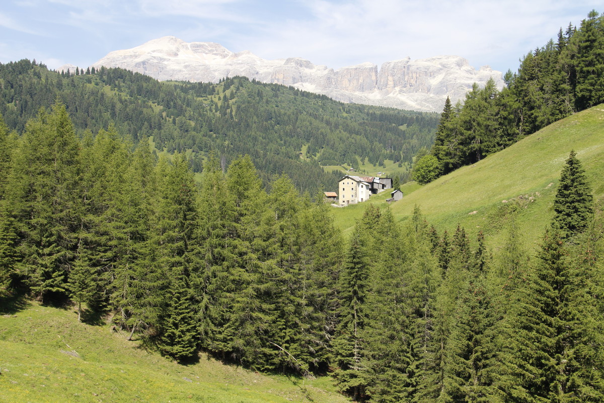
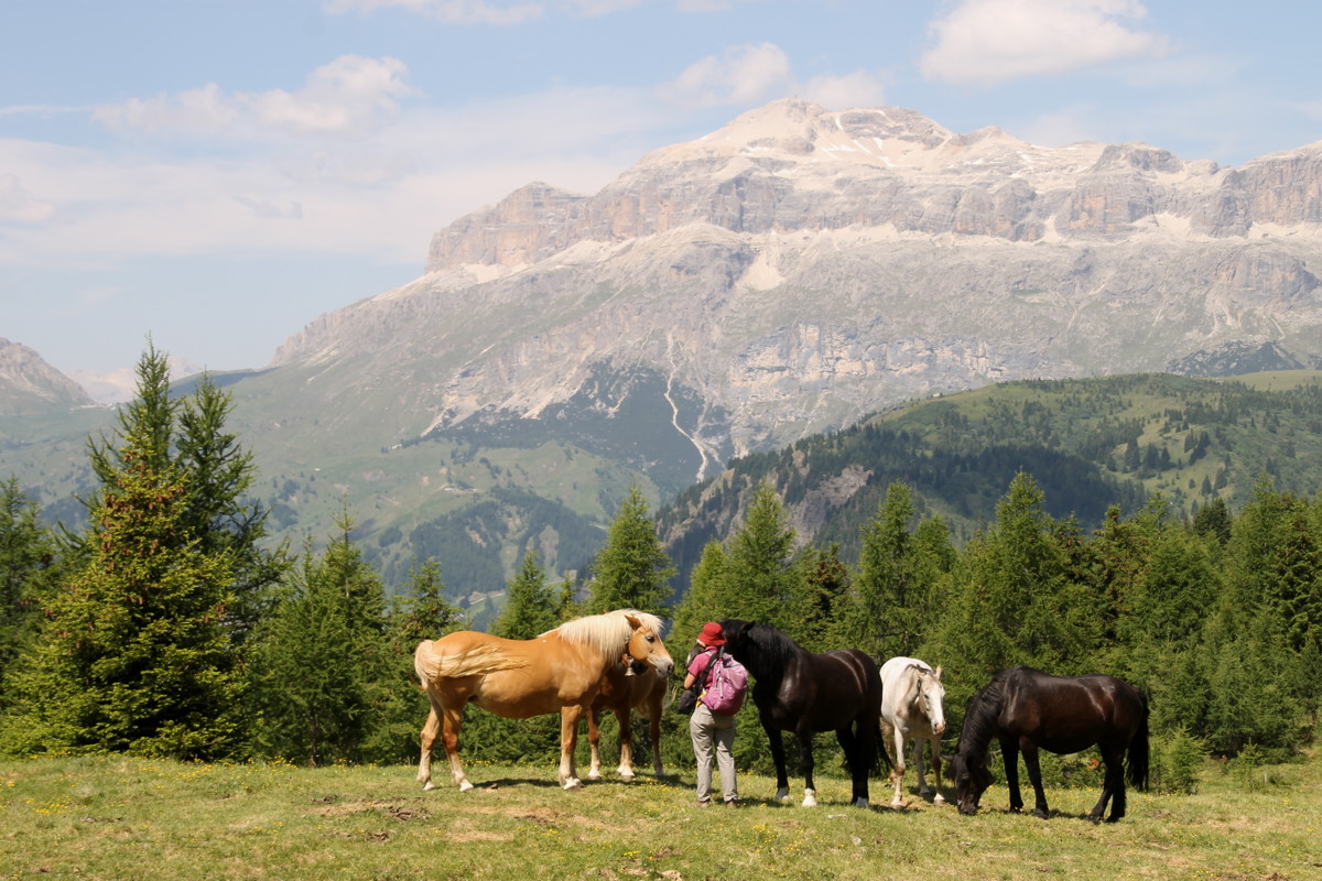
24 Jun 2017 – 2. Cima Sief, 8km, +/-800m (1665-2425m)
We picked this one out as a reachable peak above beautiful valleys and amidst
striking massifs. And we got it right. It was a toughish, persistent 1 in 5,
from forest, through pasture, to rocks, with a path that was pretty stony, in
part because the rain uses it as well as the walkers. The views in all directions
were striking. The ridge to the SE, which ends in the slightly higher Col du
Lana, is about 25m lower than it was until 1917. The Italian undermining was
less successful than that of the Austrians, who used 45,000kg of explosive to
blow the central section of the ridge off the mountain, and the Italians as
well.
We parked the car on the outskirts of the village of Cointrin and walked directly
up through the wood. Given that Linda was coming off the back of a 24-hour tummy
upset, and Roger was still recovering from the 6 week lay-off in April-May,
we were very happy to do it within the times indicated on the track-markers
– 2h10m up and 1h25m down, for 350m phr up and 500m phr down. (That's
omitting 25m m/tea and 45m for lunch and a search of the peak, of course). At
1 in 5, you only need to walk at 2kph to achieve 350m vertical per hour.
|
|
|
|
A reference-point,
40m above the car |
First views, Pordoi
right, Capello left
(Penia on the other side) |
The forest begins
to open out |
Horses with Sella |
|
|
|
|
Marmolade, SW,
its glaciers rapidly
disappearing |
The stony path,
leaving the forest |
Looking SW,
Ornella left,
Arabba, Pordoi right |
At the loop path,
at 2200m, looking
WNW to Sella |
|
|
|
|
Looking NNE,
to Setsas |
Walkers NNE,
with the Monte Castello
wall behind |
Linda nearing the peak,
Sella/Pordoi/Marmolada
as backdrop |
NE from the summit |
|
|
|
|
The massive breach
in the ridge ... |
... after 1917 mining
by Italians and ... |
... then decisively by
Austrians (45000kg) ... |
... winning that ridgeline |
|
|
|
|
SE along the ridge,
with Moss Campion |
Ditto, towards
Cortina, with
Falzarego, Nuvolau |
On the way back, to
the buildings low-left |
The evening storm
building in the E |
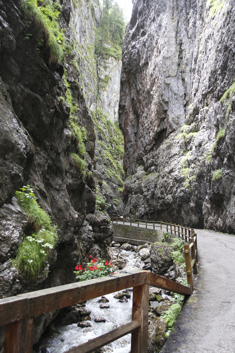
25 Jun 2017 – 3. Serrai de Sottoguda, 3km, -/+200m
After a very rainy night and morning, we took a brief afternoon stroll through
a steep, touristy gorge, to the north-east of the Fedaia Pass.
|
|
|
|
Gorge walls |
Falls used for
ice-climbing in winter |
Dressed up for
tourists ... |
... but no photo of
the bus-train, sorry |
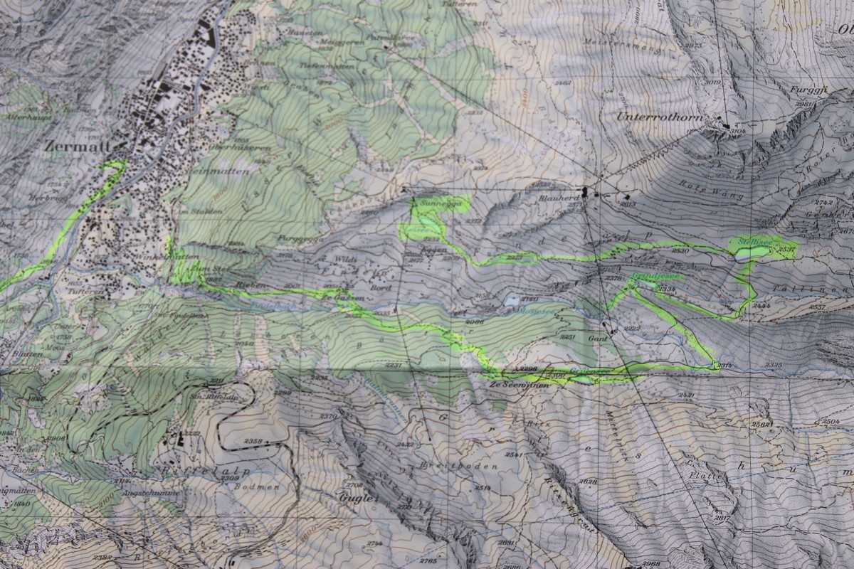
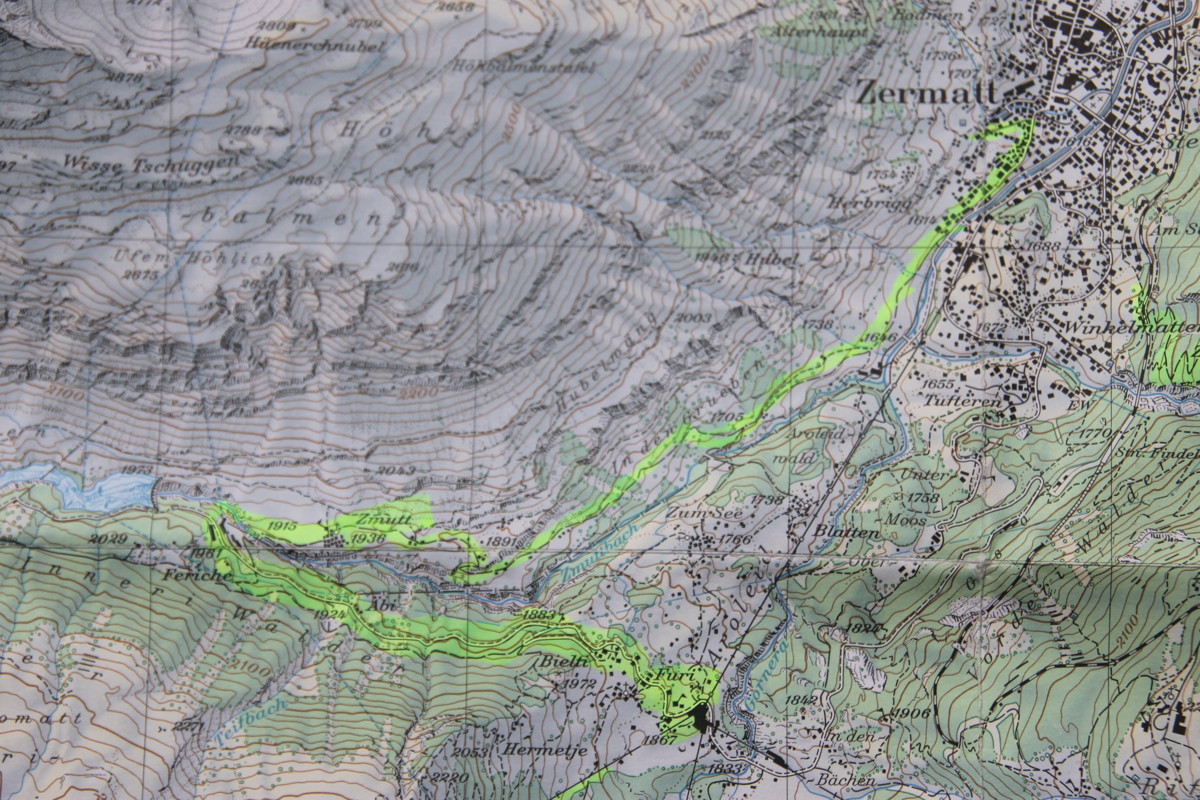
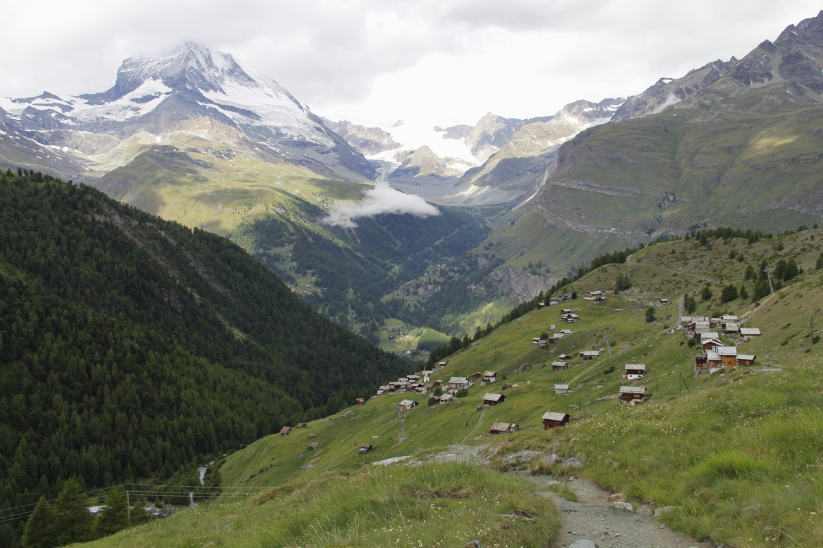
Zermatt
We did 3 walks, for which the maps are here. We'd recommend doing 1. first.
(It's only an average walk, but an excellent orientation to the area). Then
the brilliant (but demanding) 2. and 3., in either order. 3. needs a good day,
because the balcony has a 180-degree panorama at 5-10km range. With 2. the views
aren't quite as important, but given that you're walking at 3200m on a rock-wall,
avoid nasty weather. We didn't see any other walks we were particularly interested
in, and 5 nights / 4 days (3 walking, 1 rest-day) was perfect:
|
|
|
|
1. Five Lakes Walk |
2A. Hörnlihütte Pt 1
Zermatt to Zmutt |
2B. Hörnlihütte Pt 2
Schwarzsee upwards |
3. Höhbalmen |
|
|
|
From late in Walk 2A:
1. is on the slope
opposite,
and down
through the wood |
From early in Walk 1:
2A is in the
valley at centre,
2B is high-left;
and the 2nd half of 3
is high right |
The first part of 3. |
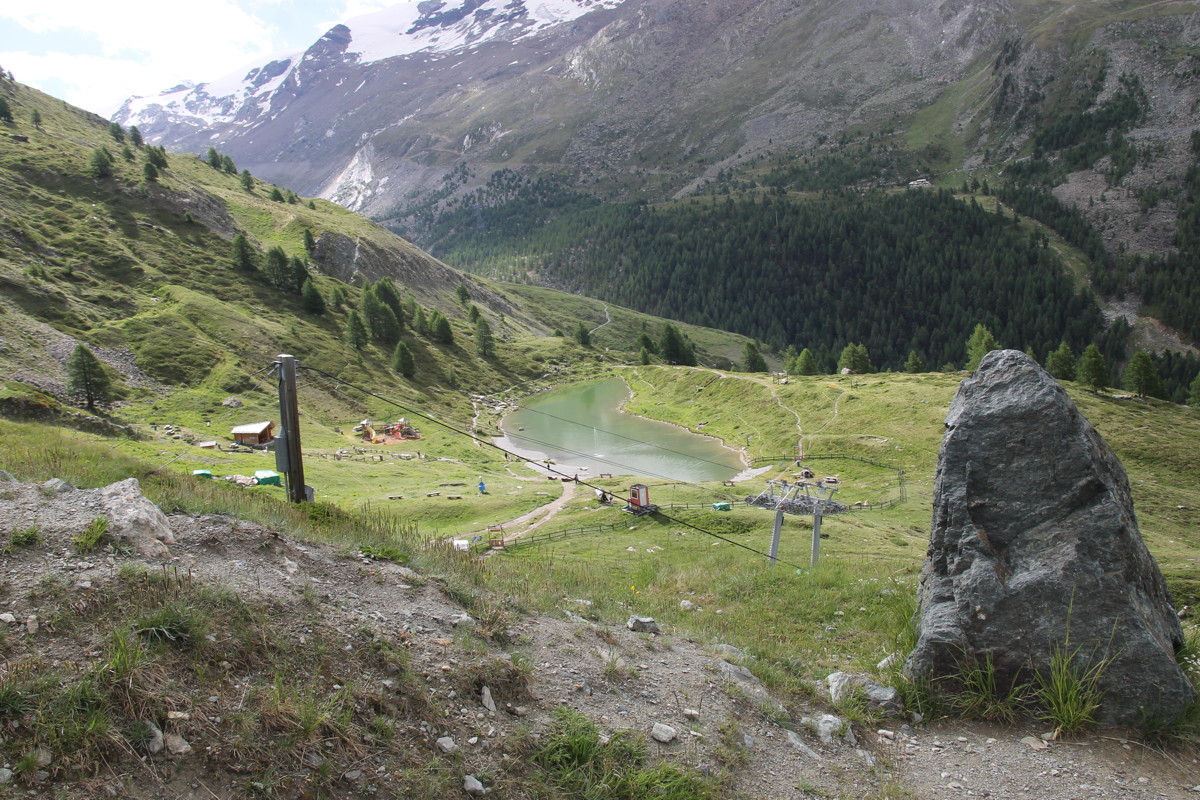
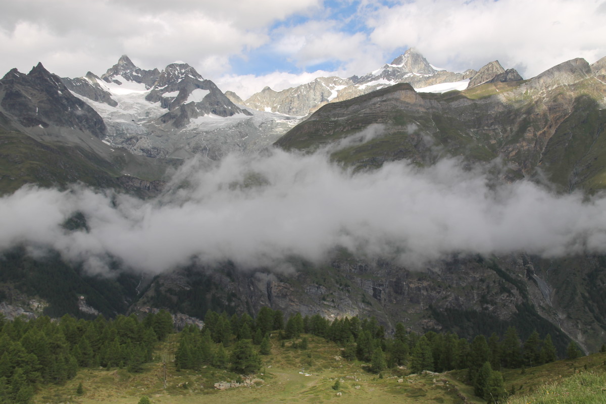
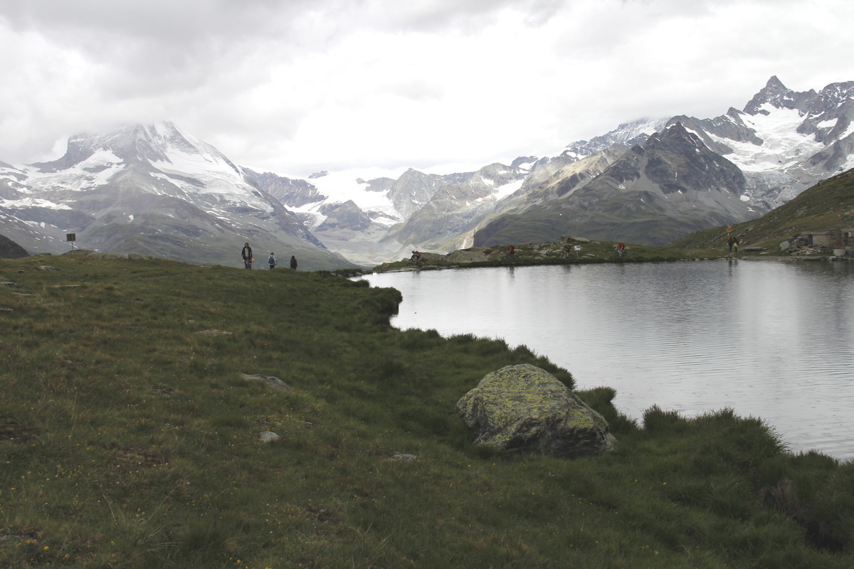
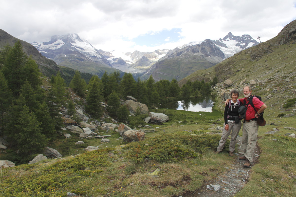
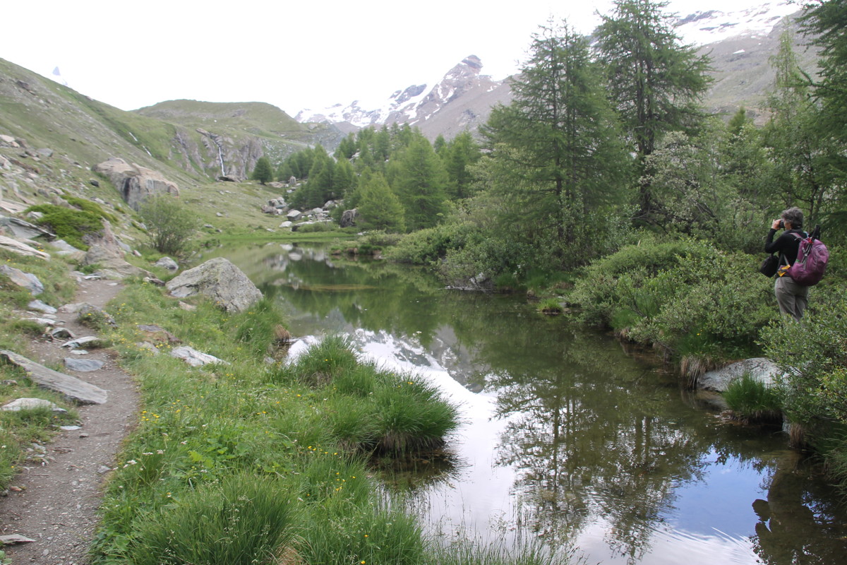
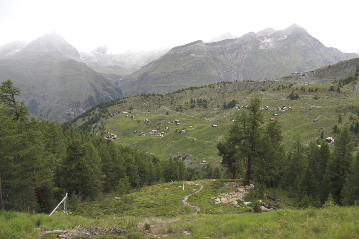
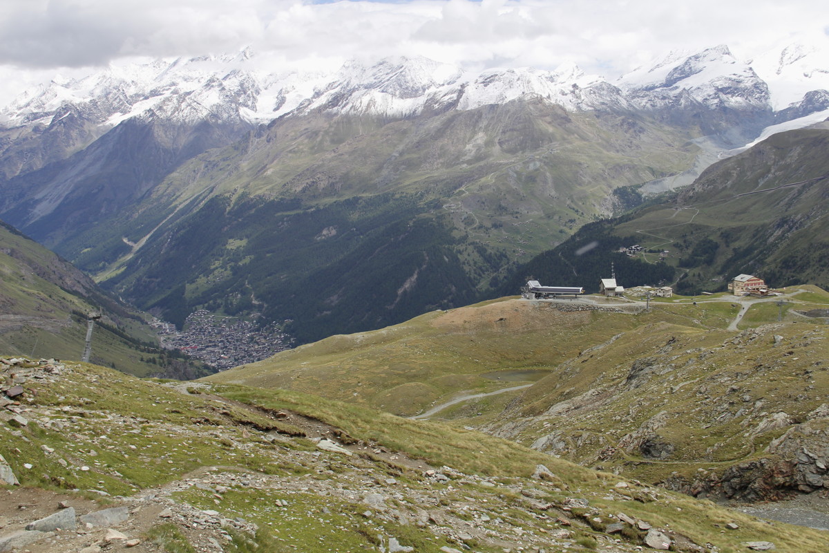
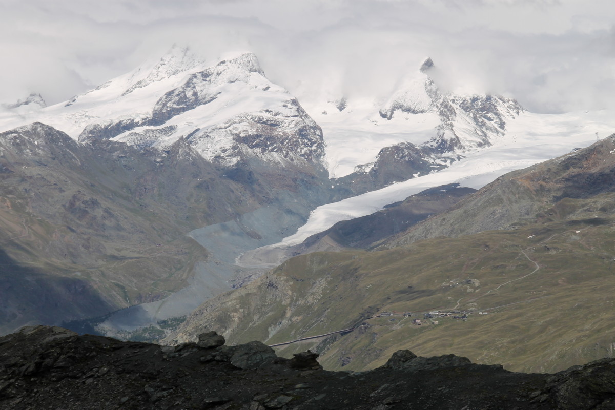
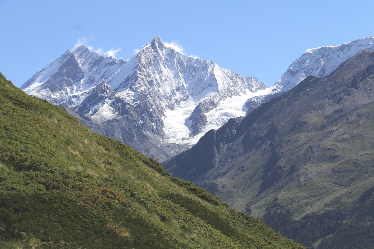
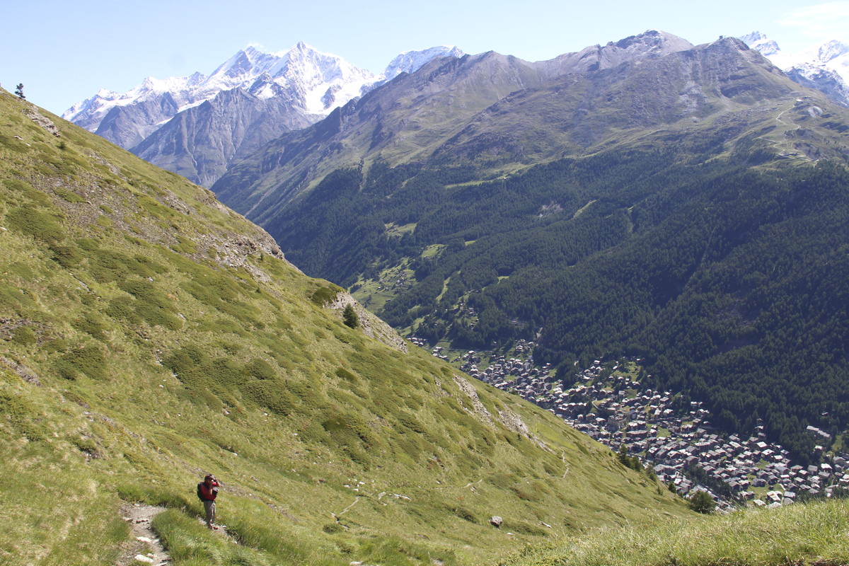
28 Jun 2017 – 1. The Five Lakes Walk, 11km, +300m/-1000m (1630-2540m)
The five lakes are mostly reservoirs. However, the east-west valley has views
of not just the Matterhorn but also multiple other mountains and glaciers. We
took the (underground) rack-railway up to Sunnega at 2280m, and walked around,
up, across the valley, and back down to Zermatt. The weather started as cloudy,
and shifted to rain about 1pm; so we got to exercise our wet-weather procedures.
|
|
|
|
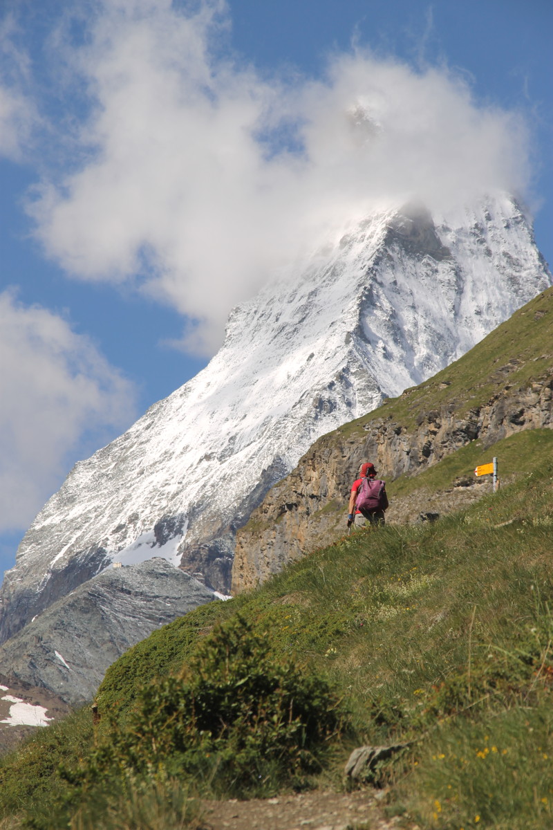
SW to the Matterhorn,
3300 of 4400m visible |
The Leisee and
playground below |
Downvalley and across
to glacier fields |
3500-4200m mts and
glaciers to the W |
|
|
|
|
View down
to Grindjisee |
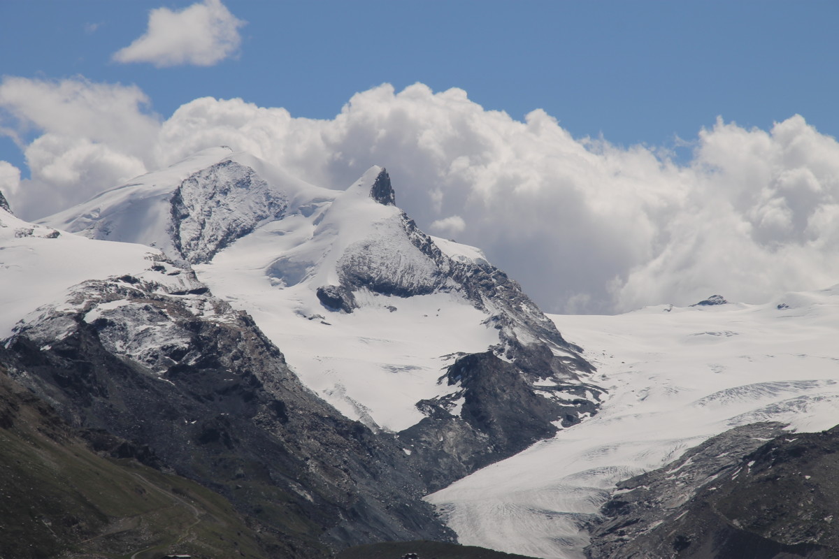
Stellisee at 2540m |
At Grindjisee, the
one 'pretty' place in
the huge, grand scene |
E along Grindjisee |
|
|
|
|
NW, Sunnega high
right, weather closing |
Matterhorn just
before showers |
The lunch-spot |
The track home,
rain arriving |
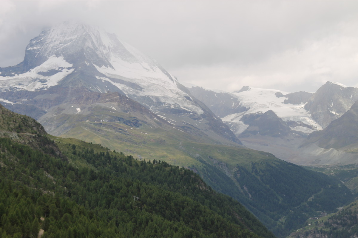
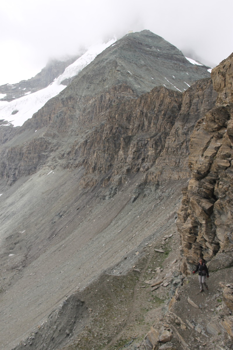
29 Jun 2017 – 2. Hörnlihütte, 16km, +1050m/-950m (1630-3260m)
Hörnlihütte is the gateway to the 1200m climb up the Matterhorn.
It's at an altitude of 3260m, which is several hundred meters higher than we've
walked before, and at the level at which oxygen is just starting to thin. (Roger
once tested himself out at 3300m at the Jungfraujoch, nearly tipping a 6-mth-old
Kasia out of the backpack when nearly passing out after taking a score of shallow
steps the – then – usual two-at-a-time).
We weren't up to a 1700m climb from the village, so we walked up 350m via the
village of Zmutt at 1936m and down to Furi at 1870m (a nice walk, which also
skips the expensive first leg of the gondola), then caught the second leg of
the gondola up to Schwarzeee at 2580m, and walked the remaining 700m of height,
some of the track moderate, and some very steep (the last third being up a 1-in-2
rock-wall).
It's one of those places you just have to go, not least so that you can gaze
at the knife-edge ridge-line above the hütte, and disabuse yourself of
the idea that, one day, you might just acclimatise yourself for a week, hire
the (semi-obligatory?) mountain-guide (AUD1500), stay in the hütte dormitory
at least 1 night, and have a crack at the last 1200m of a mountain that's been
climbed by many hundreds of mere mortals (and attempted by many thousands more)
and whose 2-in-1 for 900m followed by 3-in-1 for the last 300m has only killed
about 500 people so far.
|
|
|
|
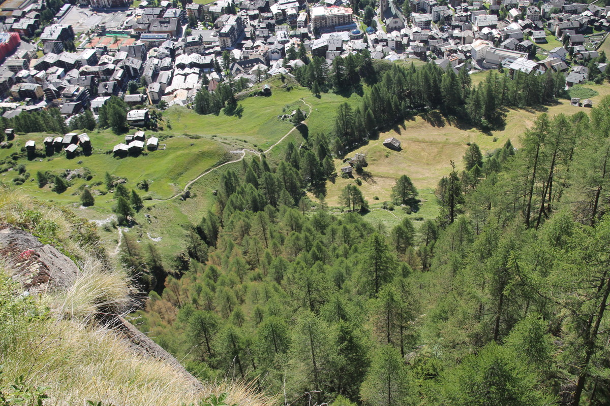
Leaving Zermatt |
Looking back NE
to Walk 1 |
Zmutt |
Back to Zmutt
across the ravine |
|
|
|
|
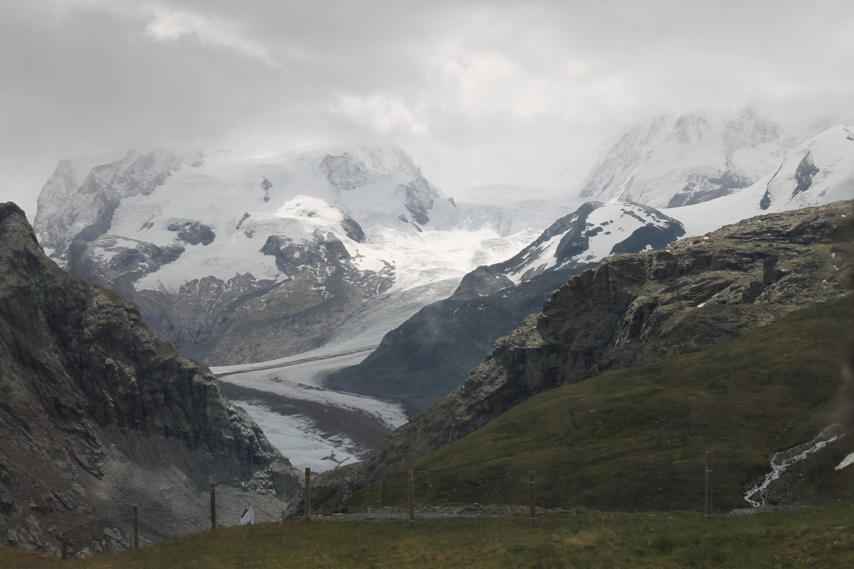
From the gondola,
Gornergletsch, to
its left Monte Rosa |
The forbidding nature
of a large glacier |
Back to the gondola
(and yesterday's walk) |
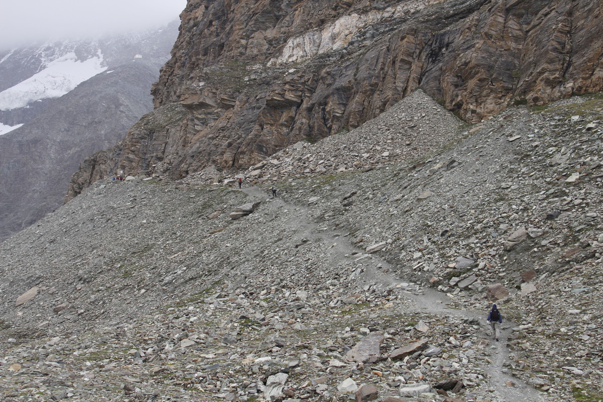
The approach to
the first obstacle.
Where's the track? |
|
|
|
|
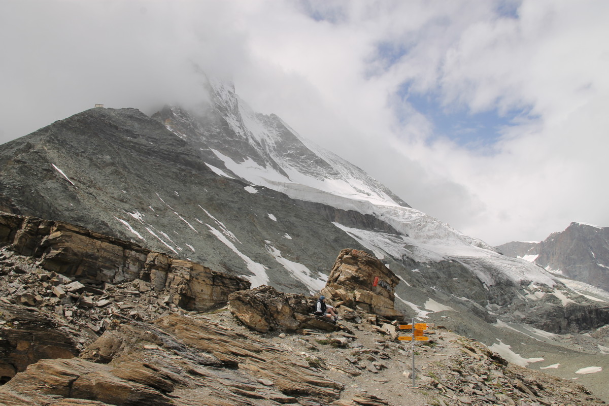
First obstacle, and
first view of the
Hütte (just below clouds) |
Second obstacle, a
1-in-2 rock-wall ... |
... with the Matterhorn
ridge above |
Looking back to
first obstacle ... |
|
|
|
|
... and the path |
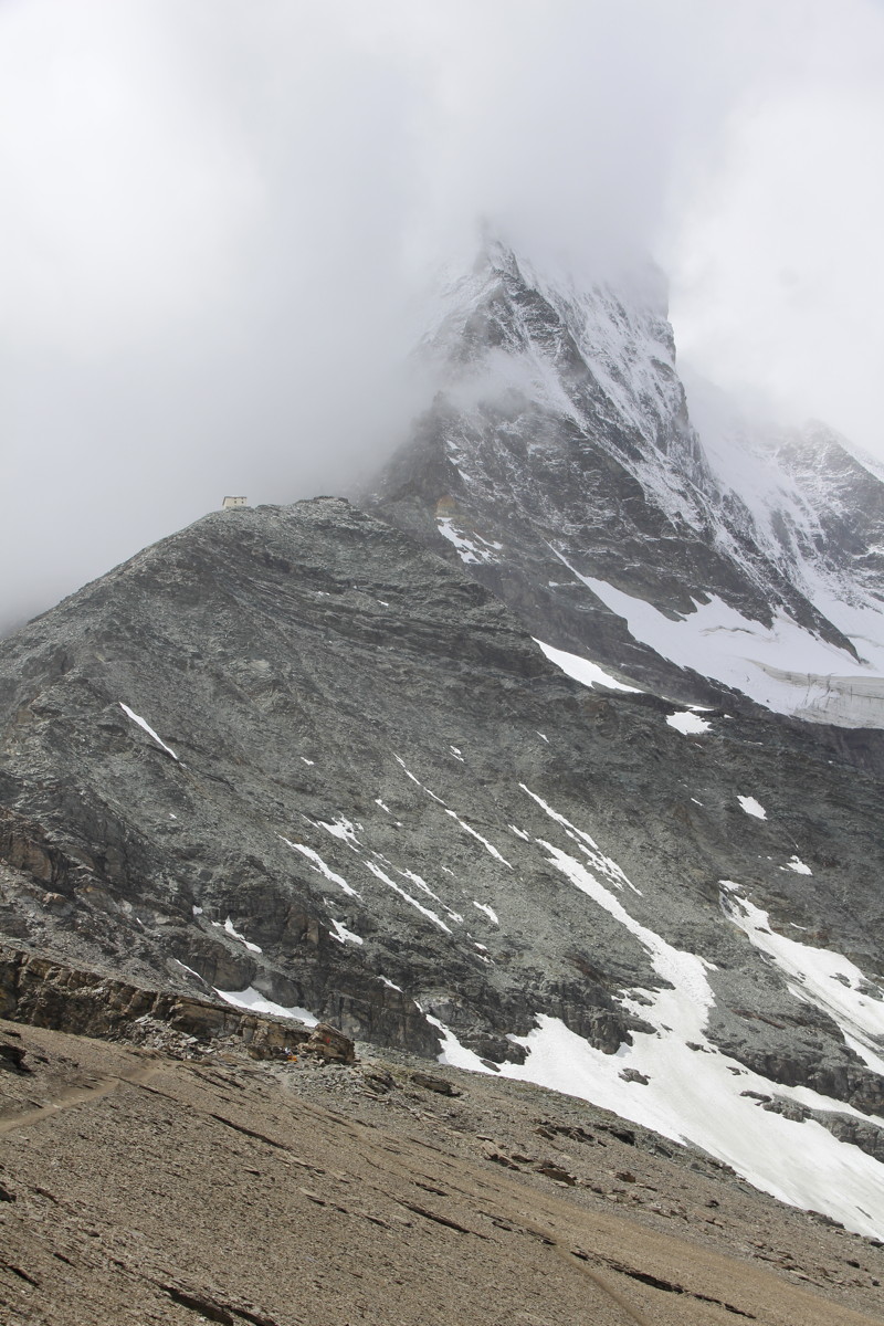
Finally,
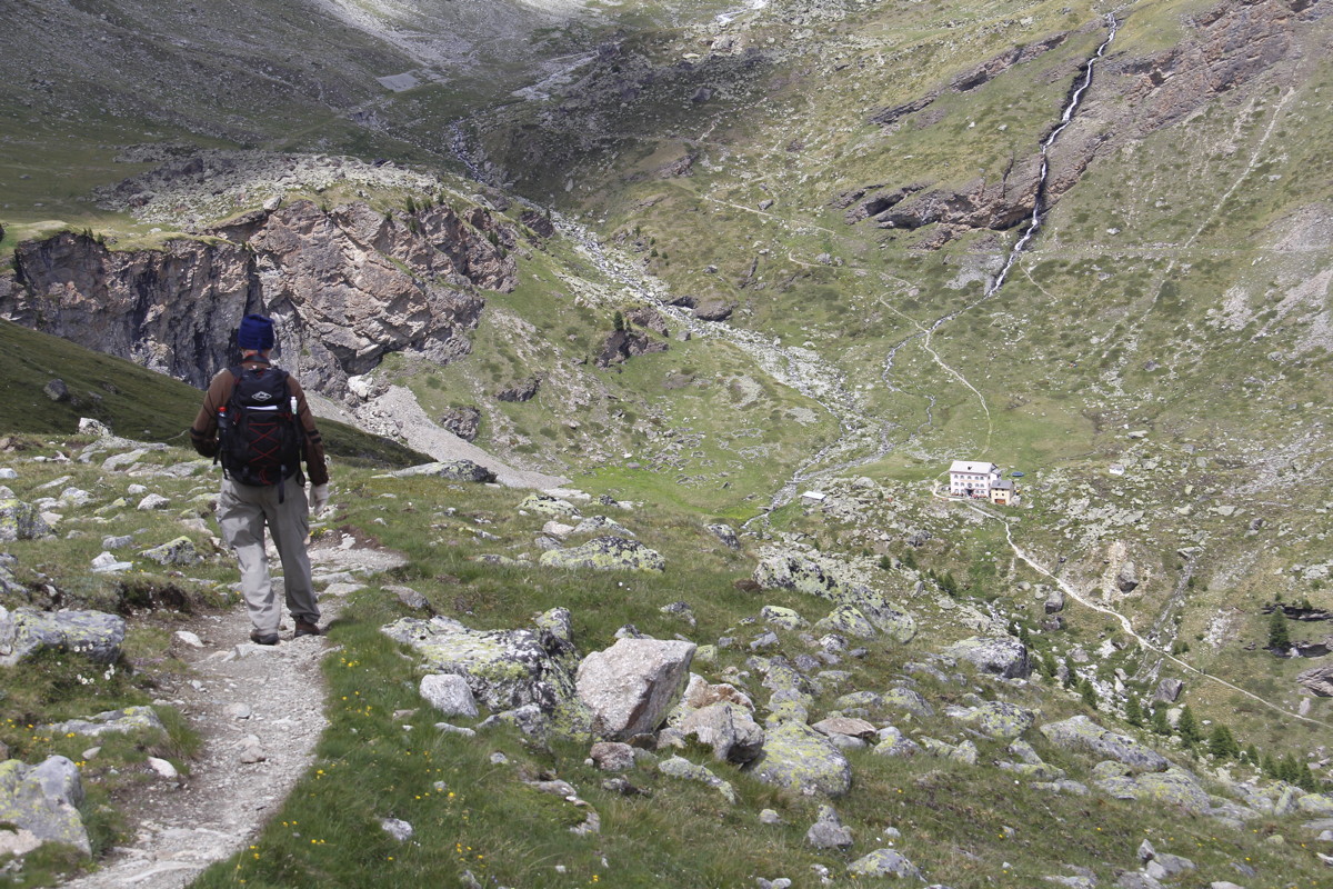
the Hütte ... |
... newly extended,
and the ridge above |
... and the
adjacent glacier |
|
|
|
|
The Matterhorn ascent
(first 900m only;
the rest is steeper) |
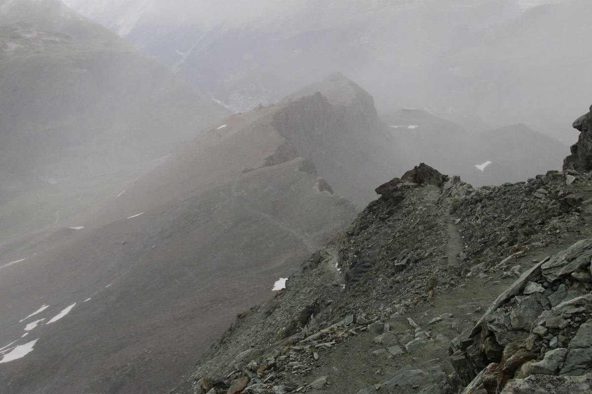
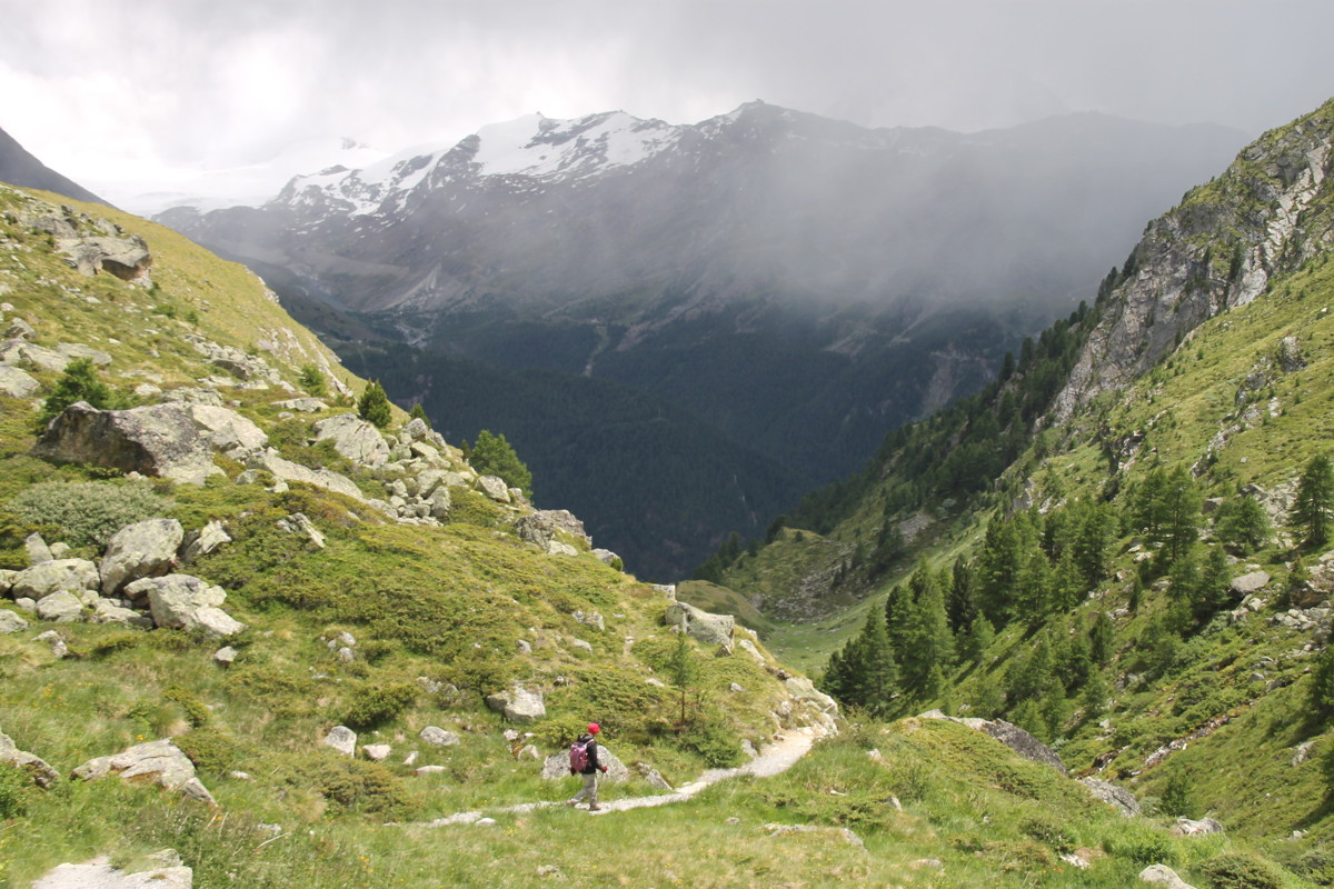
Returning, weather
variable ... |
... and the path too |
The mid-section,
path part-visible,
partly not |
|
|
|
|
One tricky section,
the glacier-fields beneath |
A high-level view
of glacier-fields
above our first walk |
Looking back up
the mid-section |
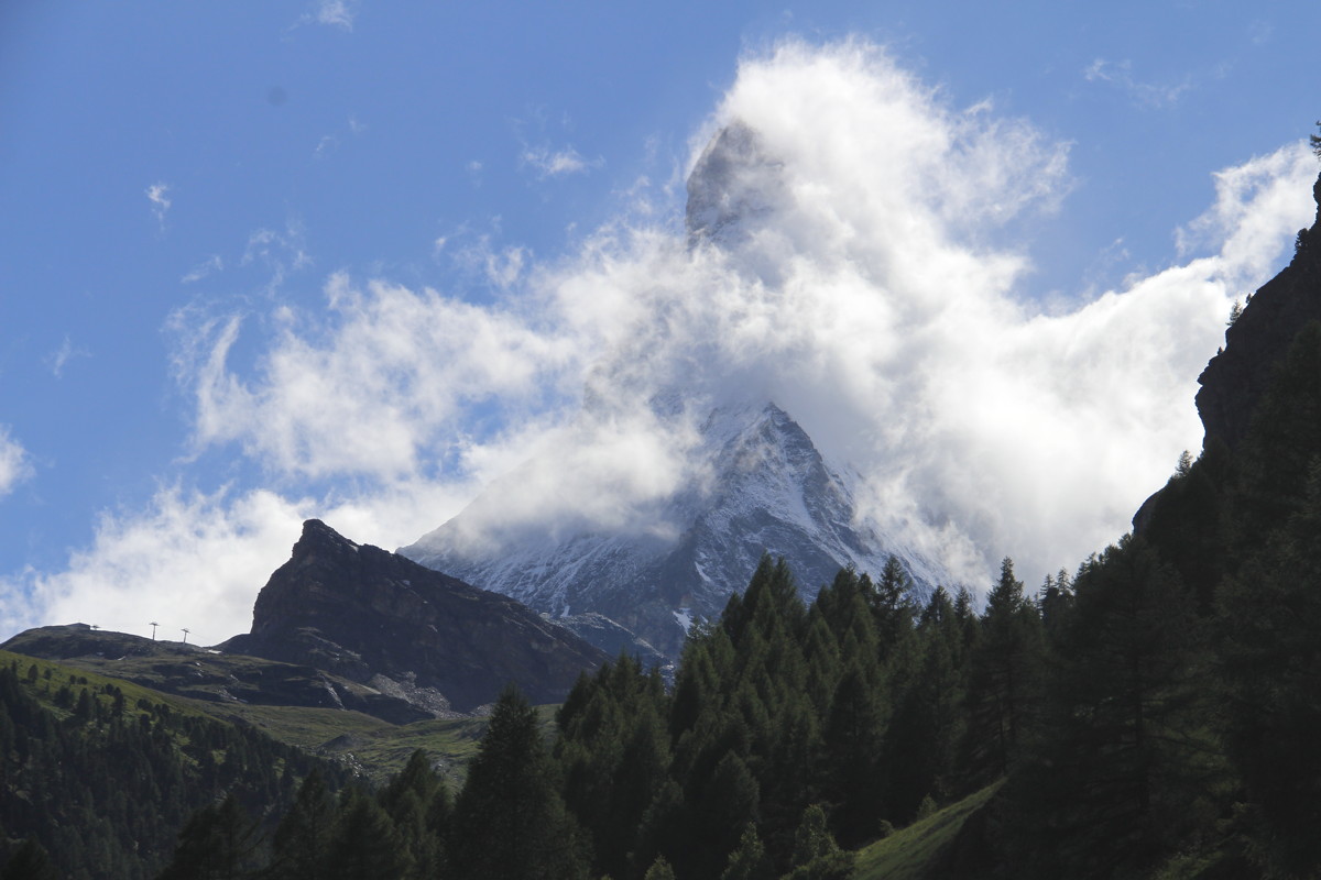
Back in Zermatt,
weather clearing,
Matterhorn looming |
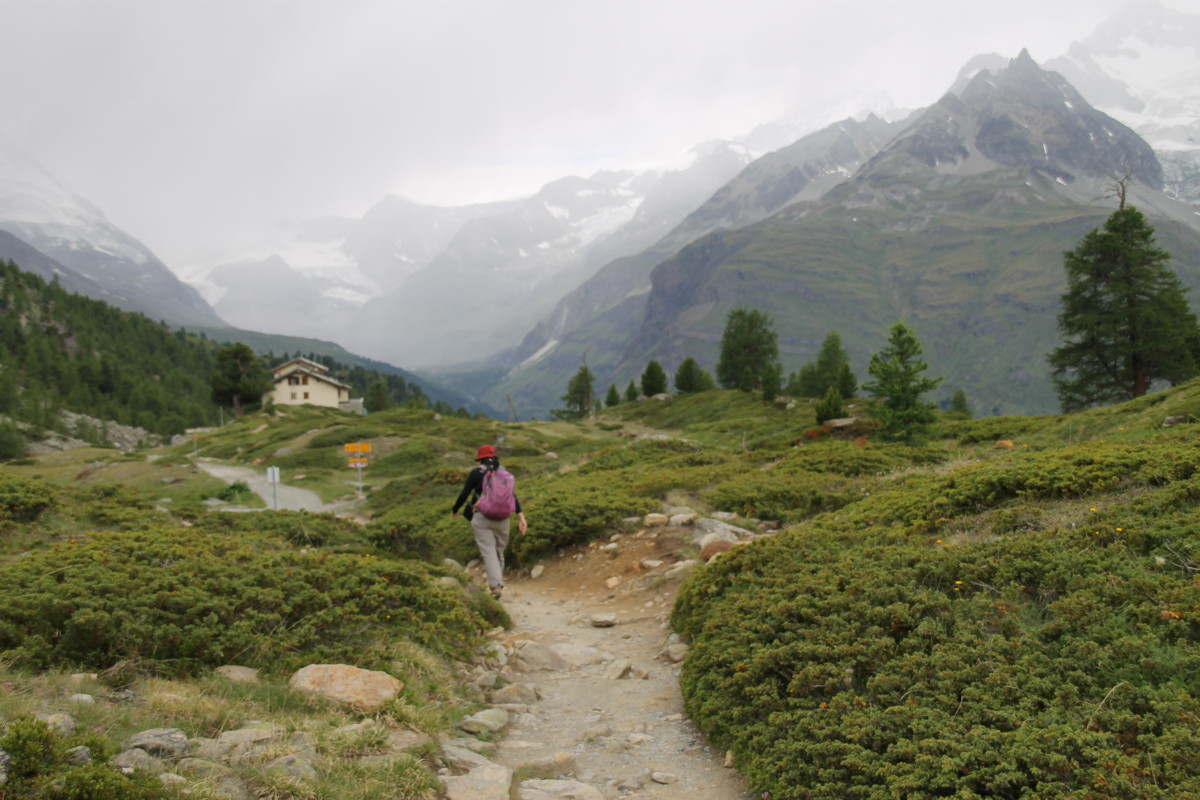
30 Jun 2017 – 3. Höhbalmen, 11km, +/-1050m (1630-2665m)
This is a highly-recommended walk up to a balcony at over 2600m, which provides
views of 3500-4500m peaks in all directions, notably the Matterhorn, Breithorn
and most of the Monte Rosa (although Switzerland's highest peak, at 4634m, is
obscured). The glaciers are too numerous to count.
The path leads west from Zermatt up a steep gully to Alterhaupt (+350m, 1-in-4, 1 hr).
From there, we took what turned out to be the second-best option, SW then W, much of it
uncompromisingly up a steep gully (+700m, 1-in-4, just under 2 hrs). We went a bit
further W to get varied views, then returned on the other two sides of the triangle
via Trift.
|
|
|
|
From above Zermatt,
up to Edelweiss
at Alterhaupt |
Looking north |
Looking back down |
An early view
of Matterhorn,
still 6km away |
|
|
|
|
LtoR, Liskamm 4479m,
Breithorn 4164m,
Kl. Matterhorn 3883m |
To the N,
Taeschhorn
4491m |
The steep track
up the gully |
Monte Rosa 4500m,
(Gornergrat 3090m),
Castor, Pollux 4100m |
|
|
|
|
Breithorn,
Little Matterhorn |
Strahlhorn 4190m,
Adlerhorn 3988m,
Findelgletscher
to the E |
Matterhorn 4476m,
now 4km away,
from Höhbalmen 2665m |
With yesterday's
ridge and hütte L |
|
|
|
|
Zinalrothorn 4221m,
to the NW,
with violas |
Returning on the
higher path,
looking N |
Down to Trifthütte
at 2337m |
Up the Trift to
Zinalrothorn |
|
|
|
|
"One day, all this
will be yours" |
Afternoon storm
missing us |
One more looking
up the Trift ... |
... and another |
This is a page within the Clarke-Spinaze Photo Gallery, home-page here
Contact: Linda or Roger
Created: 9 Jan 2017; Last Amended: 1 Jul 2017