Mountain Walks – 16 May - 17 June 2011
13 walks (9 in the Central Pyrenees, 1 each in the Cevennes,
the Dolomites, Slovenia and Appenzell)
144km and a vertical 8200m
Click on any image to see a larger version
|
|
|
This was a longstanding inspiration, by friends
– walked and written back in 1985 |
We did it more easily, with
day-walks and a 5200km drive |
The longest segment, for 14 days,
was our first visit to the French Pyrenees |
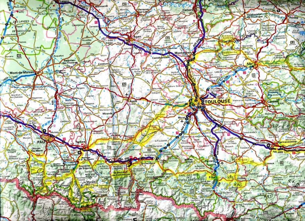
We flew into Zürich. The next day we drove 777km SW to Le Rozier at the
southern end of the Tarn Gorge (at the SW corner of the
Cevennes). After 2 days and 3 nights there, we spent a food-filled weekend with
friends SW of Toulouse. Then we drove SW to the Pyrenees for 12 nights, starting
in the Ossau, then E to the Central Pyrenees
/ La Bigorre area, then E to the Cathar Castles area.
A 1200km drive got us via Barolo to the Dolomites for 2 nights,
then 1 night in Austria. 3 nights in Slovenia enabled the assault on our biggest-ever
mountain, Triglav. (Denial of our age was of course the
real purpose of the trip). After 3 nights at the conference in Bled, we spent
the last 2 nights near Appenzell, including a warm-down walk to Seealpsee
beneath Säntis.
WARMUPS
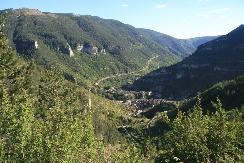
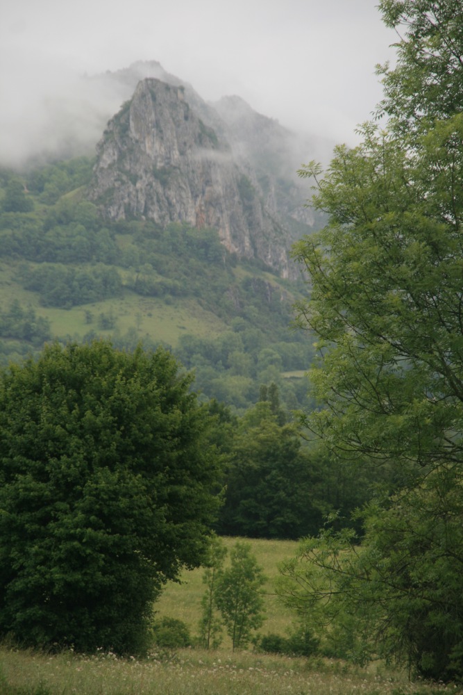
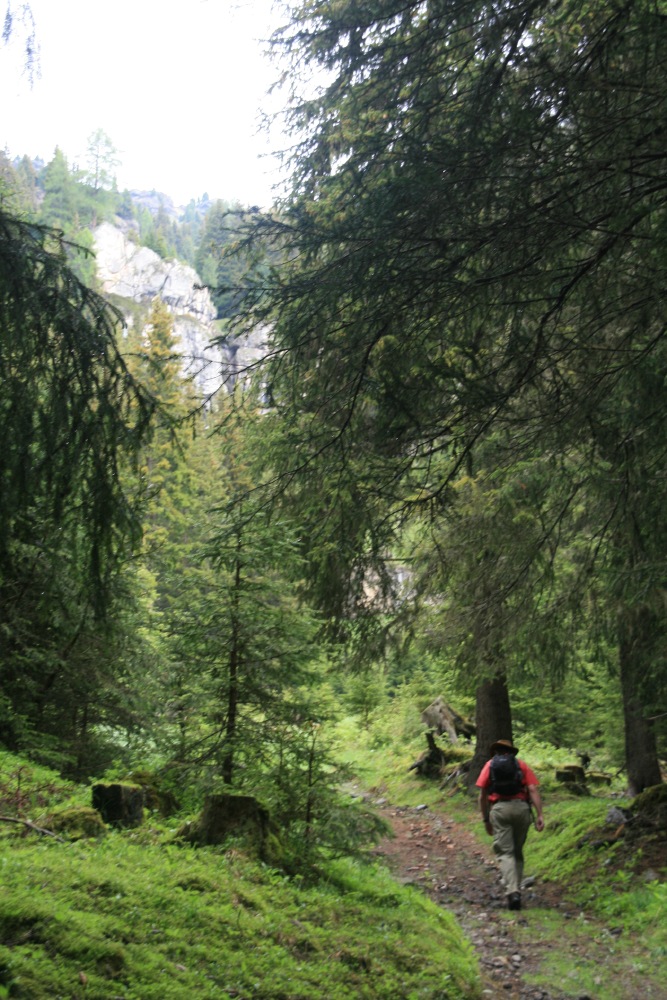
In the Gorges du Tarn (SSW of Lyon) – Tue 17 May 2011
A striking gorge, map here, interesting surrounds, a
little dry by French standards; but a great start. 8.5km and 250m,
surprisingly tiring (what jet-lag?). Fortunately we met, and exchanged
car-keys with, a couple from Paris, Susan Thompson & Eric Boschwitz –
thereby avoiding having to walk back again
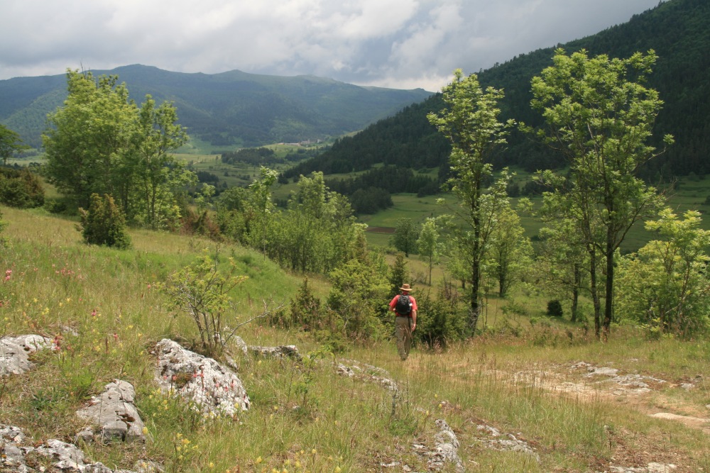
Proper Warmup on Pic Pibeste (S of Lourdes) – Mon
23 May
12km and 777m, 2.5 hrs up to 1350m, 1h35min back. Stony, and
slow going, views south to the Pyrenees
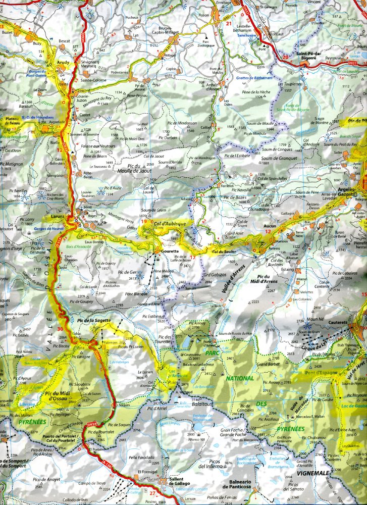
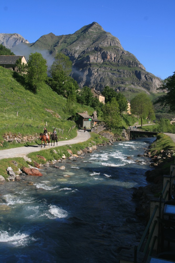
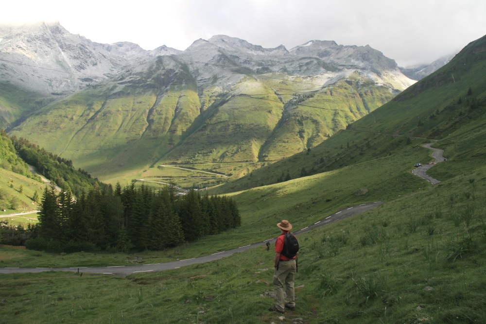
THE OSSAU VALLEY – Basque Country, in SW France
We'd targeted the Ossau Valley,
for a couple of walks, and cheese; and we picked the location and Pension
well
– Bilheres
and Veronique: |
|
So we started the Pyrenees with an easy 1km and 150m
above 2000m, after a gondola and train-ride: |
|
Above Lac Arouste (S of Laruns) – Tue 24 May
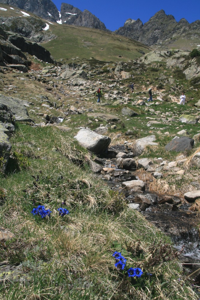
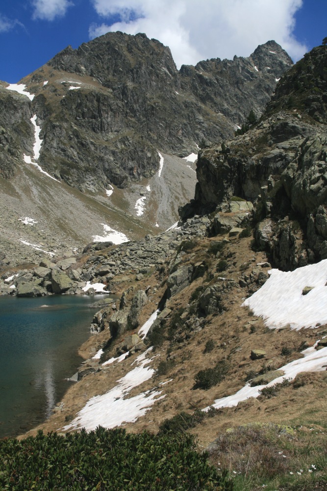
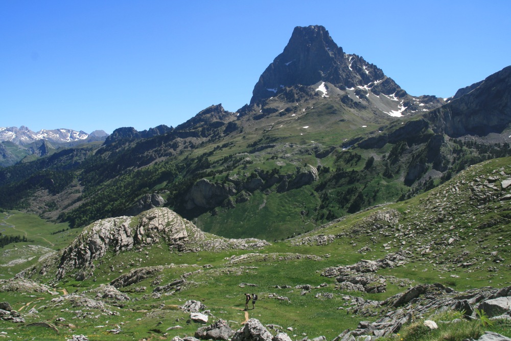
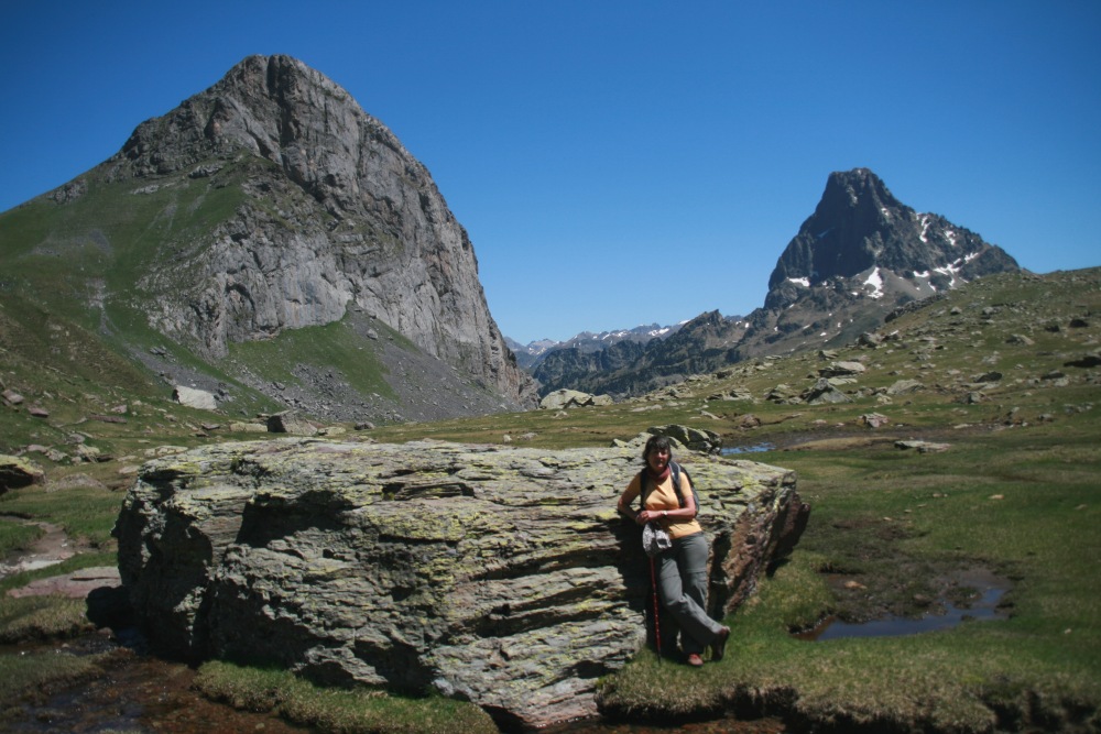
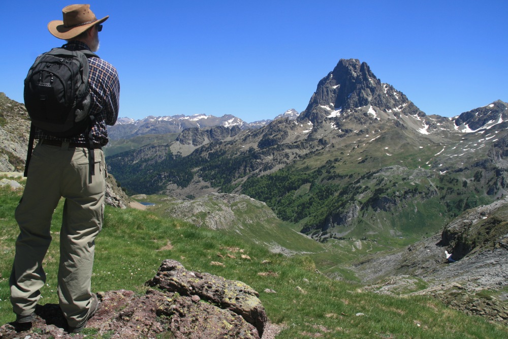
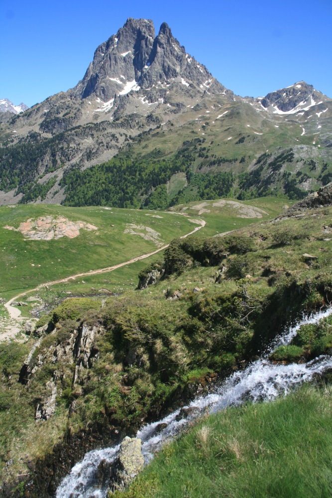
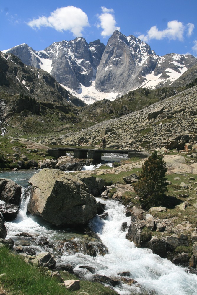
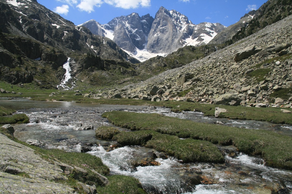
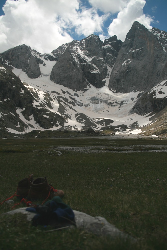
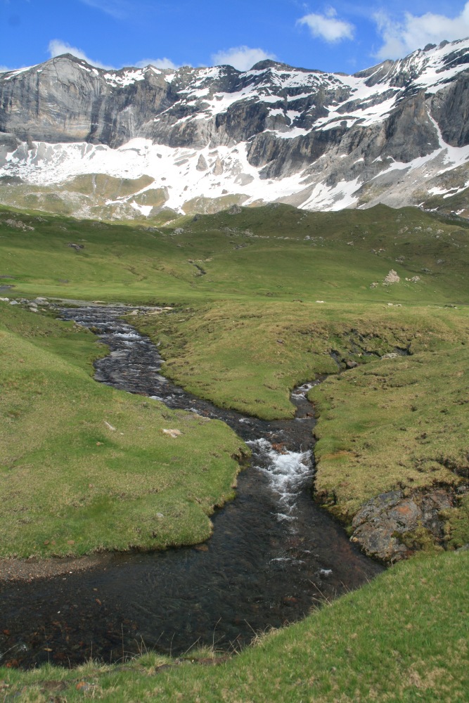
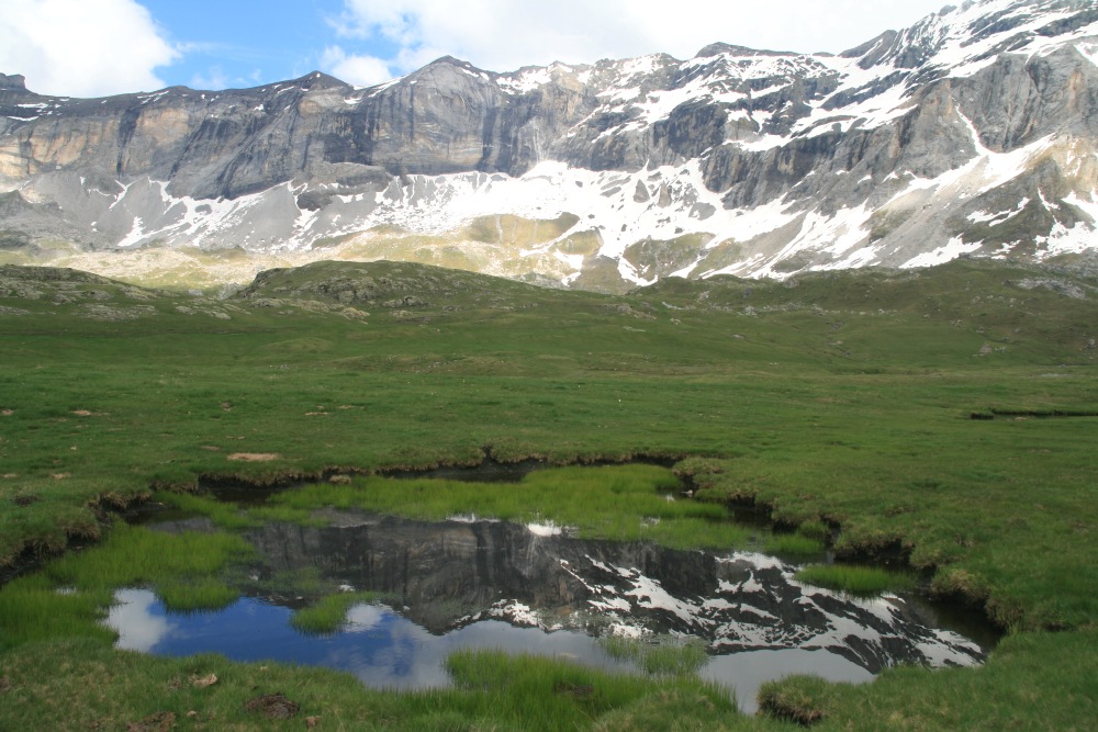
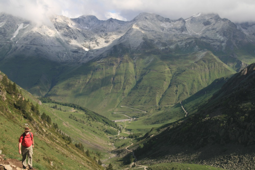
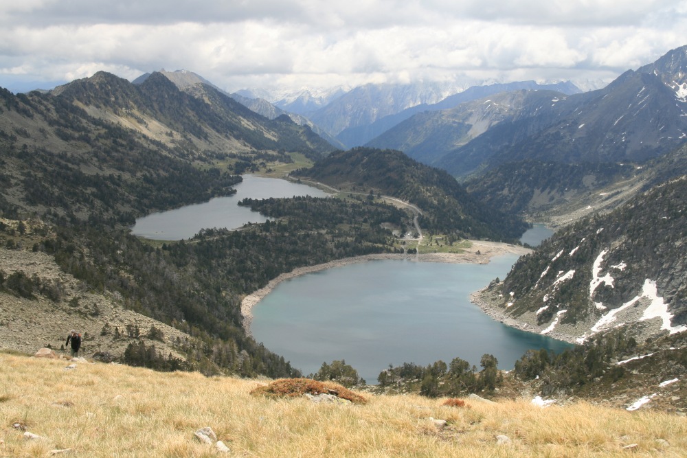
The Lakes Below Pic du Midi d'Ossau – Wed 25 May
This is a great walk, up to the furthest
and highest of the lakes,
then back down through the lake system, with the Pic lauering above
15km and 666m, 1420-2086m, a 5-7 hr circuit |
|
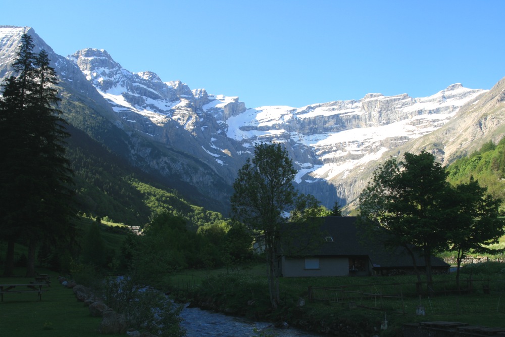
THE CENTRAL PYRENEES
We spent 6 nights in La
Bigorre – too few! – fitting our walks (very nicely) between
rain periods.
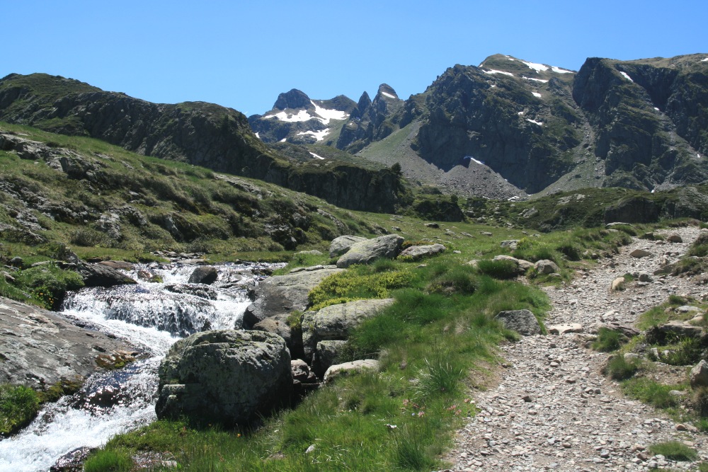
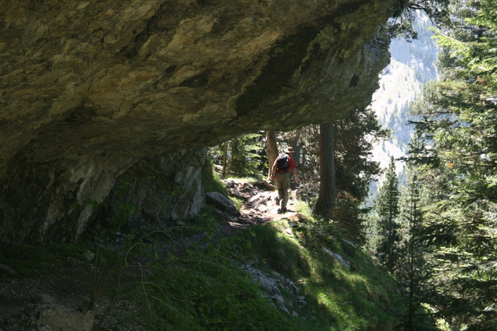
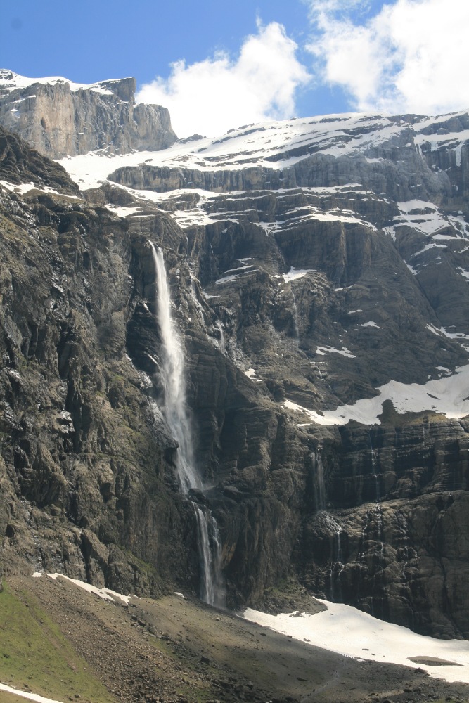
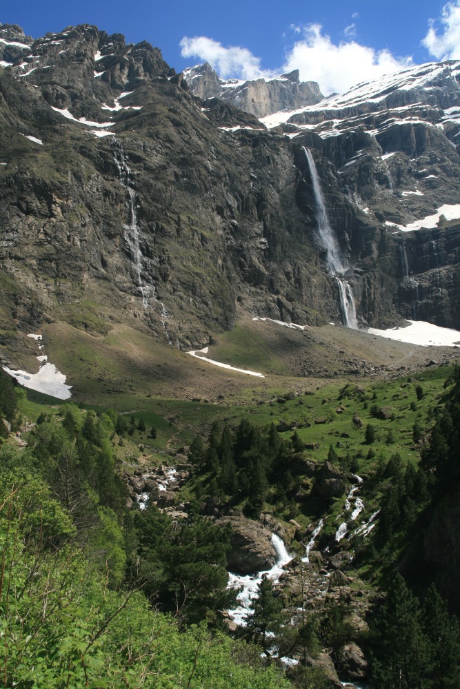
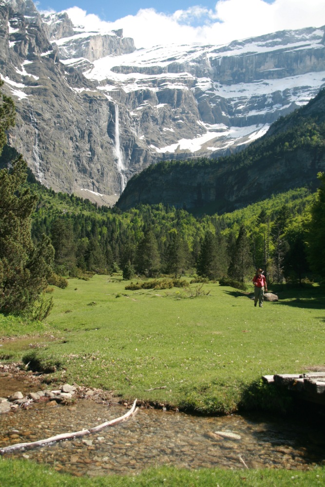
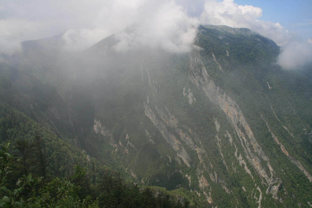
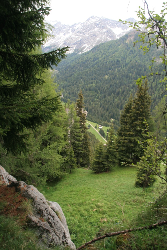
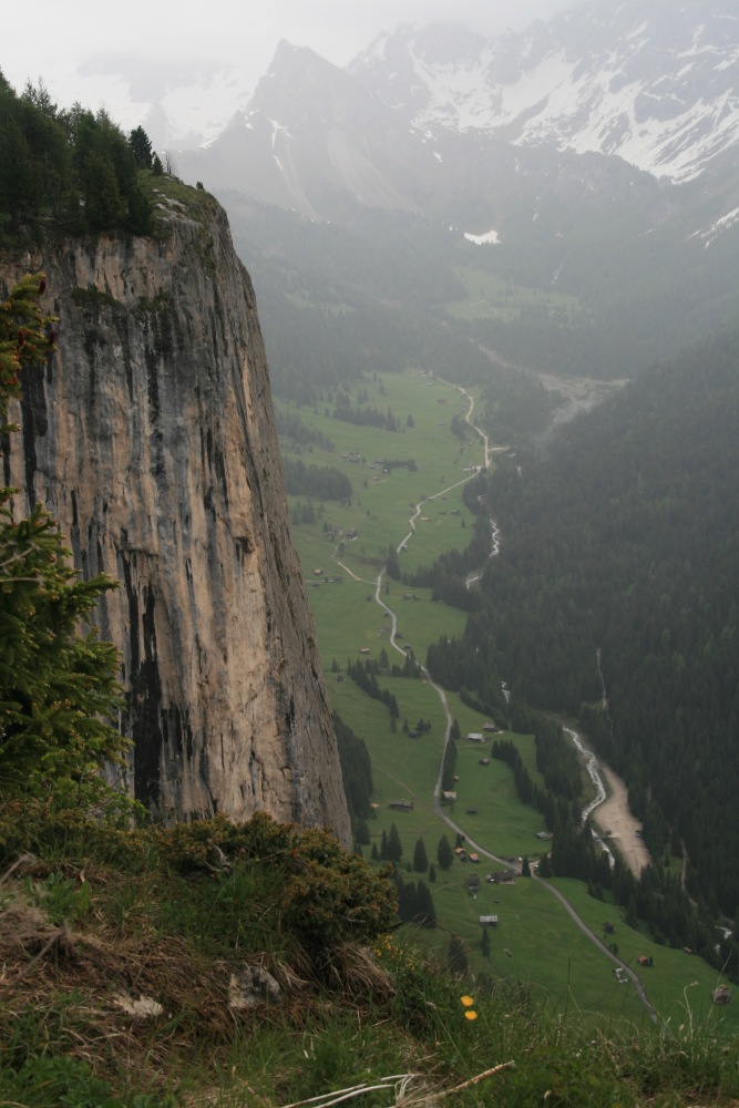
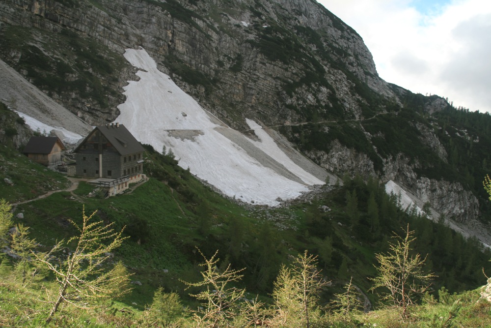
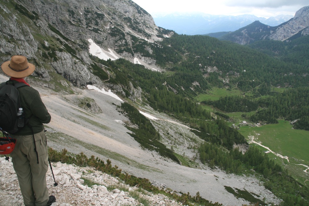
Cirque du Gavarnie (S of Luz-St-Sauveur)
– Sat 28 May
This is a Grade A walk in the central-west of the
area, 15km and 1050m. We started in Gavarnie, up the
eastern wall of the valley, then across the alp to a refuge, and on up
to the sharp col (hourquette) d'Alans; then back and south to
the side-wall of the main valley. This led beneath striking limestone
cliffs to, oh by the way, the highest waterfall in Europe; then back to
Gavarnie along meadows on the valley-floor.
|
|
|
|
|
|
|
09:45 at the car-park |
Along the stream |
Pensioned-off
trail-horses? |
Morning-tea
near the Refuge |
|
|
|
|
The path up to
Hourquette d'Alans |
The next Cirque,
d'Estaubé |
Looking back down,
incl. the Refuge |
The track up
beneath Pic Pimené |
|
|
|
|
The overhanging cliff |
The Gavarnie Cirque
coming back into view |
The waterfall, incl.
people on the path |
Mountains above,
torrent below |
|
|
|
|
Meadow? Garden? |
Or park? |
1450m from stream
to Pic Pimené |
Well-deserved beers |
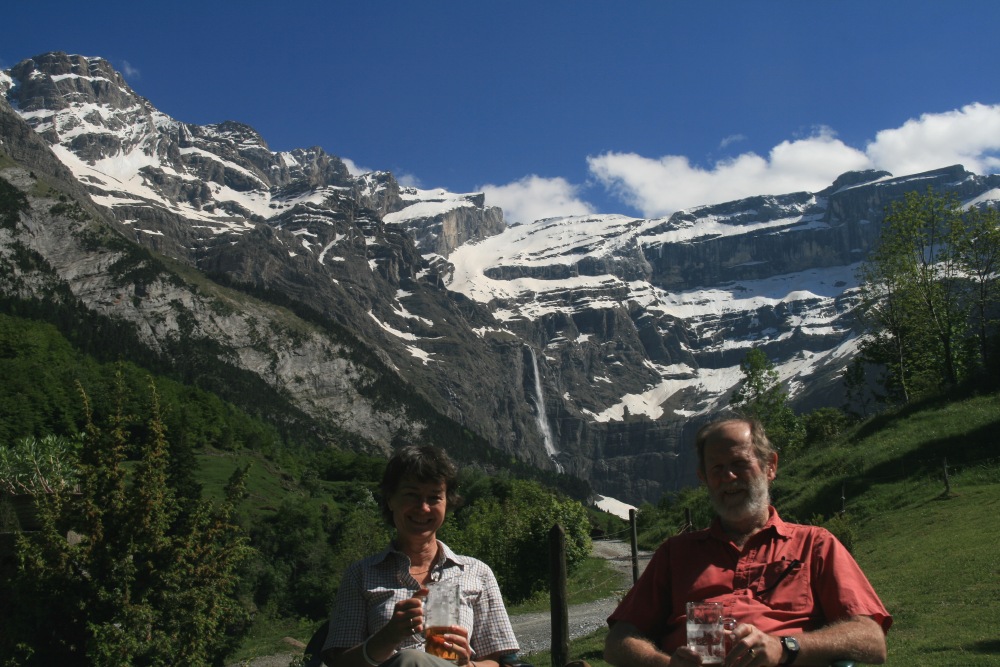
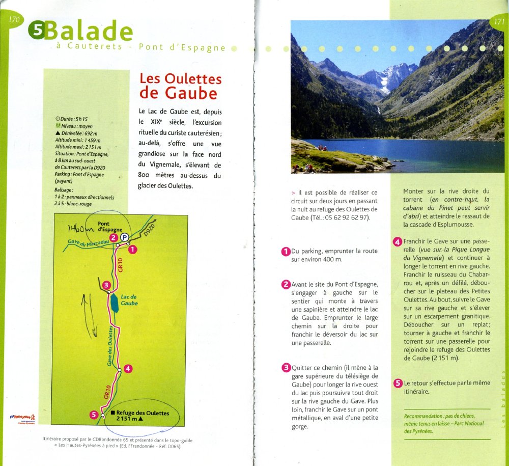
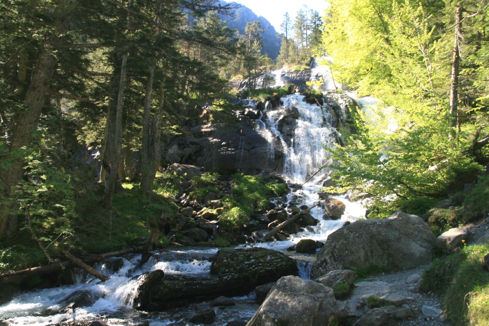
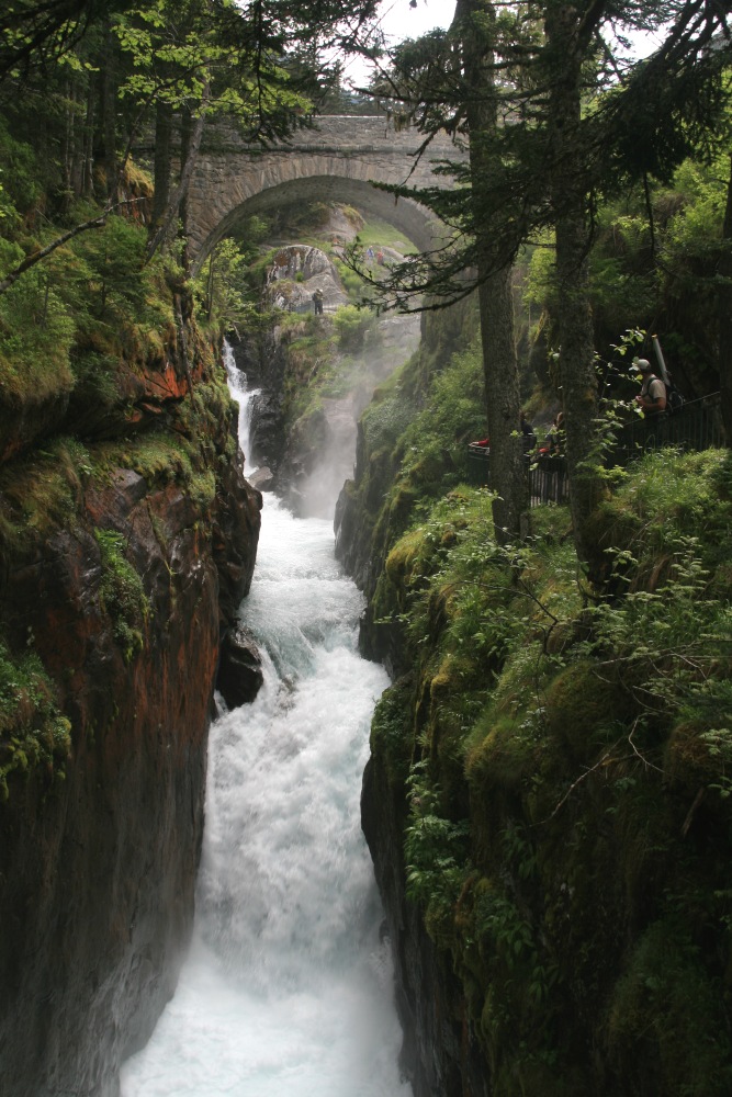
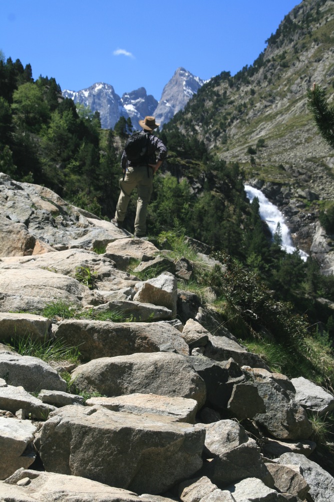
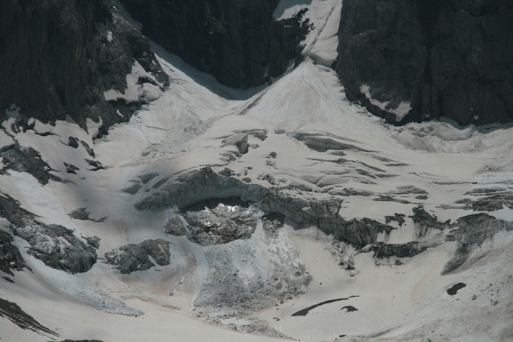
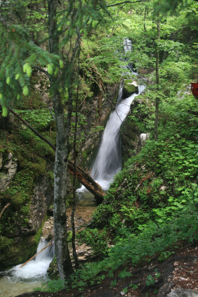
Pont d'Espagne (S of Cauterets) – Sun 29 May
14km, 650m. Despite the quality of
the light and the scenery, and the considerable contrasts along the way,
it was a rocky track, and that and leg-weariness from the previous day
slowed us down.
We needed the photos to remind us what a striking day it was. |
|
|
|
|
|
|
The Pont D'Espagne ... |
... at the top of a series of ... |
... gorges and waterfalls ... |
... late in the day,
plus figures |
|
|
|
|
Lac d'Gaube ... |
... a climb above the Pont ... |
... crystal-clear water ... |
... and the stream above it |
|
|
|
|
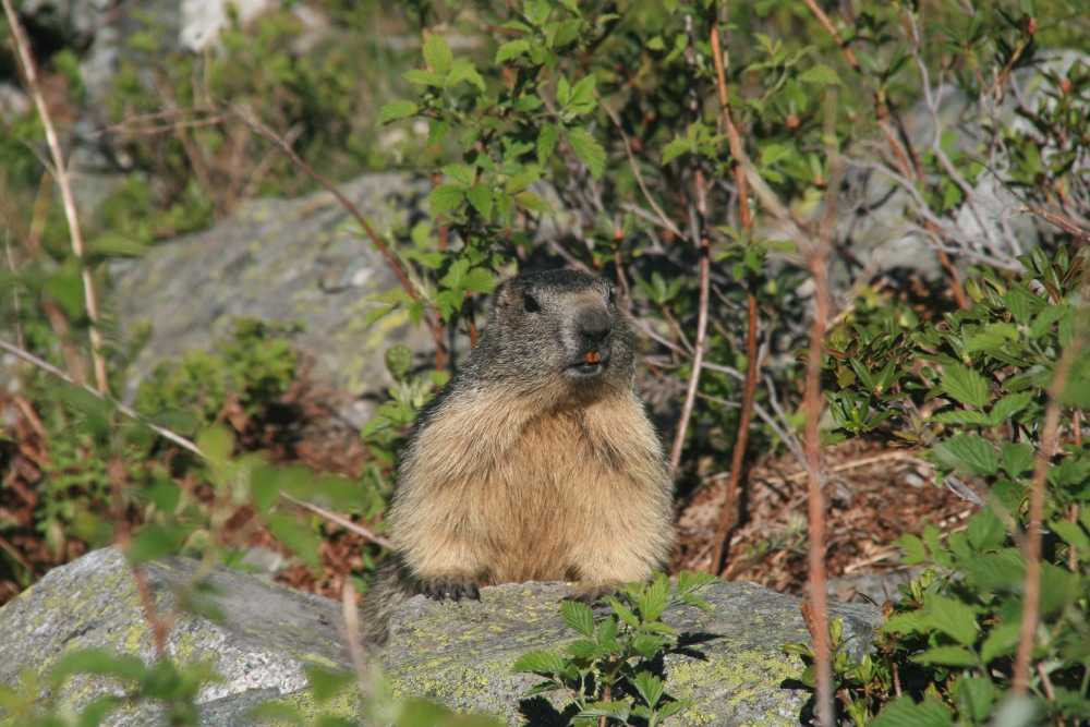
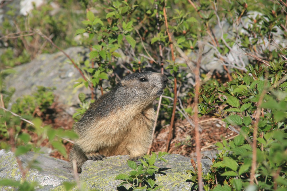
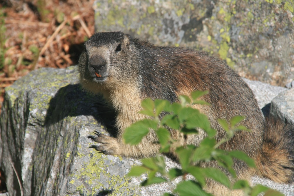
A marmot ... |
... inquisitive ... |
... well, maybe hopeful ... |
... but very healthy |
|
|
|
|
The upper section ... |
... rocky and tiring ... |
... but along a stream ... |
... with inspiring views |
|
|
|
|
The view back down the track |
Lunch on the glacial delta ... |
... beneath Vignemale ... |
... highest peak in the French Pyrenees |
|
|
|
|
Walking back ... |
... still looking at Vignemale ... |
... and the other way |
Alpenrose (rhododendron) |
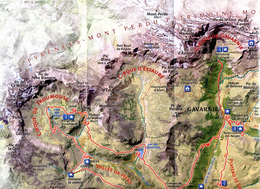
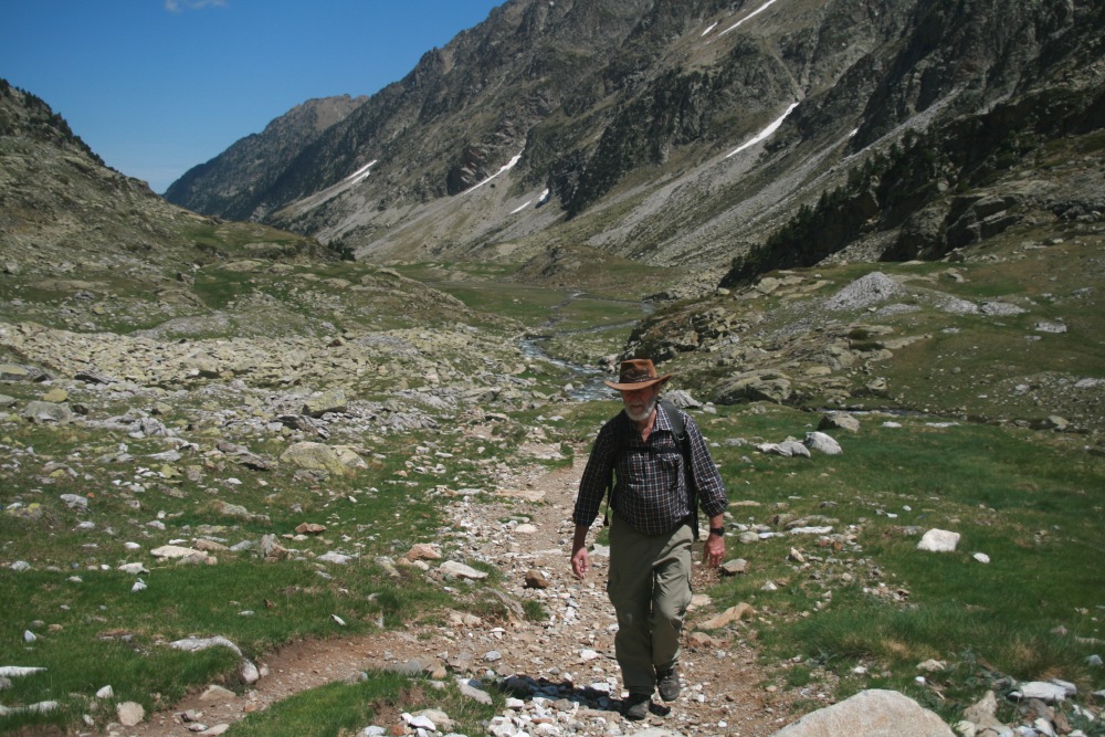
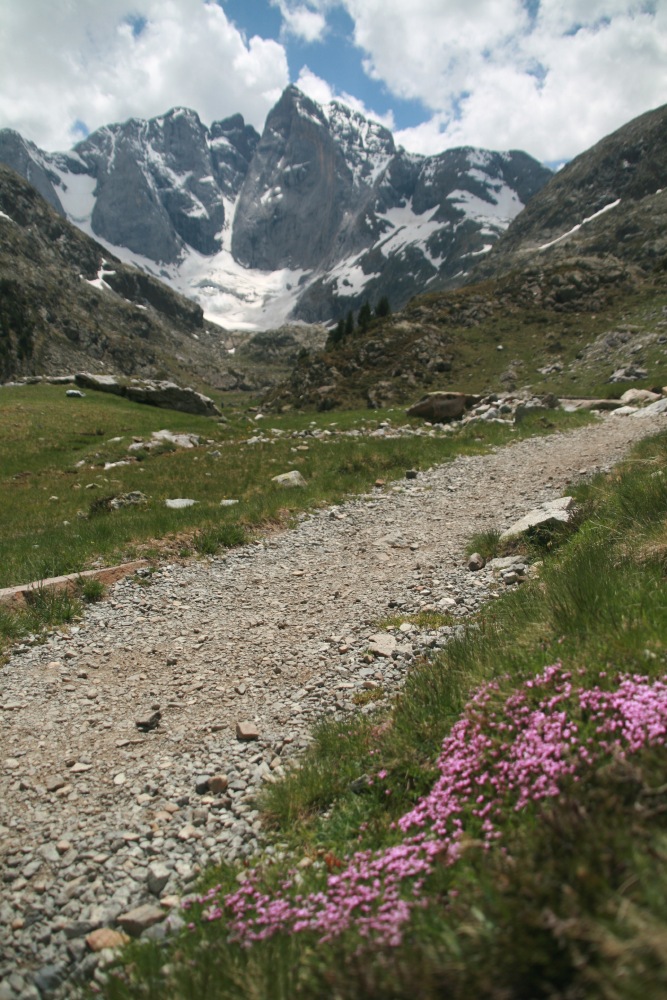
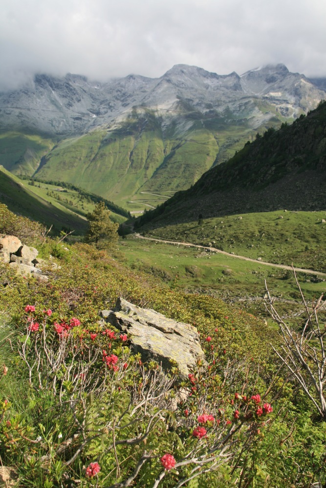
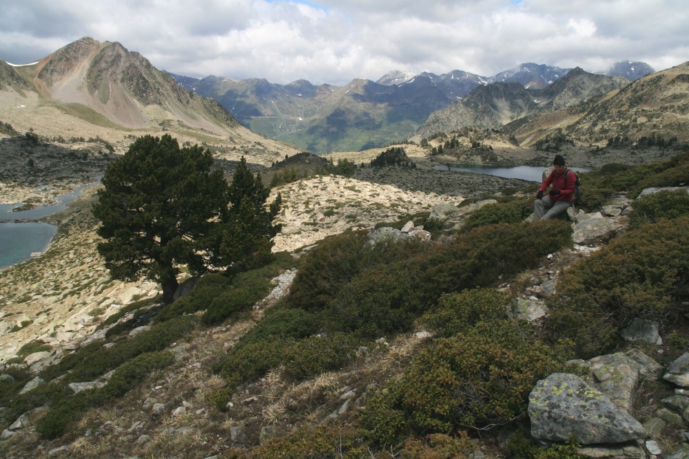
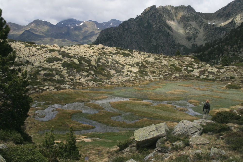
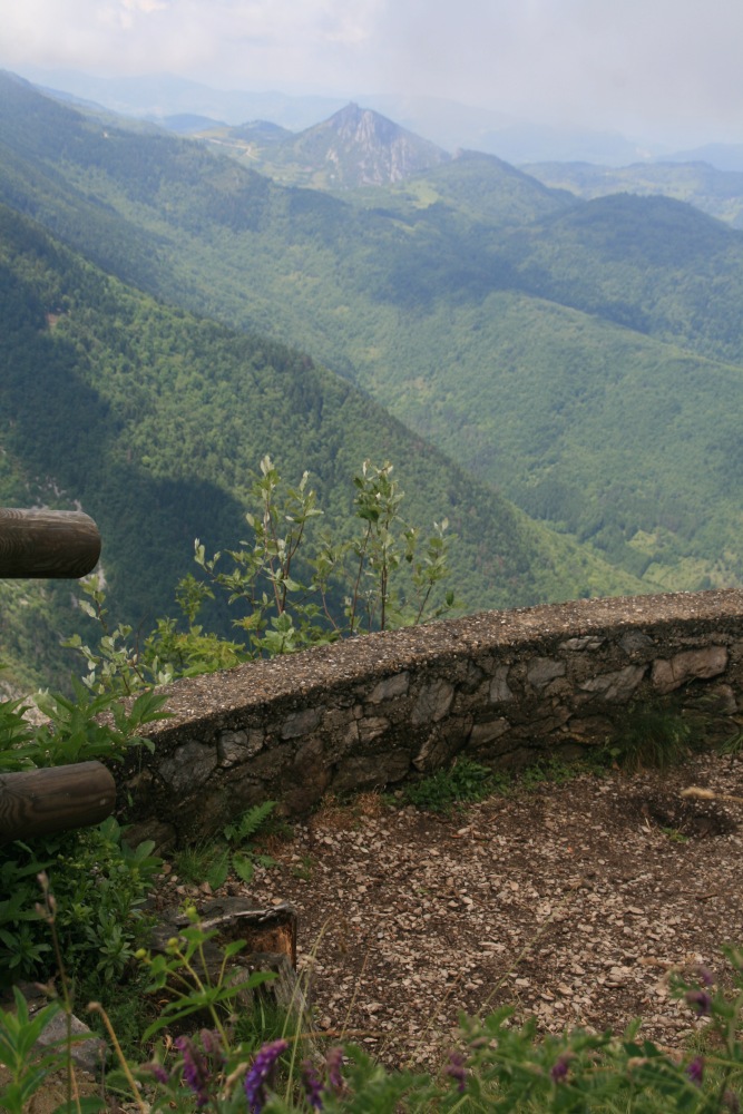
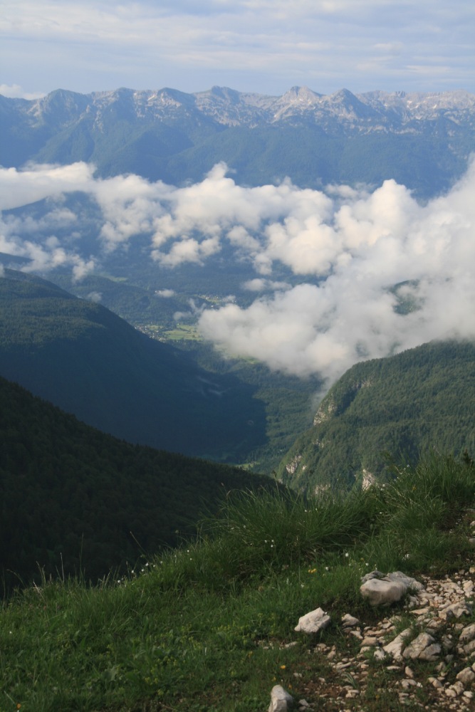
Cirque de Troumouse (S of Luz-St-Sauveur) – Mon 30
May
2km, 50m stroll around the vast meadow at 2100m, beneath the
glacier-hacked walls. See the the Gavarnie Area
Map.
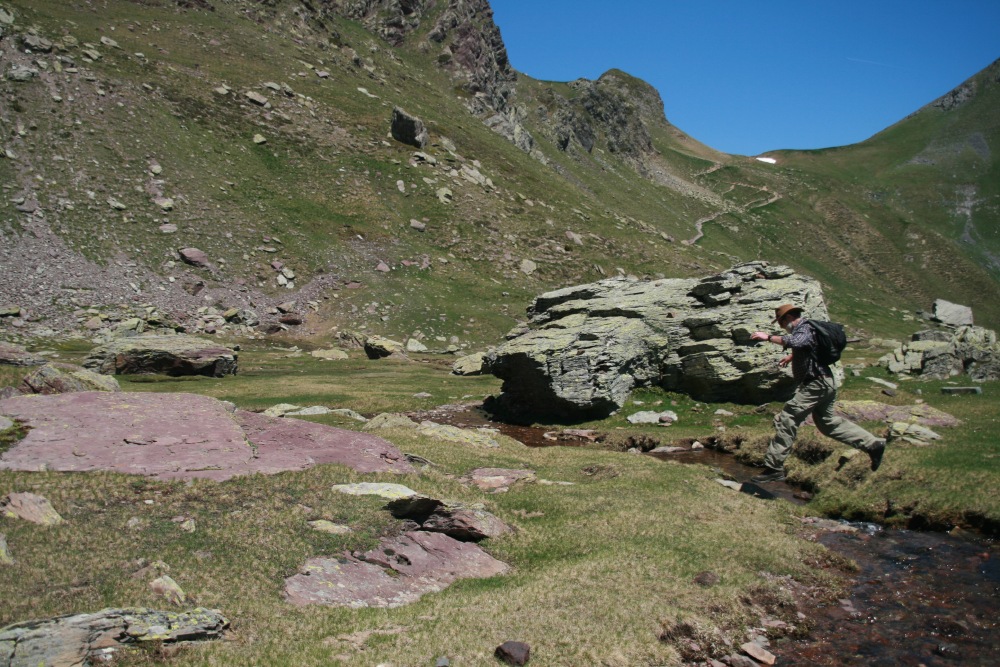
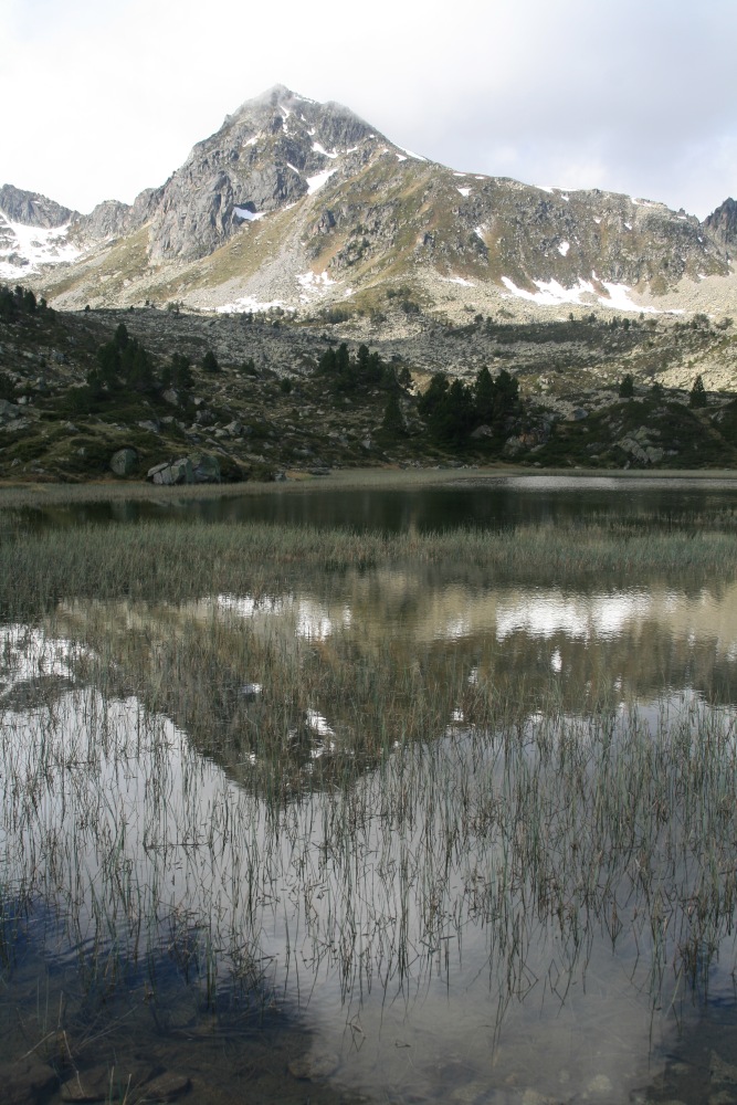
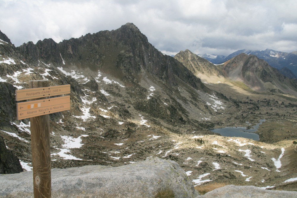
Hourquette d'Aubert (S. of Baréges) – Wed 1
Jun
A striking walk of 16km, 1050m, 1450m
to 2500m, from the Jardin d'Alpin up the valley, right up a steep slope,
then on past the dam and the lakes up to the sharp col (hourquette). At
one stage we accidentally followed a fisherman's path, and had to use
the map and (for once!) the GPS to find ourselves, then rock-clamber 500m
to get back to the path. The famous lakes on the southern side of the
(2500m) ridge looked less interesting than the ones we'd passed. The weather
looked threatening all day, but remained friendly (except for the very
cold wind at and near the Hourquette). |
|
CATHAR CASTLES
The many castle ruins in the foothills SE of Toulouse
have only a little to do with the Cathars (or Albigensians), but the interests
of tourism dictate that it's the 'Cathar Castles' region. We squeezed in a short
sojourn in the W, visiting Roquefixade and Montsegur, on the way up to Carcassone.
We'd targeted Peyrepertuse and Queribus as well (SE towards Perpignan), but
time and (mainly) weather beat us.
Here's a schematic map
of castles in the region: |
|
And here's a real map: |
|
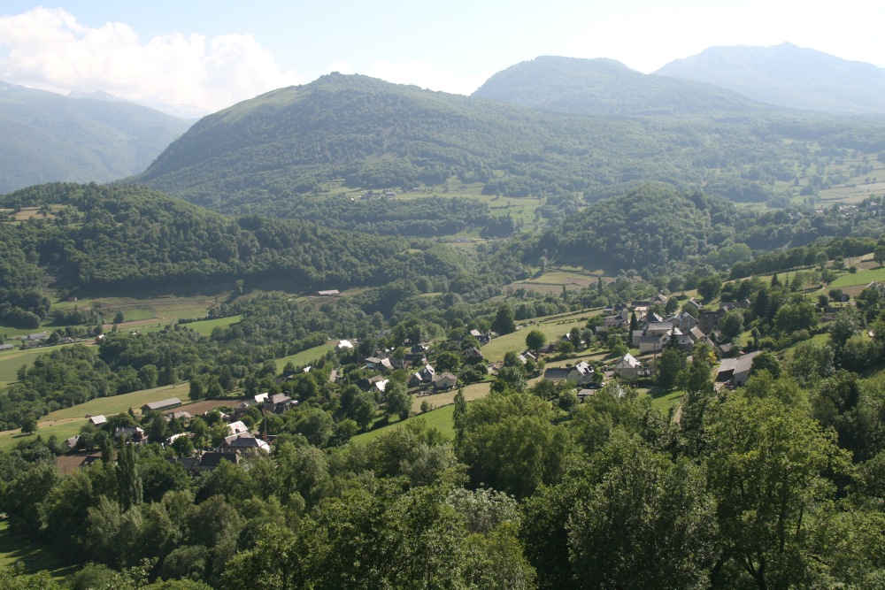
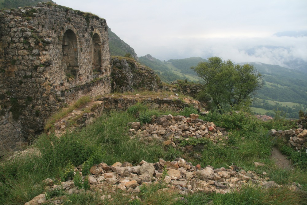
Roquefixade (E. of Foix) – Thu 2 Jun
Roquefixade, at the W extremity, is small, but one of the best. Yet it barely
even registers on the tourist guides. 1km, 100m, from the village
up to the castle ruins:
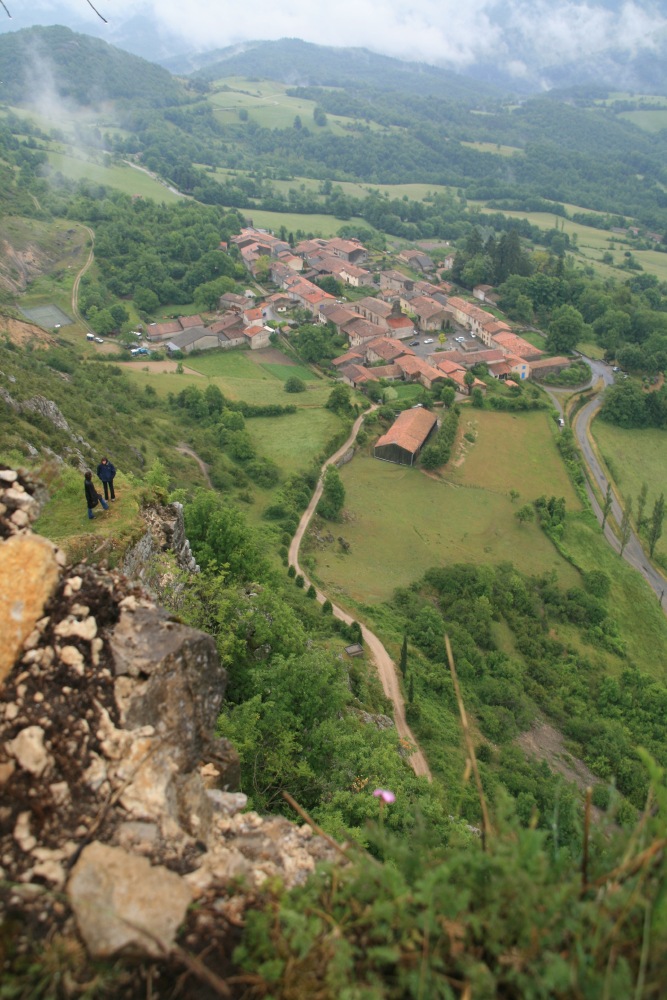
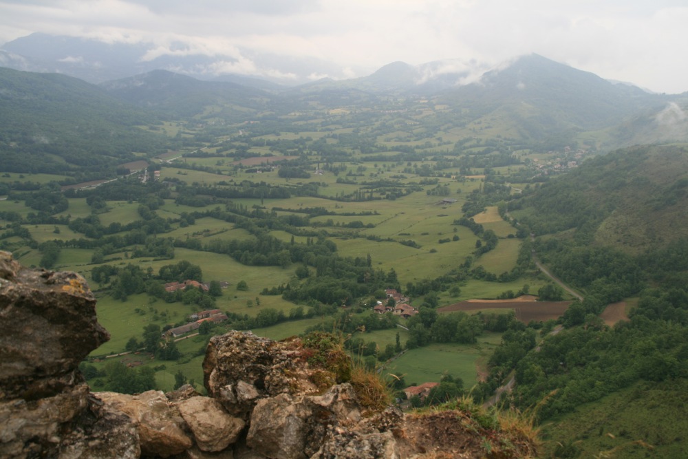
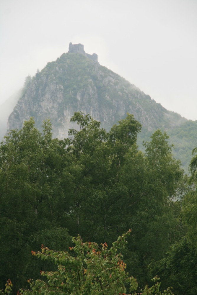
Gorges de Frau / Mont Segúr (E. of Foix) –
Fri 3 Jun
We'd booked a great Pension, Serre de Marou, 1km W of MS (Yves & Nicole
Masset). We did a day-walk, followed by a quick climb to the ruins of the famed
castle. 15km, 700m, 700-1400m, south up the Gorge, then north
again via Comus and Col des Gargante, to a Point du Vue looking 4km NW to Mont
Segúr. Unsettled weather, wet the days before and after, but merely cloudy
on the day, down to low levels much of the time. +1km, +150m,
up to the castle of Mont Segúr. The setting is great, the partially re-built
castle ruins only so-so, and the path very poor considering the thousands who
go there (in bad shoes). And the rain closed in. The last four shots below are
from Yves & Nicole's place – two on arrival the previous evening and
two during the evening after the walk
|
|
|
|
On arrival at the Point de Vue |
View to the SW,
clouds clearing |
NW to Mt Segúr,
4km away, nearly clear |
Closer up,
incl. Y&N's place |
|
|
|
|
Looking down into the Gorge |
The Valley back
towards Comus |
Just above Comus |
The Gorge walls,
now in sunlight |
|
|
|
|
MS from Y&N's verandah ... |
... and per telephoto |
Same shot, in the evening ... |
... after another storm |
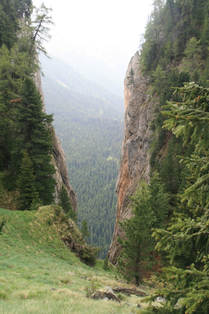
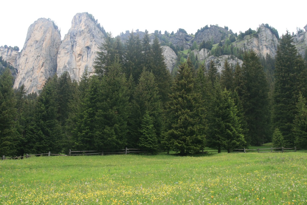
DOLOMITES
Val de Sen Nicolo (S of Canazei) –
Tue 7 Jun
1200km later and 48 hours later, we diverted to visit our frequent hosts and
friends at the Dolomites Inn in Penia, Bob and Lucia. This short walk was 5km
and 500m, from 1700m at Rifugio Baita Cuz, straight up the
side of the valley, through and above sheer cliffs to 2200m, although with only
a few vertiginous sections. We came back down another chute a little
further west. +1km and +100m back up the road to the car. The
drizzle held off until we'd got back. The last photo looks back up at the cleft
through which the fifth was taken.
SLOVENIA
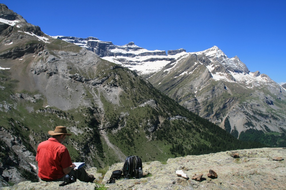
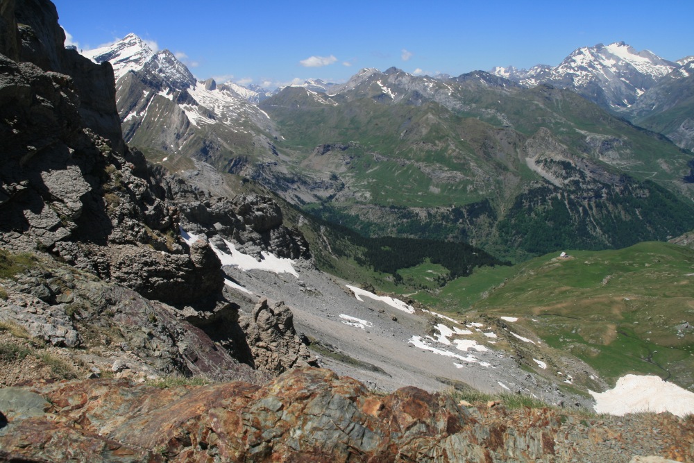
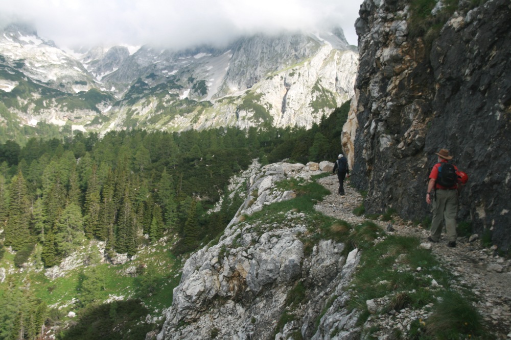
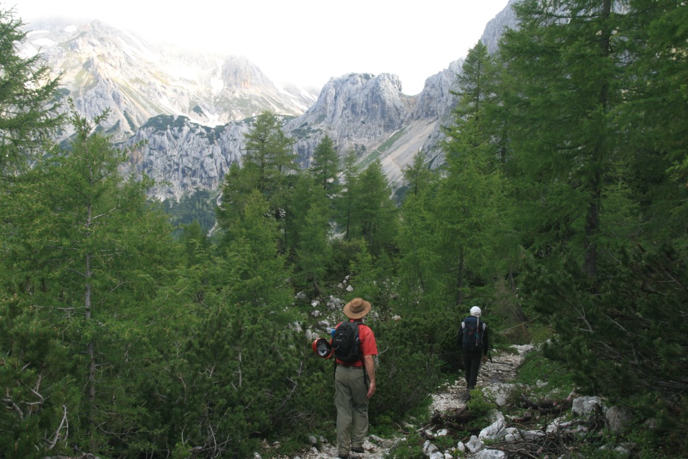
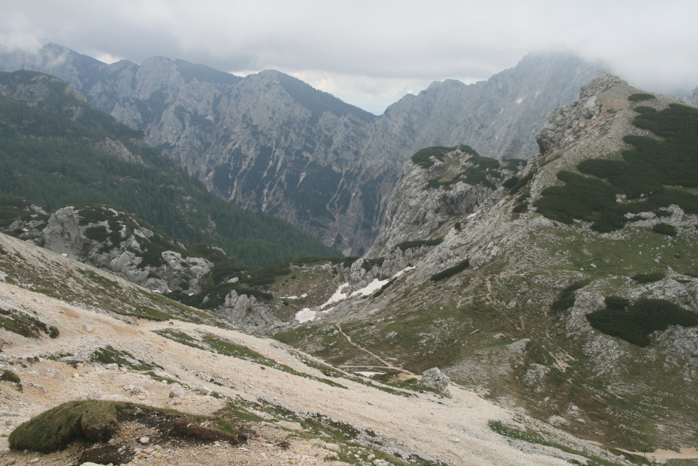
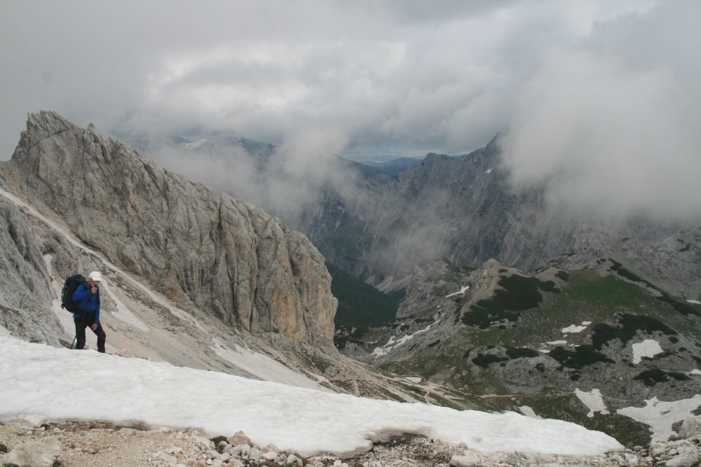
Triglav (The Mountain that defines Slovenia) – Fri
10 Jun
This was the target – intended as the culmination of our mountain-walking
careers.
It turned out to be one or two levels again beyond what we'd anticipated ...
It was our longest (30km), greatest height-difference (1700m,
from 1310m to 2864m, plus 150m rise and fall along the path), and hardest ever
(a track that's only occasionally smooth, with a great deal of gravel, rocks,
slippery tree-roots and 7 or 8 snow-crossings). We now understand why people
normally do this as a 2-day walk. (In summer, several huts offer an overnight
stay; but that option is only available from mid-to-late June to mid-September).
We walked 06:06-20:36. The indications were 6-7 hours up (it took us 8-1/4),
and 4-5 down (we needed 6-1/4). The experience was exhilarating, but completely
exhausting. This is not a hike / tramp / moutain-walking. It's a long walk followed
by a 450m ascent of a rock-ridge, with quite some hundreds of metres of via
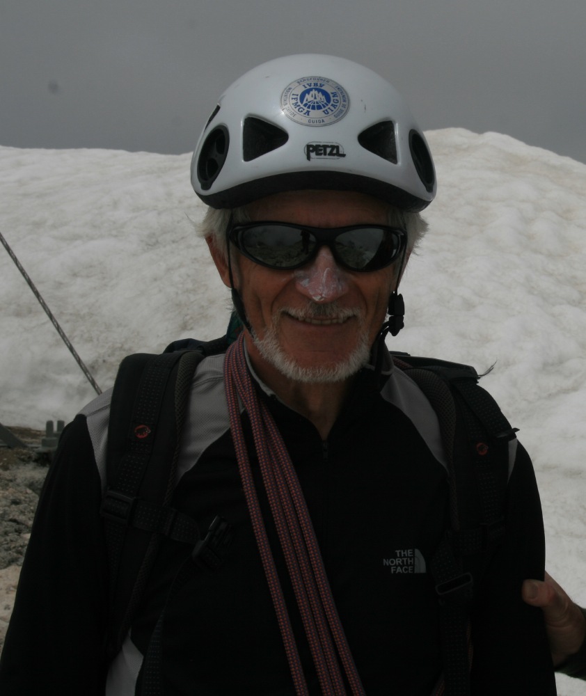
ferrata, i.e. dangerous. For mountain-walkers like us, a mountain guide is essential.
Without our polar-expeditioner mountain-guide Stane Klemenc, we'd have had to
give up a long way from the summit.
|
|
|
|
Near the start in the forest at 1350m |
The dairy flats at 1430m |
The climb from the valley |
The mountains hanging over the path, working up towards
Studorski Preval at 1892m, up to the left |
|
|
|
|
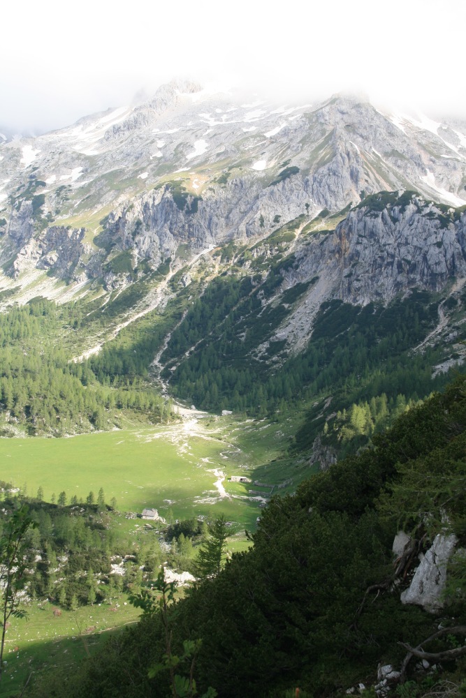
Then comes a 4km traverse SW, W then N around Tosc
(mountain). 2/3rds of the section is visible here (taken the next day,
with zoom, from our Pension) |
Just below Studorski Preval, Stane starts on the first,
SW segment of the traverse |
Views down over forests to the Bohinj Valley, including
Stara Fuzina and our Pension. (The reverse of two shots earlier) |
Most of this segment had steep slopes below –
a little light training for the ridge-line in the last kilometer of the
climb |
|
|
|
|
The path back E, with Stara Fuzina visible (taken
on the way back) |
The traverse swings North (with our track just above
centre of picture) |
Above pastures called Velo Polje |
Looking at Miselj vrh (peak) at 2350m |
|
|
|
|
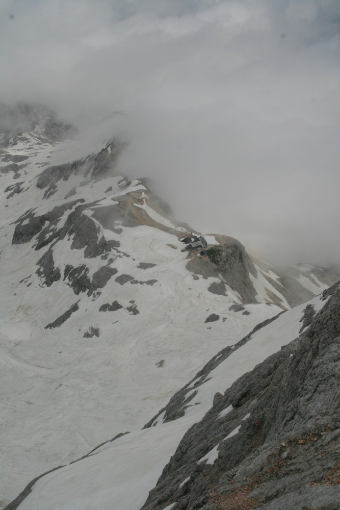
(A little down) to Vodnikov Dom (house) at 1817m |
One of the better parts of the path. (You don't take
photos of the hard bits, because you're too busy) |
Looking back down the path ... |
... on the way to Konjsko Dom at 2020m |
|
|
|
|
(This and the previous 4 shots were taken on the return
journey) |
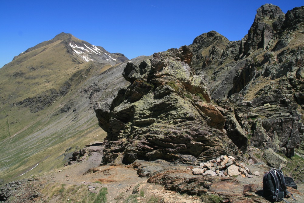
Then a very hard section from 1817m to 2401m. (The
first shot shows the easy bit) |
Looking back at our path ... |
... rising over multiple snow-crossings |
|
|
|
|
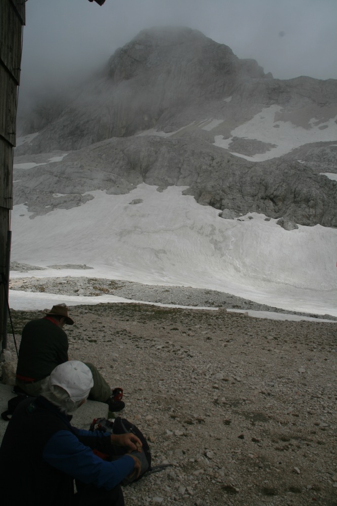
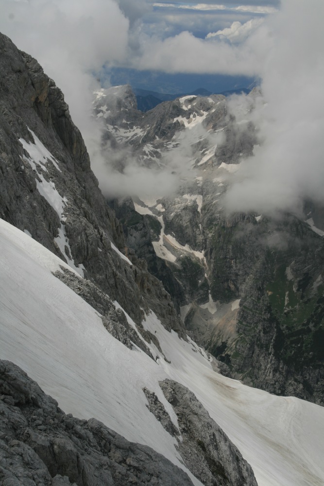
At 2401m at Dom Planika, contemplating the steep snow
and rocks up 324m to Male (Small) Triglav, and the further 140m up the
(hidden) Triglav |
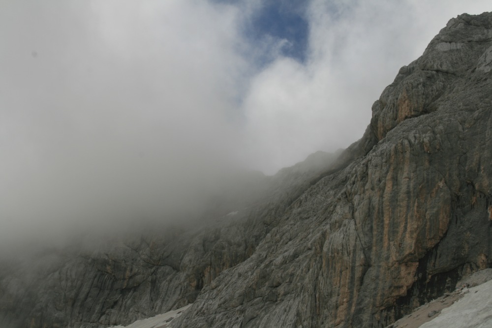
From the same place, on the way back: the cloud that
obscured Triglav throughout , and the left half of Male Triglav ... |
... and a closer-up view of Male Triglav, showing
the funnel, low-left to high-right, and the ridge-walk |
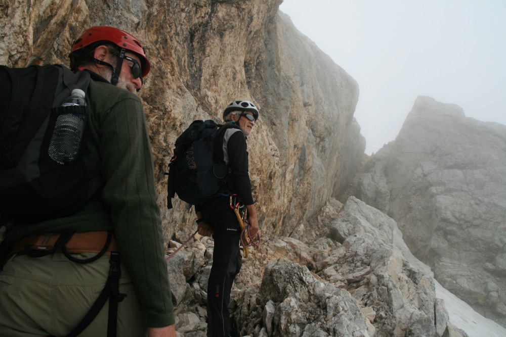
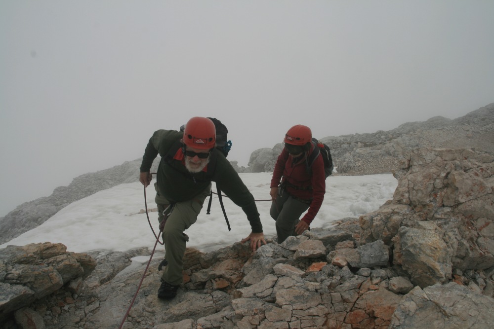
After crossing steep snow in the cirque, up the chute
onto about 800m of ridge-line, 25% via ferrata (i.e. steel rope) |
|
|
|
|
On the ridge, pretending to be happy about it
|
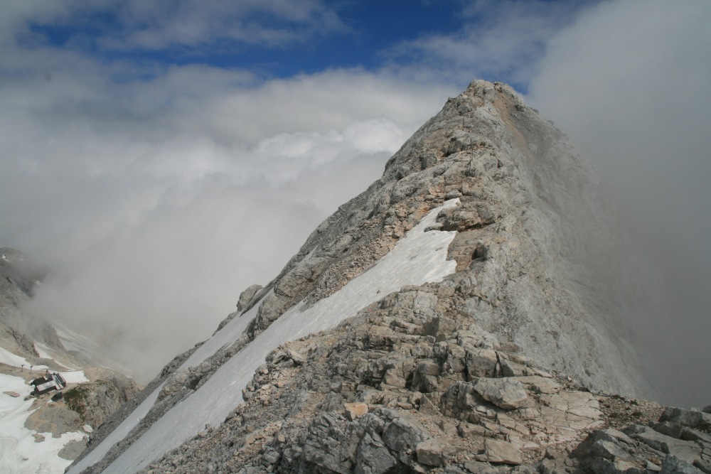
Continuing up a 1-in-1 section |
The ridge is commonly c. 3m wide, but as little as
75cm, esp. between Male Triglav and Triglav itself |
From half-way up Triglav, looking back down to a following
group of climbers who are on Male Triglav |
|
|
|
|
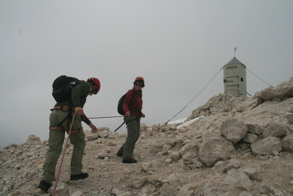
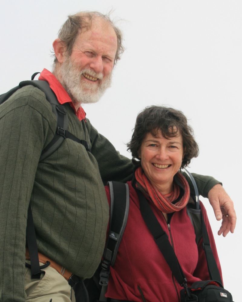
Linda leads, and Roger staggers, to the silly, round
shed that marks the summit |
From the top, looking down on the meteorological centre |
More views from the top |
Coming back, at the dip on the ridge between the two
Triglavs, looking up at Male Triglav, incl. the meteo station |
|
|
|
|
Master Bergführer Stane Clemenc |
Us, exhausted but successful |
I'd wanted a view from Triglav towards Bled, and this
is it ... |
... or maybe this one's more interesting |
|
|
|
|
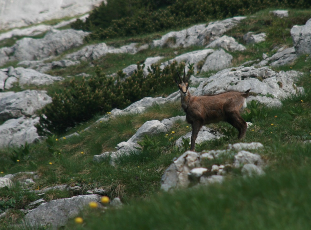
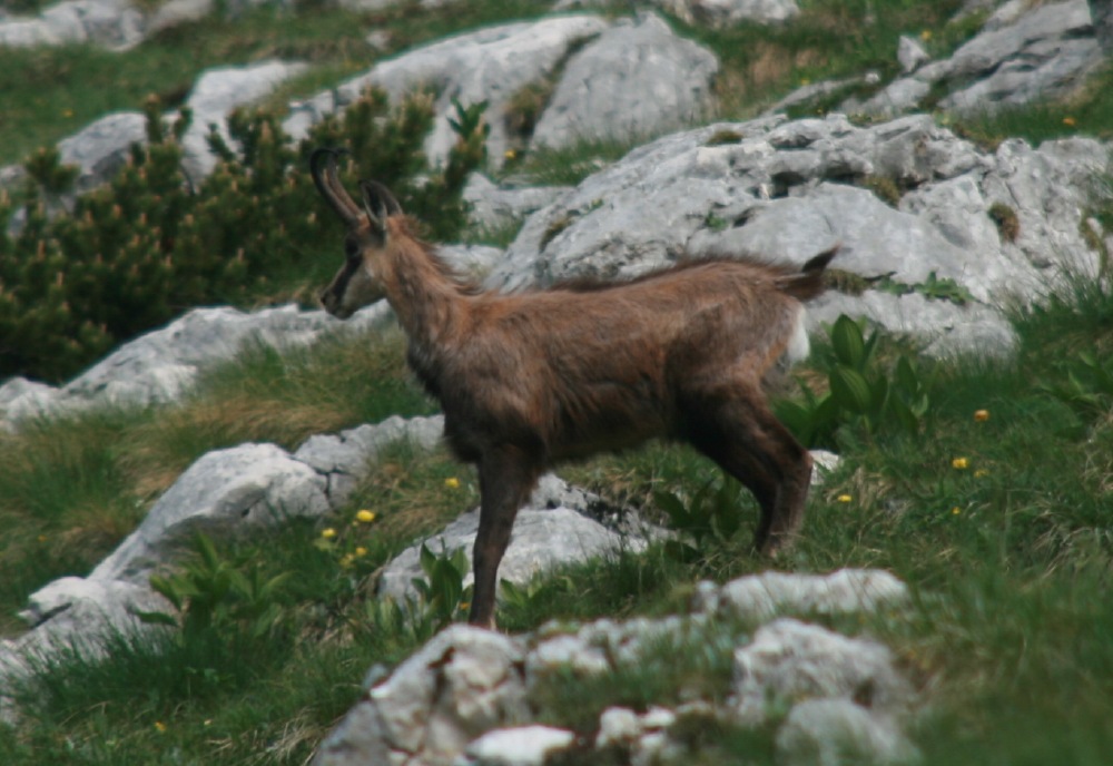
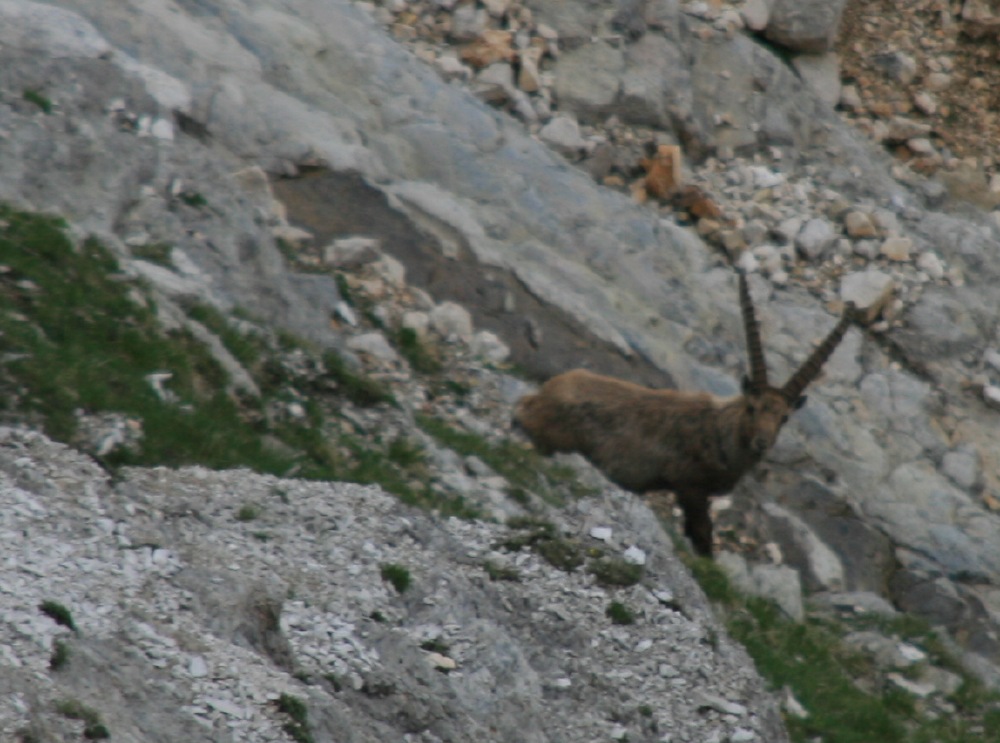
On walks like this, it's normal to see marmots ... |
... but it's unusual to see chamois, especially this
close |
And it's the only time we've ever seen ibex / steinbock
in the wild ... |
... five of them in all |
|
|
|
|
|
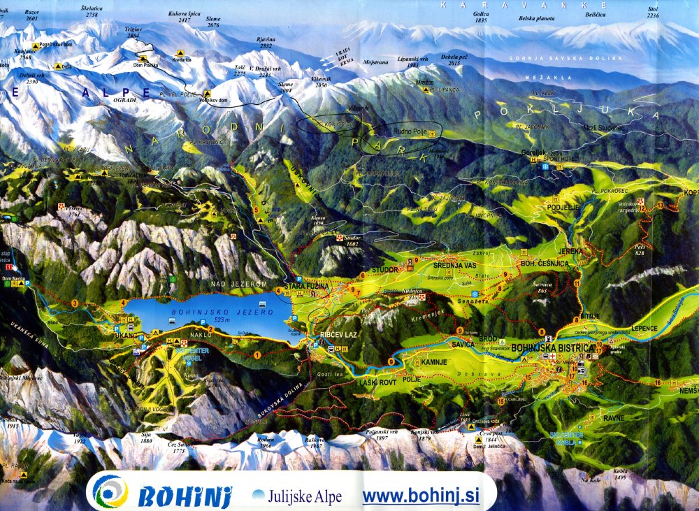
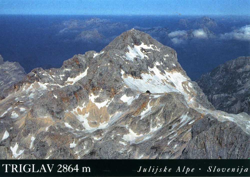
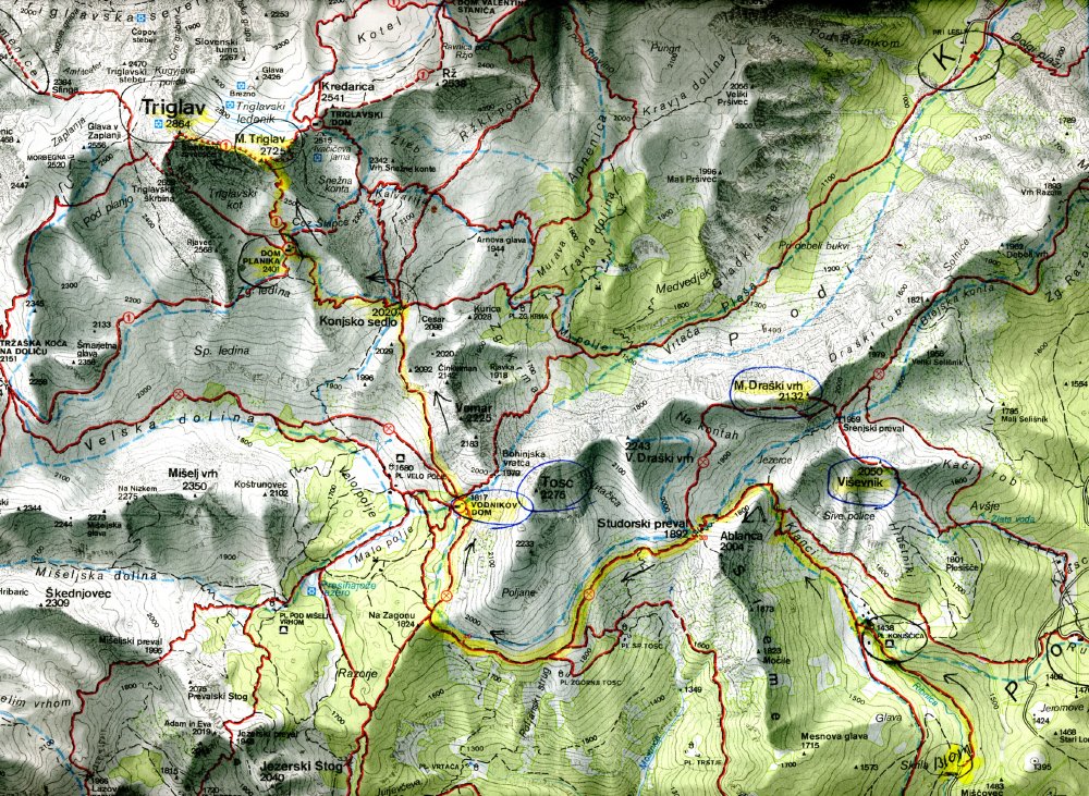
The schematic ... |
... closer-up |
One postcard ... |
... another |
The Map |
|
|
|
|
|
|
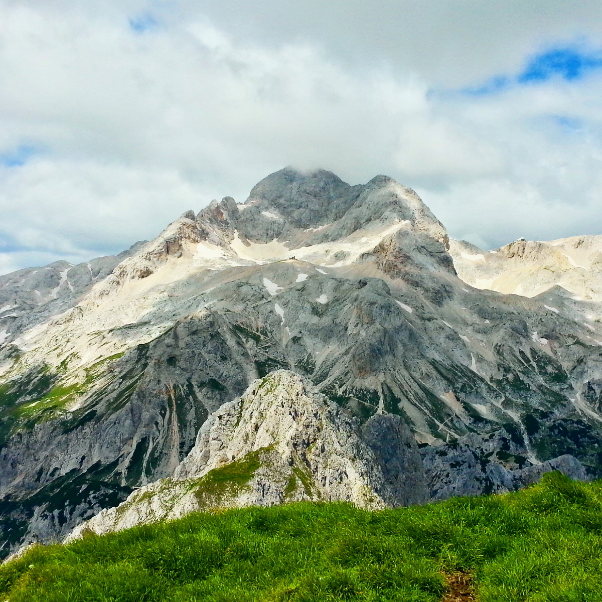
As seen by Andreja 2 yrs later, from Tosc (to the
SE) |
We walked from behind Tosc, around left
beneath it, up the zig-zag path to the hut, then just above the hut to
the right up the chute,
then left up the ridge, over Male Triglav to the peak |
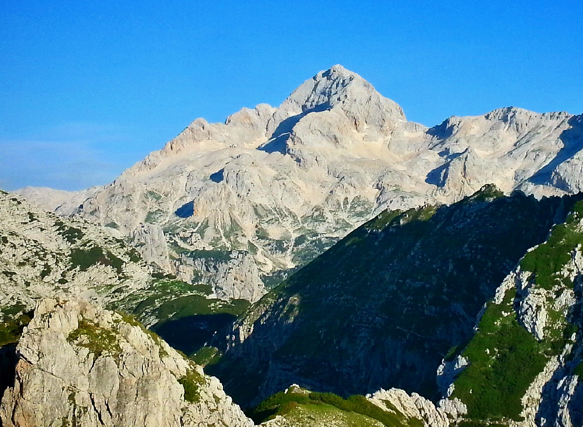
As seen by Andreja from Visevnik (to the
ESE), showing the hut, and the narrow ridge |
|
SWITZERLAND
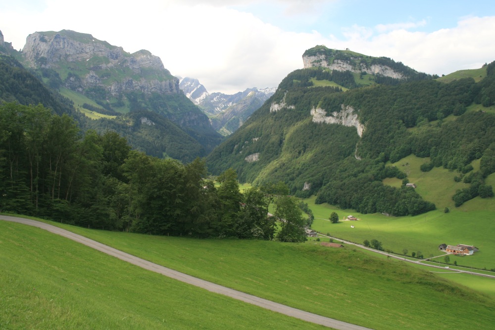
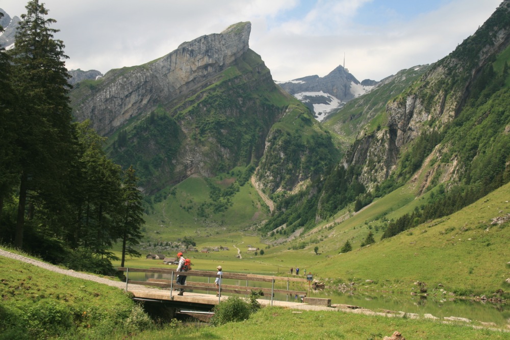
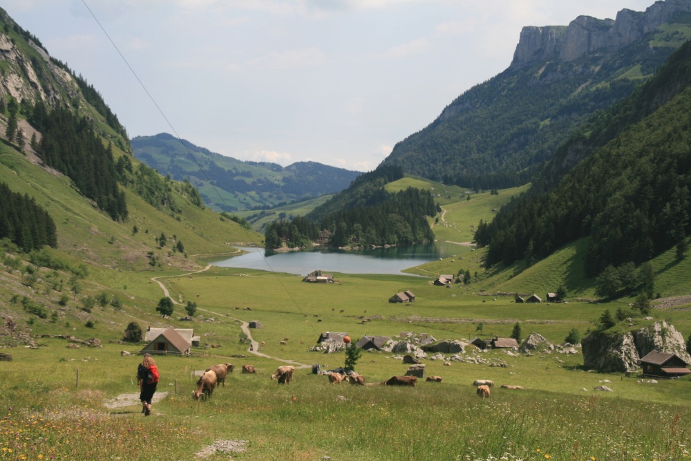
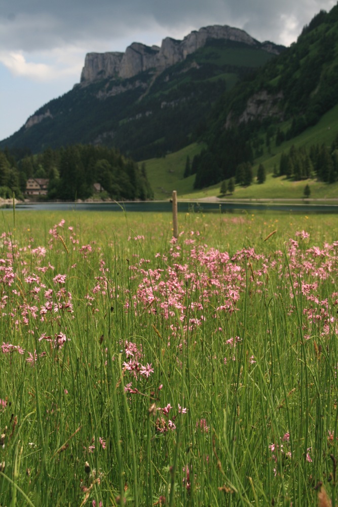
Seealpsee (Beneath Säntis, NE Switzerland)
– Thu 16 Jun
8km, 350m, a warm-down day, with our bodies still a little
in shock from Triglav. From Wasserauen 868m up the (closed) road to Seealpsee
1131m, then up to the end of the valley with its multiple milk-huts, and back
down via a treed gully on the eastern side of the cleft
|
|
|
|
From near our Pension, looking S to the walking-area |
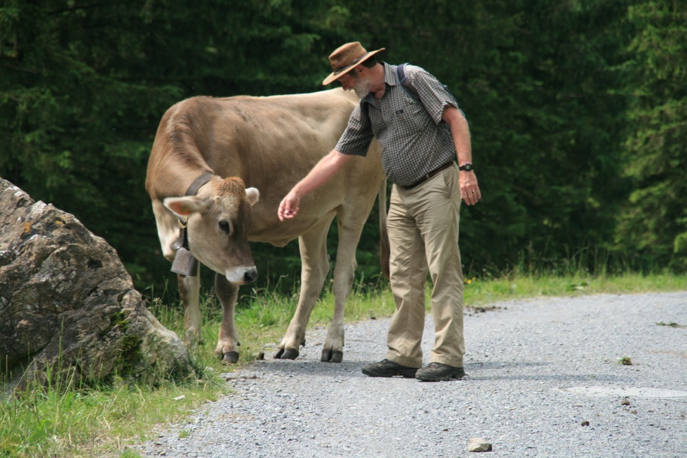
On the way up the road ... |
... meeting new friends |
Not a silk purse |
|
|
|
|
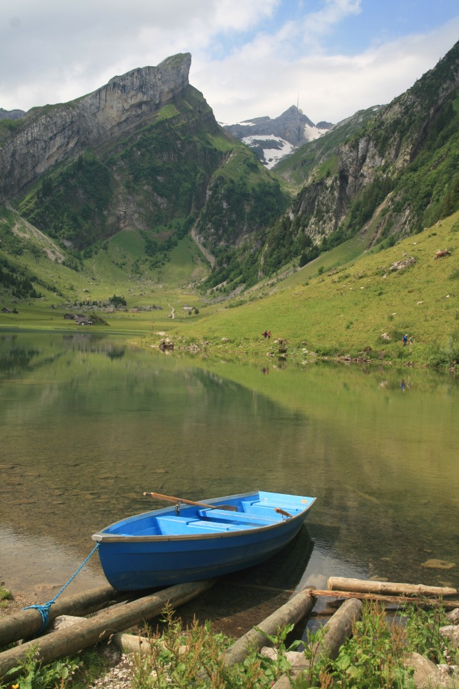
Looking S over Seealpsee (1031m) up to Säntis (2500m)
... |
... with the Agetaplatte at the head of the Seealpsee
valley ... |
... and from the other arm of the lake |
Looking back N from higher up the Seealpsee valley |
|
|
|
|
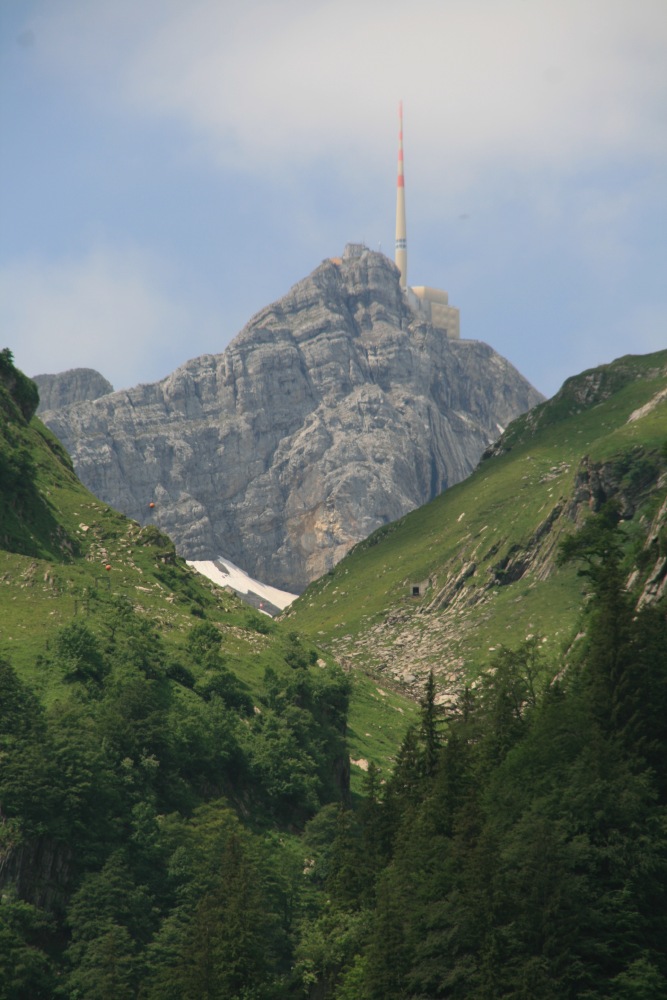
A close-up of Säntis |
Looking back over the lake to the bluff above our
Pension |
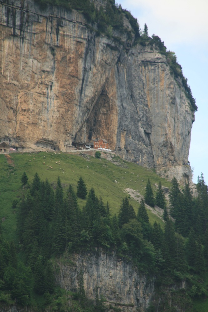
Restaurant Wildkirchli on the W side, beneath the
top of the Ebenalp chairlift |
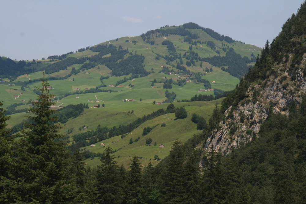
Looking back N, to the chocolate-box green-fields
of Appenzell |
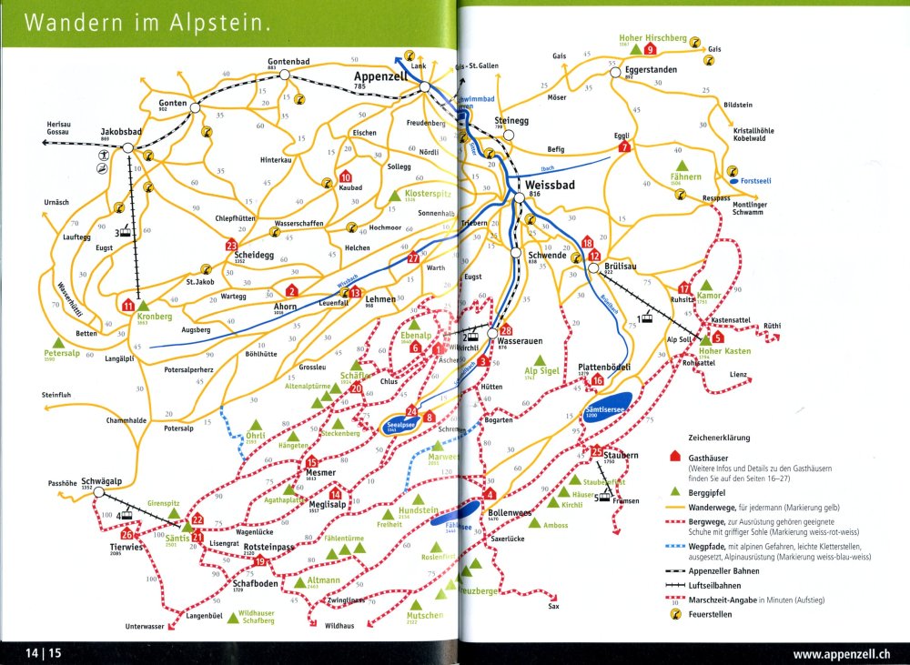
Even after the Pyrenees, the Dolomites and Triglav, we were struck by this
area. We once lived not all that far away (outside Zürich), but we'd never
actually been on this side of the mountain. It's now slotted in for closer attention
sometime (soon, or never!). So here are some more details.
|
|
|
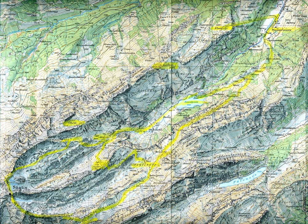
The 1:25,000 Map |
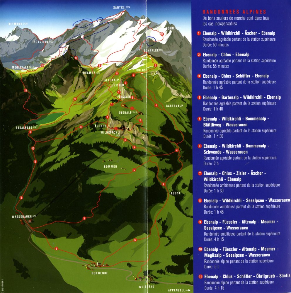
The Walks Schematic |
Key Walk Segments |
|
|
|
The Walks Sketch |
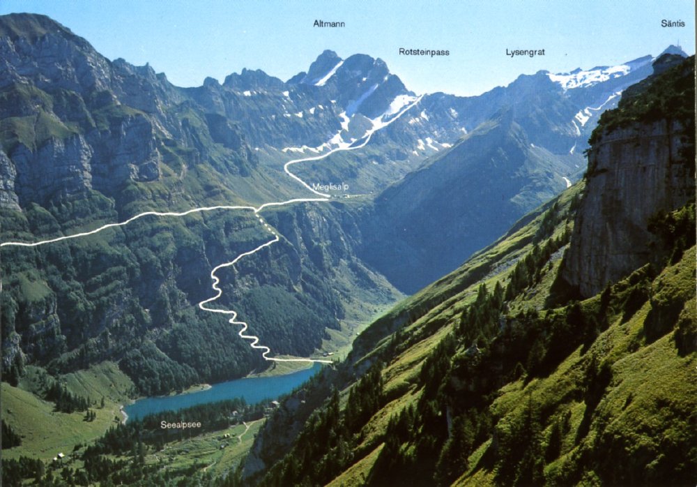
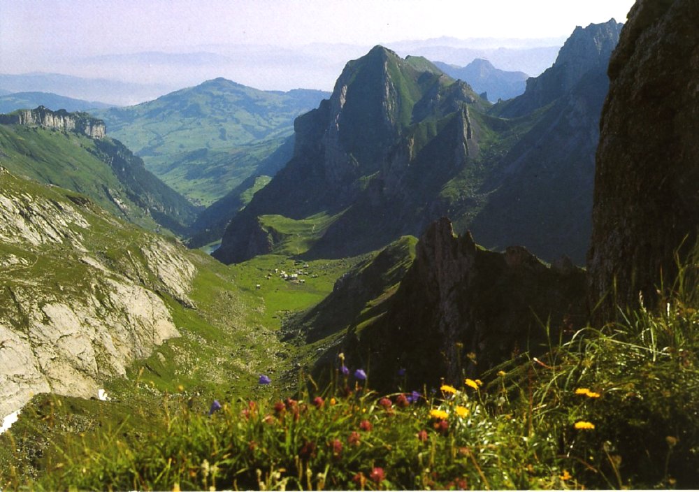
Postcard looking South |
Postcard looking North |
|
|
|
|
Our 2011 Walk |
How to extend it a little |
And some more |
And a nearby alternative |
This is a page within the Clarke-Spinaze Photo Gallery, home-page
here
Contact: Linda or Roger
Created: 25 May 2011; Last Amended: 8 Jan 2015 (added to the
end of Triglav)


