This is a page within Roger and Linda's
Bunhybee Grasslands Web-Site.
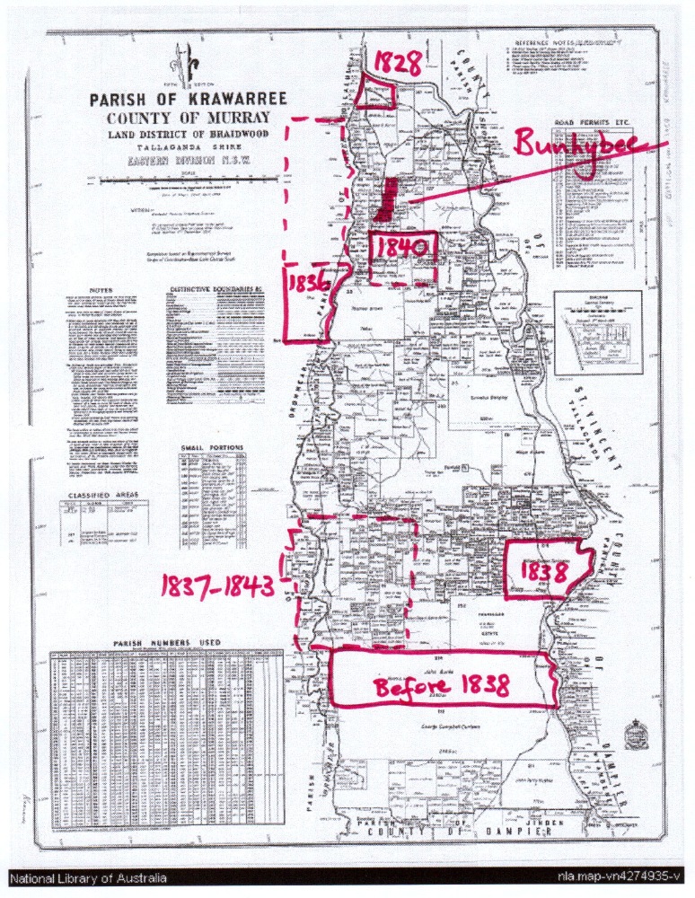
Bunhybee Grasslands is a 49 hectare / 120 acre conservation property 35km south
of Braidwood, in southern N.S.W.
You can follow through the internal links, or you may find it easier to use
the Site-Map.
In order to manage a conservation property, it's important to understand not only what it is that you think you're conserving, but also how it came to be what it currently is. Now that we've established the history of what is now Bunhybee Grasslands, we see things a little differently. This page provides extracts of the history that was researched for us by Trish Downes in early-mid 2012.
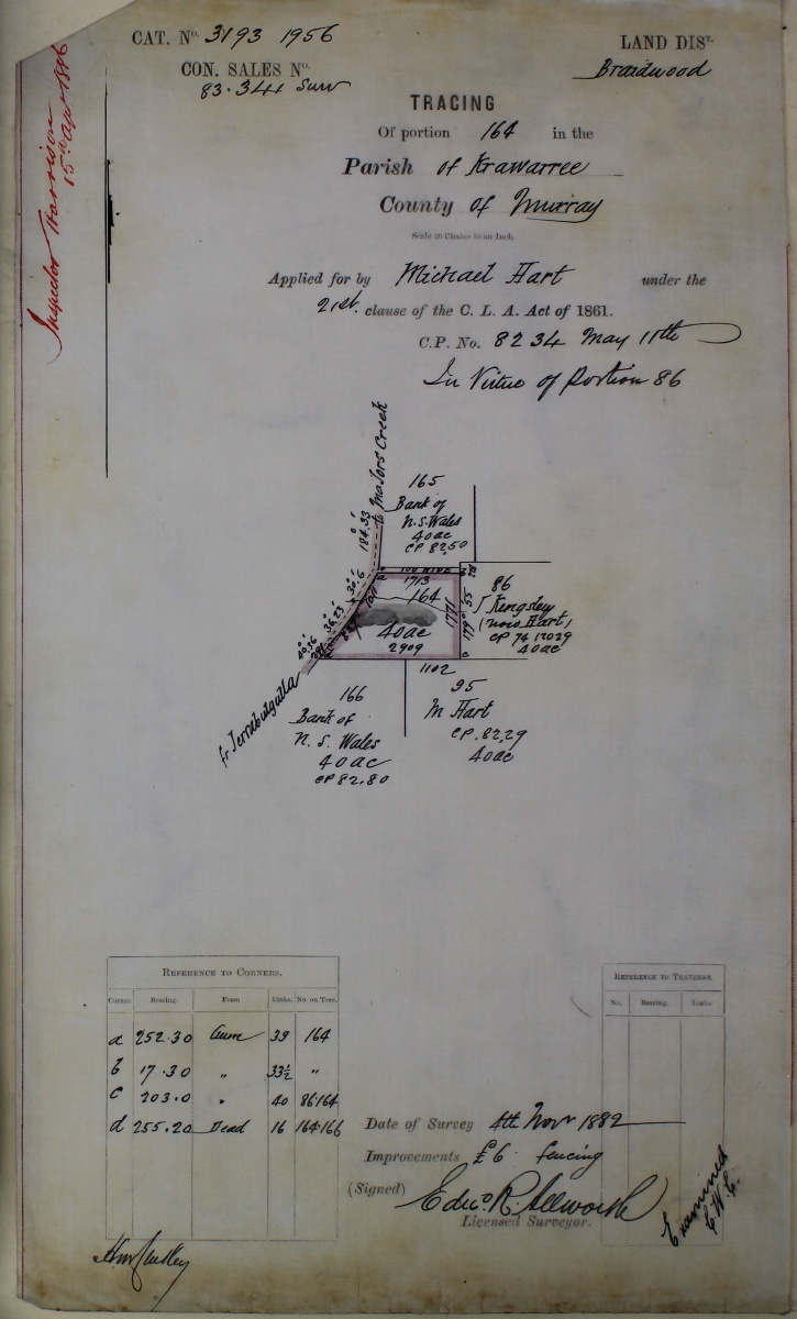
Lots 164 (the Southern Block) was originally timbered, and was cleared (presumably ring-barked) between mid-1884 and mid-1886.
Lot 165 (the Central Block) was originally timbered, and was cleared (presumably ring-barked) after mid-1886 (but probably soon afterwards).
Lot 7 (the Northern Block) was originally timbered, and was ringbarked between early 1890 and early 1893.
So Bunhybee Grasslands was, until the last two decades of the nineteenth century, a mix of eucalypt forest (dry sclerophyll) and open woodland. It became a perfect example of Southern Tablelands Grasslands only as a result of clearing, followed by light grazing, without improvement by superphosphate or seed.
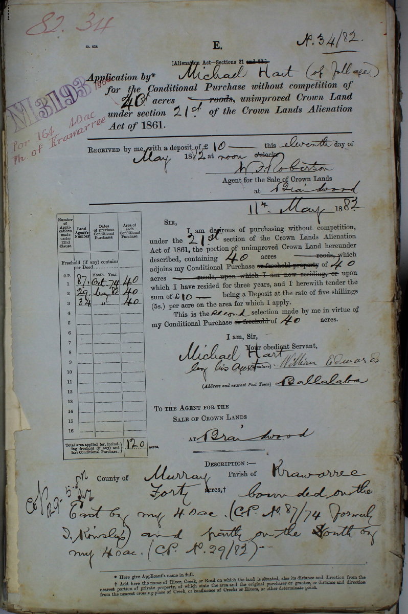
EXPLANATORY NOTE. All three Lots were Conditional Purchases (CPs), effected under the 1861 provisions of Crown Lands Alienation Act, or later equivalents. Anyone could 'select' a 40-acre block for a fee of £40 plus a commitment to occupy the block for three years and spend a further £40 on improvements during the first 3 years. A deposit of £10 was required immediately, with the remainder due within 3 years and attracting 5% interest p.a. It could take many years before Selections were converted to freehold (in the case of Lot 7, 73 years!). The first 2 digits show the year of the 'Selection', e.g. 82/34 means item 34 of 1882.
The earliest land acquisition near what is now Bunhybee was in 1828, a mere 4km north. Much of the land thought to be desirable was spoken for by the early 1840s. An earlier version of Property History in the area contains a lot of additional information, but needs revision to account for the new and authoritative information on the page that you're currently reading. The late dates at which the three Bunhybee Lots were bid for suggests that they were not highly valued.
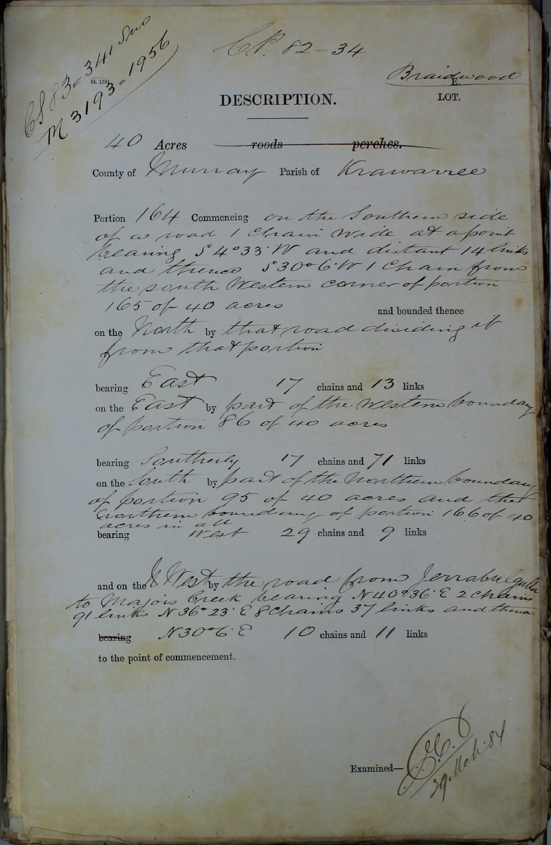
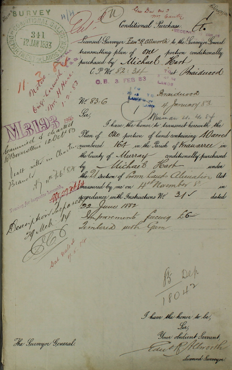
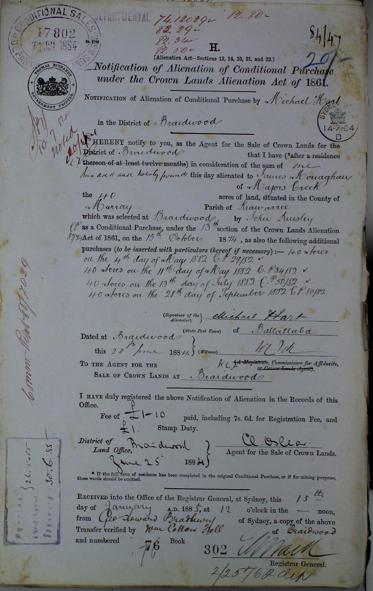
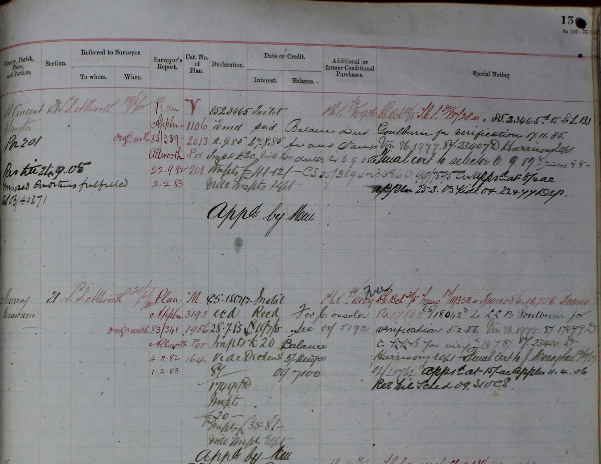
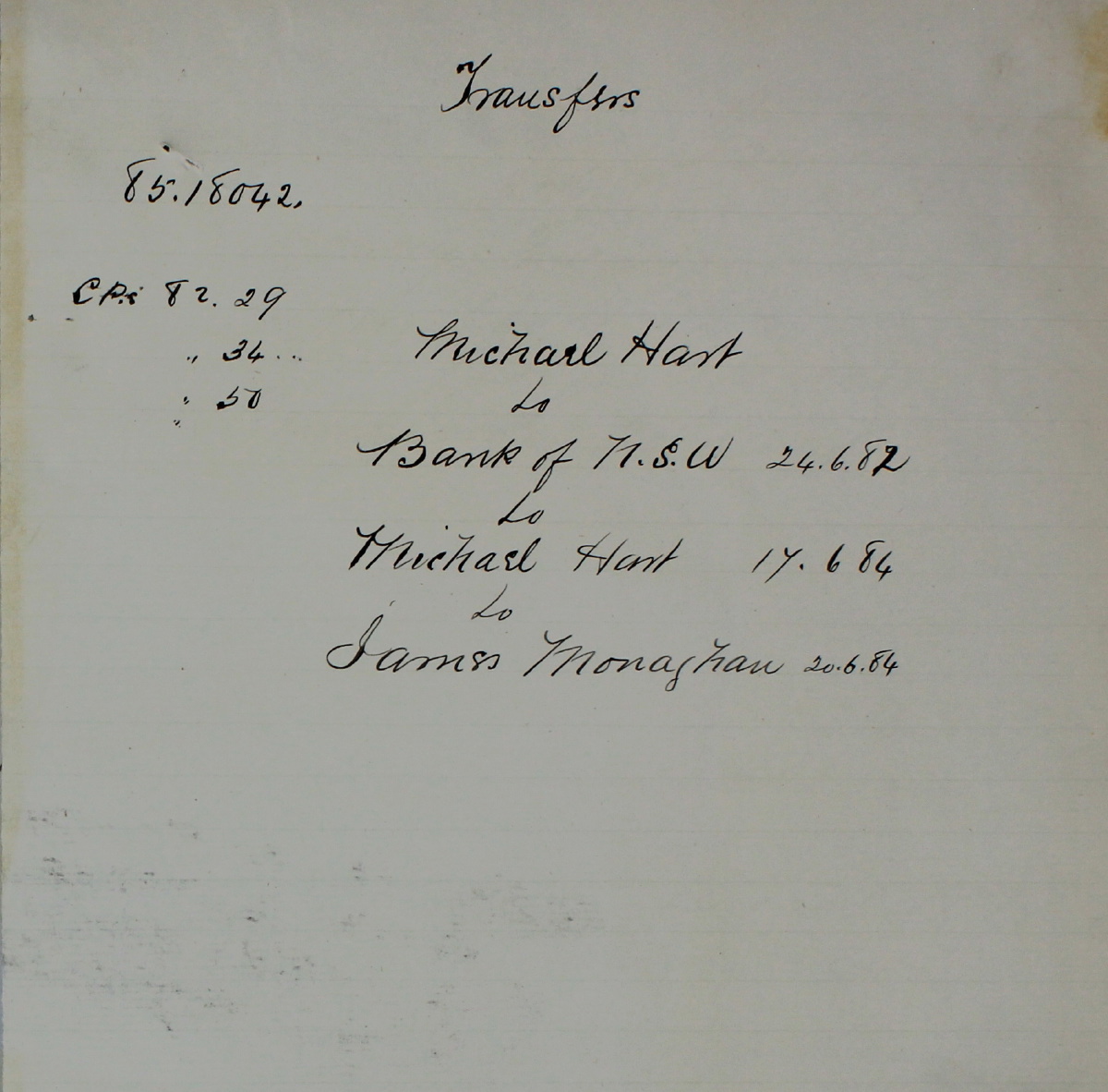
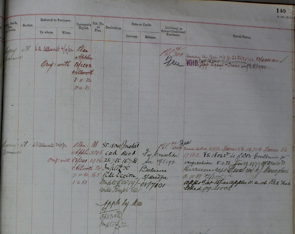
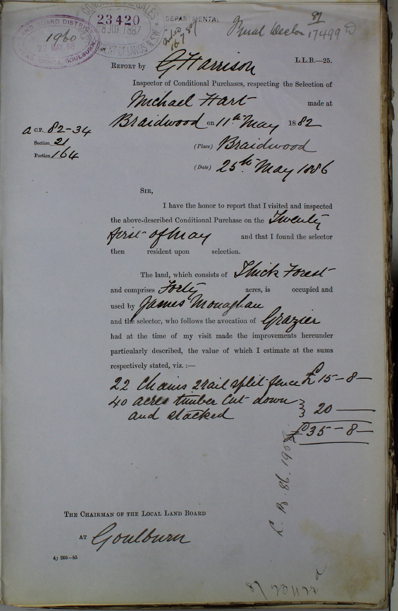
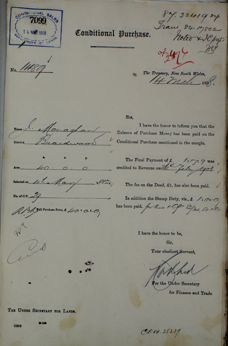
Lot 164 (the Southern Block, originally CP 82/34) was applied for by Michael Hart of Ballal(l)aba on 11 May 1882 – p.1, p.2, p.3, p.4, and surveyed on 4 November 1882. It passed to the Bank of NSW on 24 June 1882, then back to Michael Hart on 17 June 1884, for transfer to James Monaghan on 20 June 1884. James Monaghan was b. 25 Feb 1841 (or 1842), and hence 43 at the time, and resident in Majors Creek. Here is the CP Registry entry – left-side, right-side. Here is a summary of the sequence, from the file.
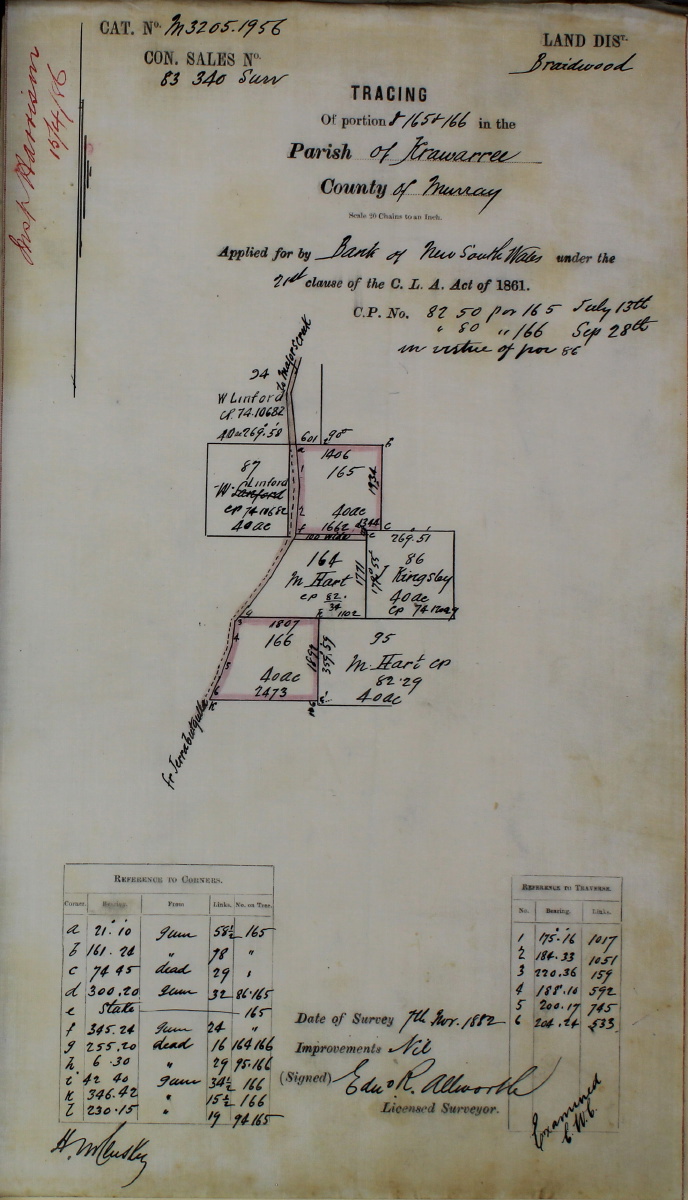
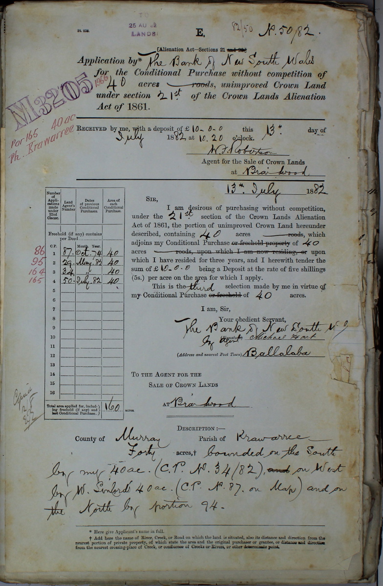
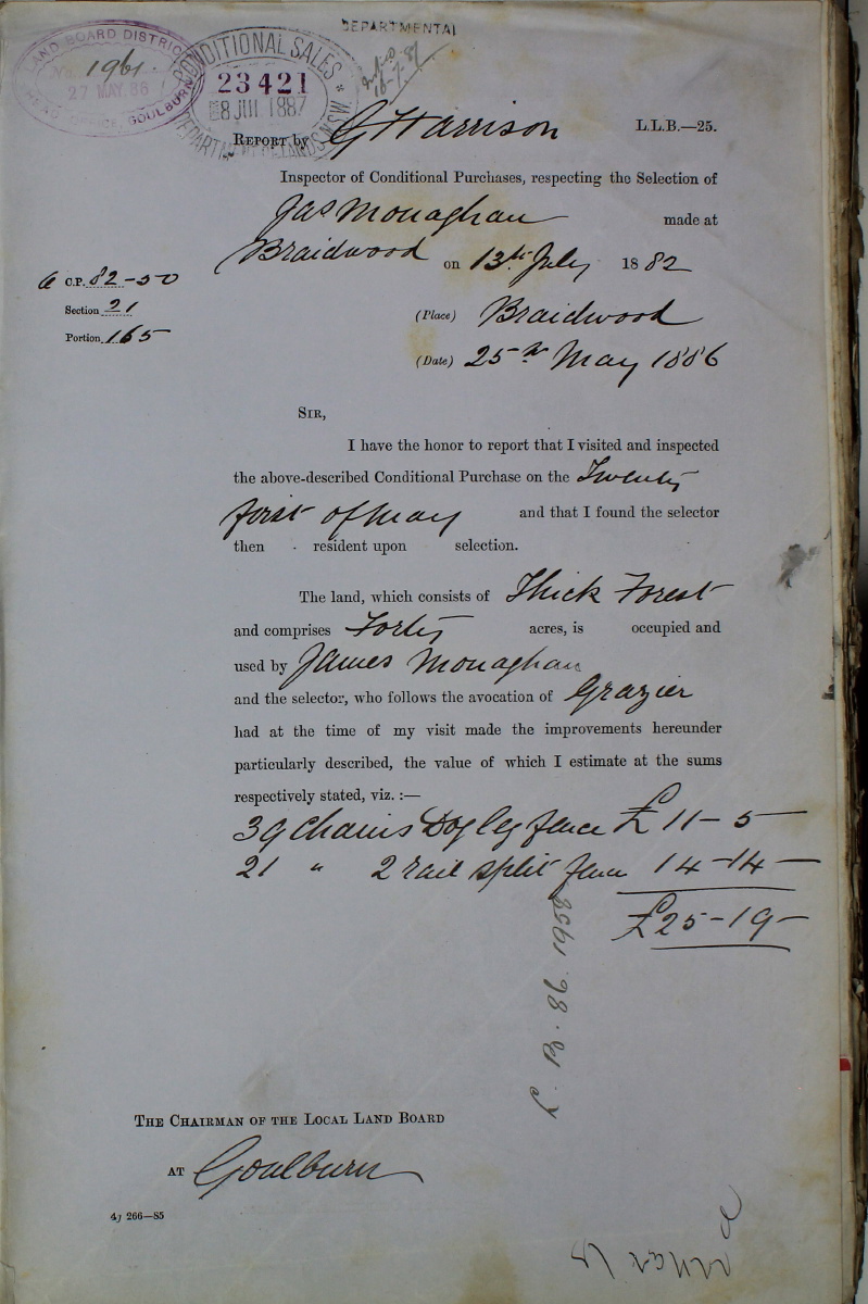
Lot 165 (the Central Block, originally CP 82/50) was "selected" by Michael Hart on 13 July 1882 and surveyed on 7 November 1882. It was acquired by the Bank of NSW on 13 July 1882 – p.1, p.2, p.3, p.4, transferred from the Bank to Michael Hart of Ballal(l)aba on 17 June 1884, and "alienated" to James Monaghan on 20 June 1884. Here is the CP Registry entry – left-side, right-side.
During 1883, a game was played relating to the designated road on Lot 164 – a game that continues to this day.
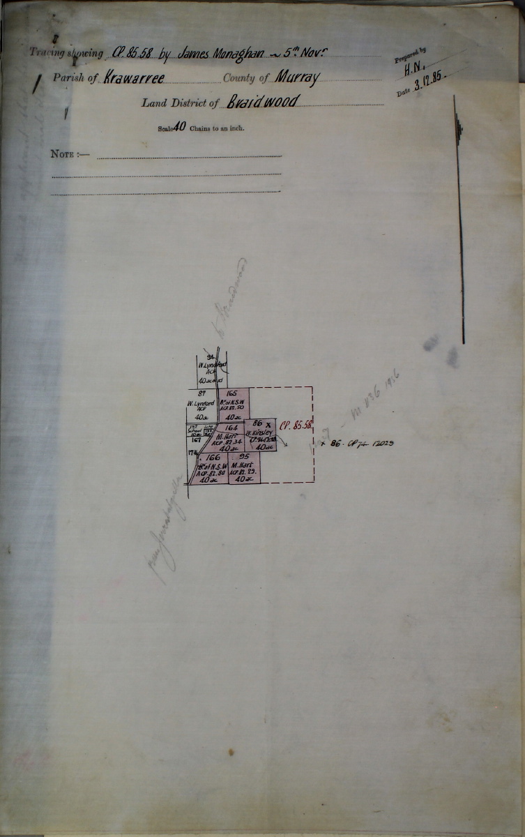
On 3 December 1885, Monaghan made Declarations in respect of 5 CP Lots on the Eastern side of Jerrabattgulla Rd – map, p.2.
In May 1886, Surveyor Allworth reported as follows:
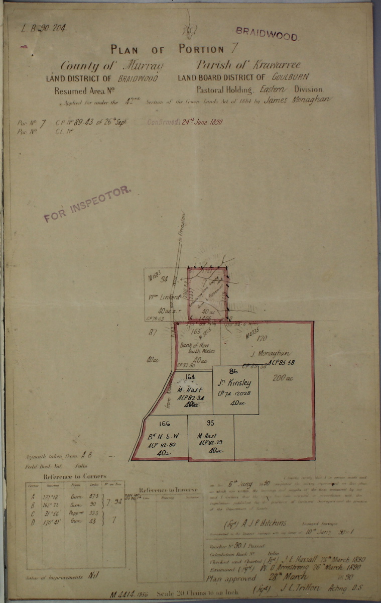
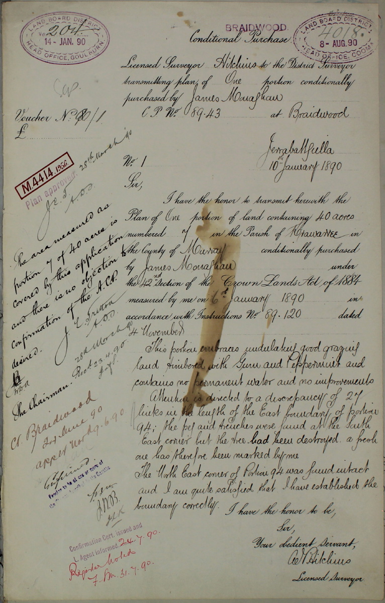
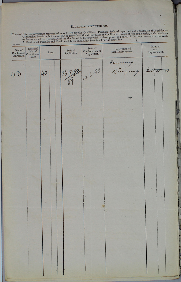
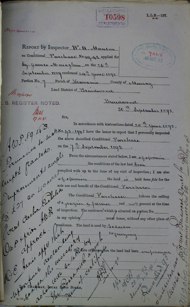
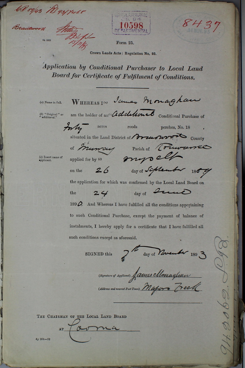
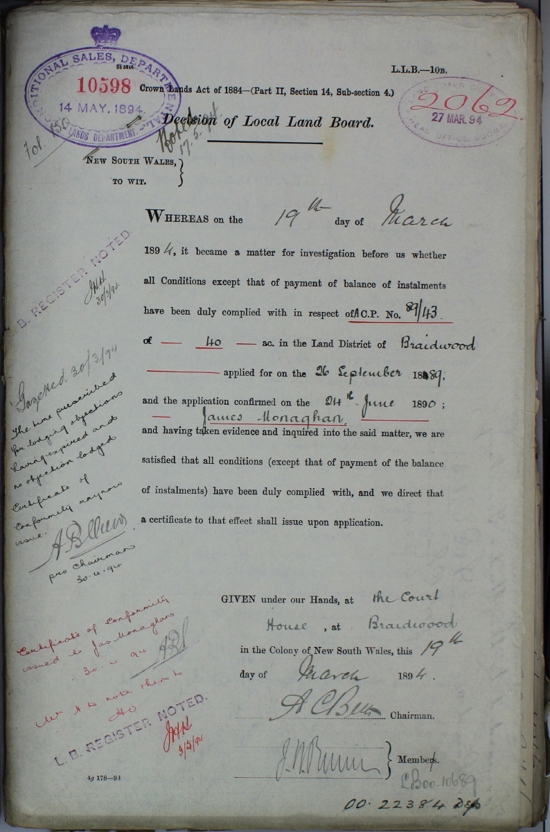
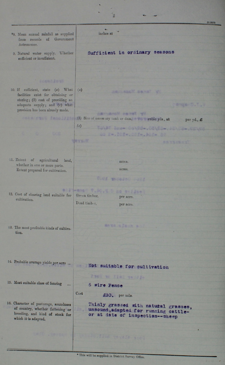
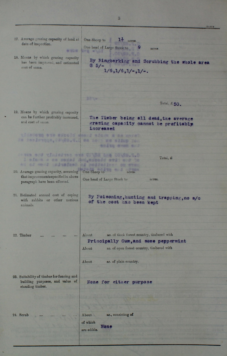
Lot 7 (the Northern Block, originally CP 89/43) was applied for by James Monaghan on 26 September 1889. Here is the application, p.2, p.3, p.4, and p.5. Here is the CP Register entry – left-side, right-side. Monaghan was 48, and it may have been about the last block he acquired. The Survey Report of 10 January 1890 describes Lot 7 as "undulating good grazing land timbered with Gum and Peppermint, and contains no permanent water and no improvements". (The dam dates from late in the 20th century). Monaghan made an Application on 18 May 1891 to vary the Improvements required under the terms of the CP (but the details are unclear).
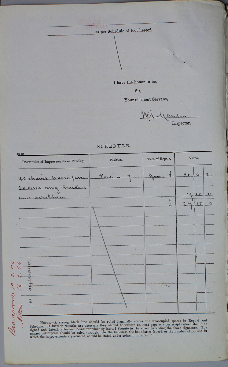
Monaghan made a succession of Declarations, on 19 June 1893, 22 July 1893 and 7 November 1893, p.2. The Lot was inspected on 7 September 1893, and approved. He then applied for a Certificate of Fulfilment of Conditions on 7 November 1893. The Inspection Report of 19 March 1894 notes 40 chains (800m) of fence (about half the perimeter), and "30 acres ringbarked and scrubbed" – so the Lot was cleared between early 1890 and early 1893, at latest by early 1894. He received approval dated 19 March 1894. Here is Lot 7's Tenure Card.
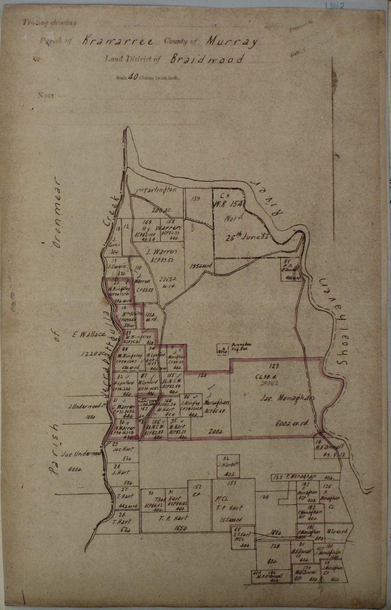
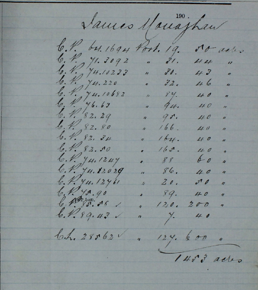
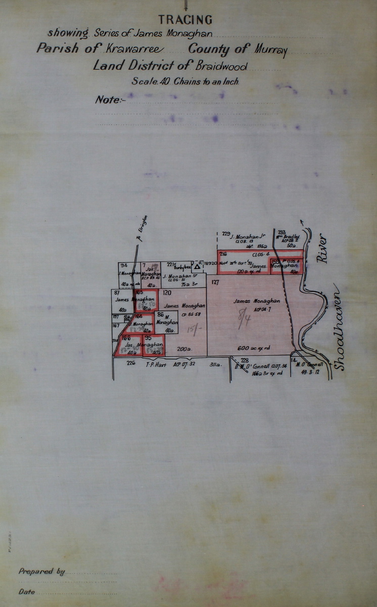
Monaghan appears to have been at Back Creek (West of Major's Creek) until 1887, but to have taken up residence at the Warragandra homestead c. 1888-1890. This was (and remains) on a Lot immediately to the South-West of Bunhybee, beside Oranmear / Jerrabattgulla Creek. (The date is based on a sworn statement that Monaghan made on 26 July 1902, that he had lived on the holding 12 or 14 years).Monaghan's complete holdings at about 10 Aug 1900 appear to have been about 1453 acres, along the Jerrabattgulla and across the saddle to the Shoalhaven – map, list.
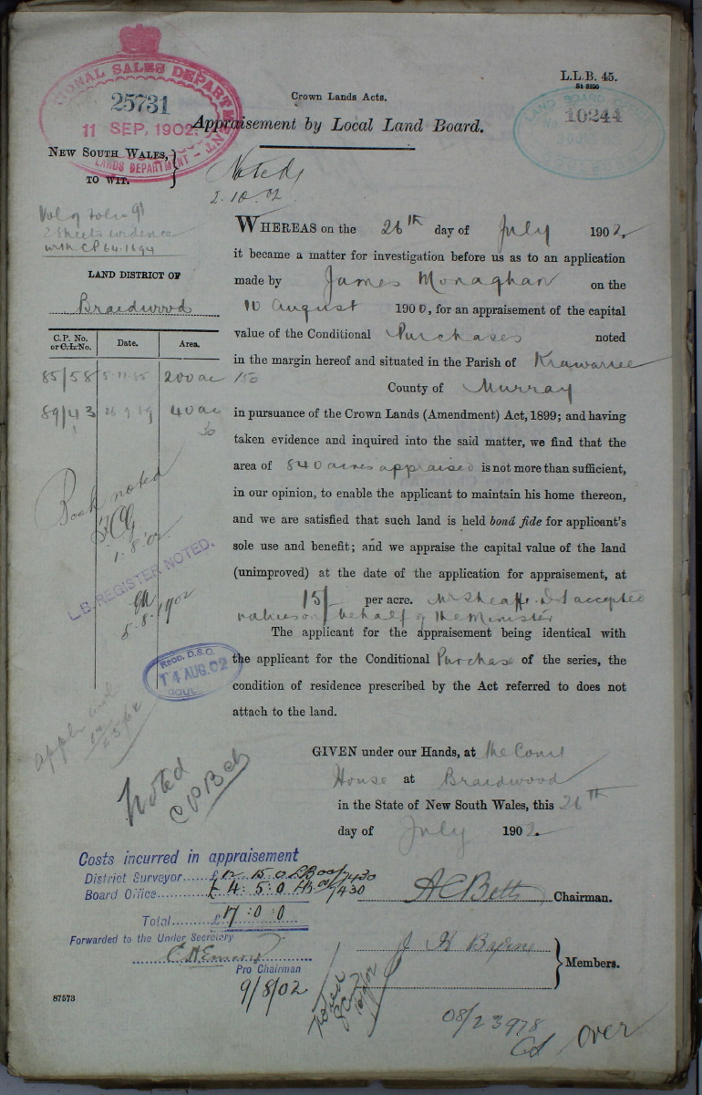
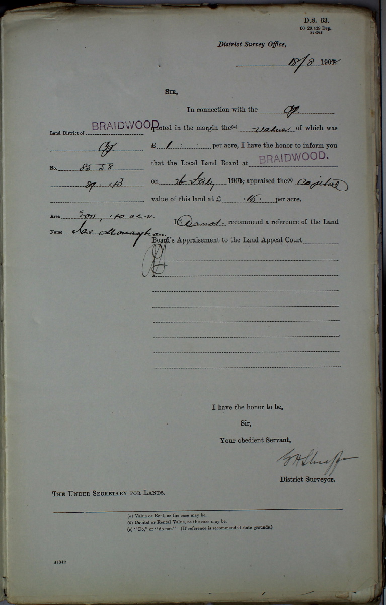
He declared soon afterwards that the 1415 acres he then held were "not more than sufficient to maintain a home". An 'Appraisement' was undertaken of his entire property on 17 March 1902 – p.1, p.2, p.3, list. Shortly afterwards, on 26 July 1902, a separate Appraisement was undertaken of Lot 7 and the larger block above it to the East – p.1, p.2.
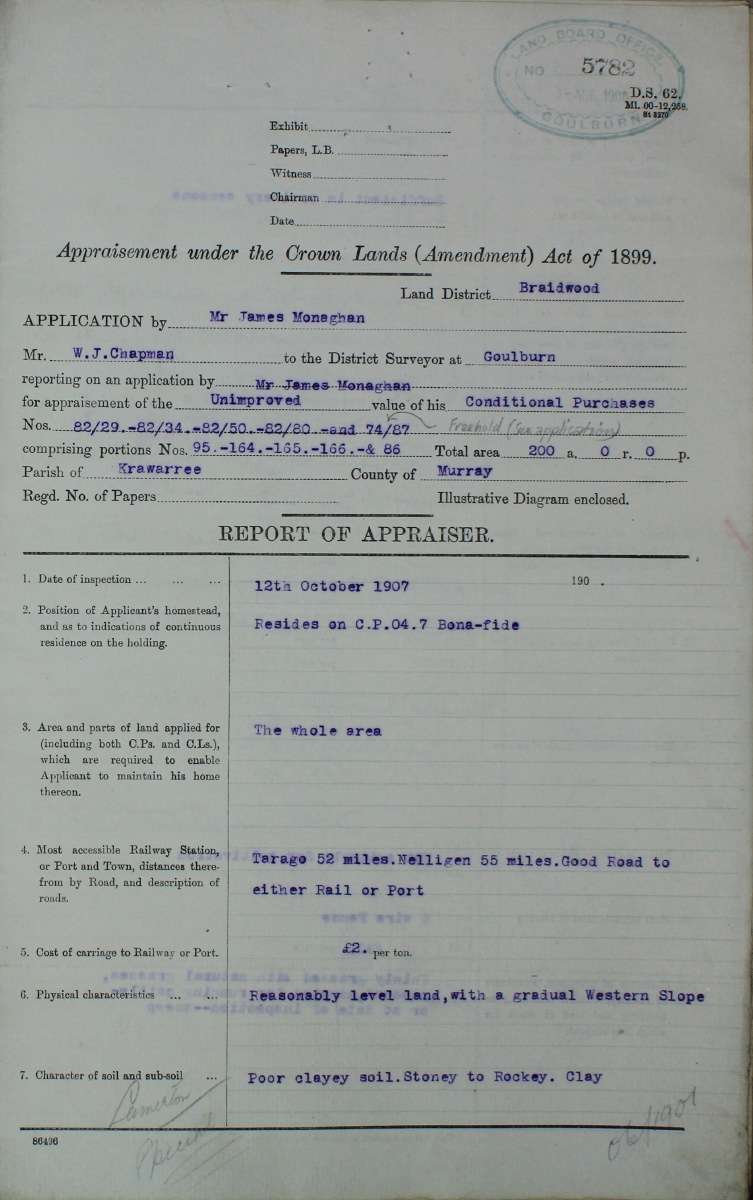
An Appraisement of 5 C.P.'s on the eastern side of the road was undertaken on 12 October 1907 – p.1, p.2, p.3. The report noted that the nearest railway station was Tarago, at 52 miles, and the nearest port was Nelligen, at 55 miles, with "Good Road to either Rail or Port", at a cost of carriage of £2 per ton. The physical characteristics of the 5 Lots (as a whole) was "Reasonably level land, with a gradual Western Slope". The character of the soil and sub-soil was "Poor clayey soil. Stoney to Rockey. Clay". The worst blocks were 95 and 166 (i.e. what is now Parlour Grasslands). Monaghan had at that stage a fairly substantial property, running from Warragandra northwards, and eastwards over the saddle to the Shoalhaven, comprising 889 ac. freehold, 200 ac. Ch. (?) and 640 ac. CP-approved.
The final payments on Lots 164 and 165 were made on 26 February 1908, presumably to consolidate more of the CP into freehold, in preparation for sale – acquittal here. As late as 14 August 1908, when he was 67, James Monaghan's address was still "Warragandra", Ballallaba.
The Lot 7 file contains reference to Michael Joseph Quilty, then of Nerriga, on 7 April 1909, when Monaghan was 68. Quilty appears to have bought the property on 20 April 1916 – see Lot 7's Tenure Card.
James Monaghan d. in Braidwood on 20 Jan 1919, so aged 77 or 78. (Monaghan's Probate papers include a statement that he sold his farming assets "about five years" before his death, i.e. c. 1914, which is near enough). He had been a bachelor all his life and had no known children. He had been bed-ridden for the previous year. He owned property in Braidwood, and had cash in the bank, but lived in the house of his sister, who was "the residuary legatee and devisee".
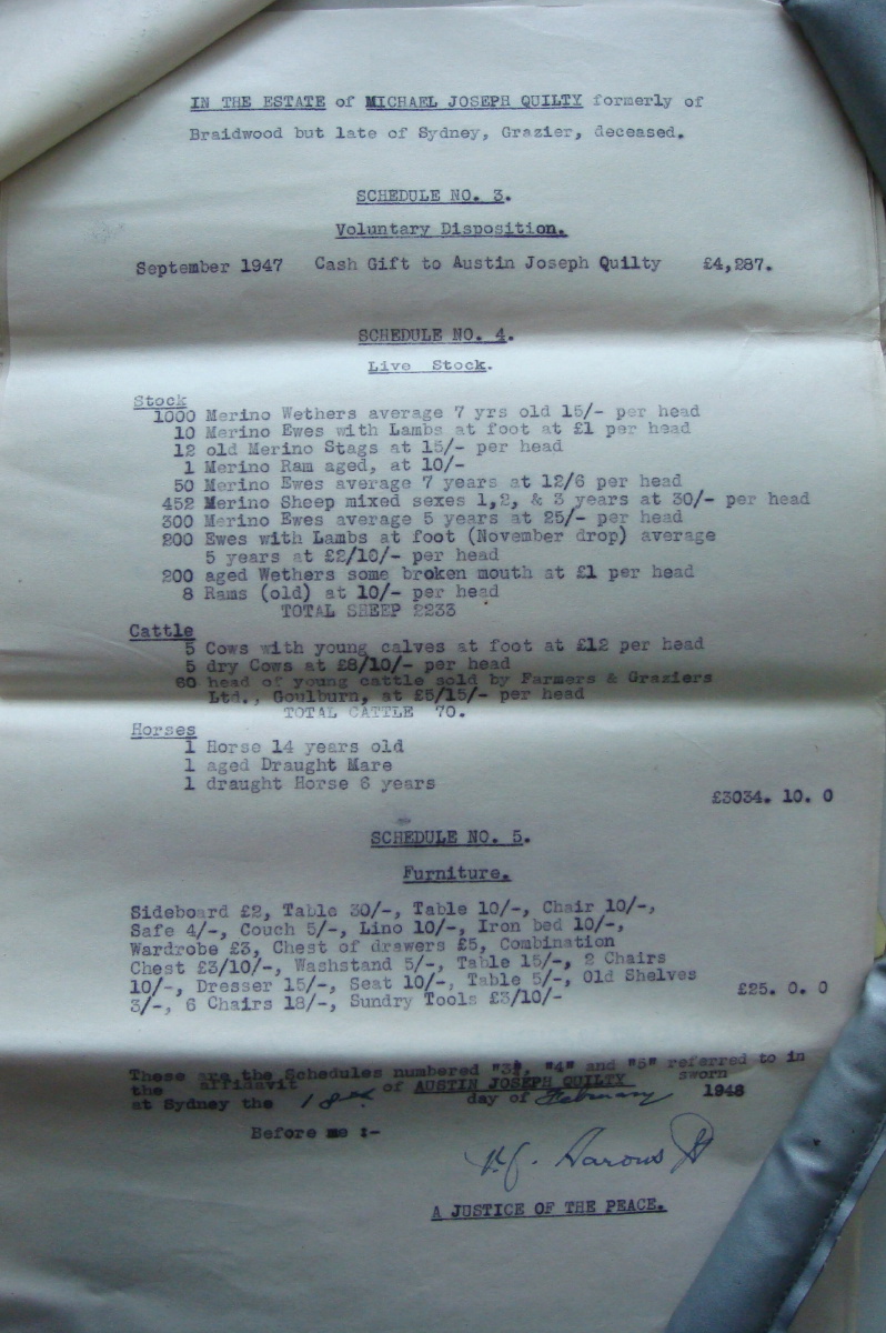
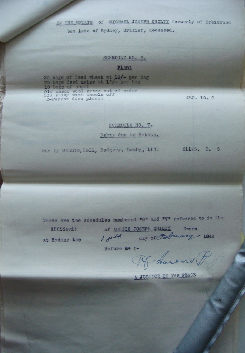
Mick Quilty worked the property for between 30 and 40 years, but appears to have retired to Manly in the mid-to-late 1940s, suffering age and a debilitating disease. He died there, at the home of his sister-in-law, Gwendoline Patricia Quilty, in Mosman, on 11 Nov 1947. His Will was dated 8 October 1947 – p.1, p.2, p.3, p.4, p.5. He left:
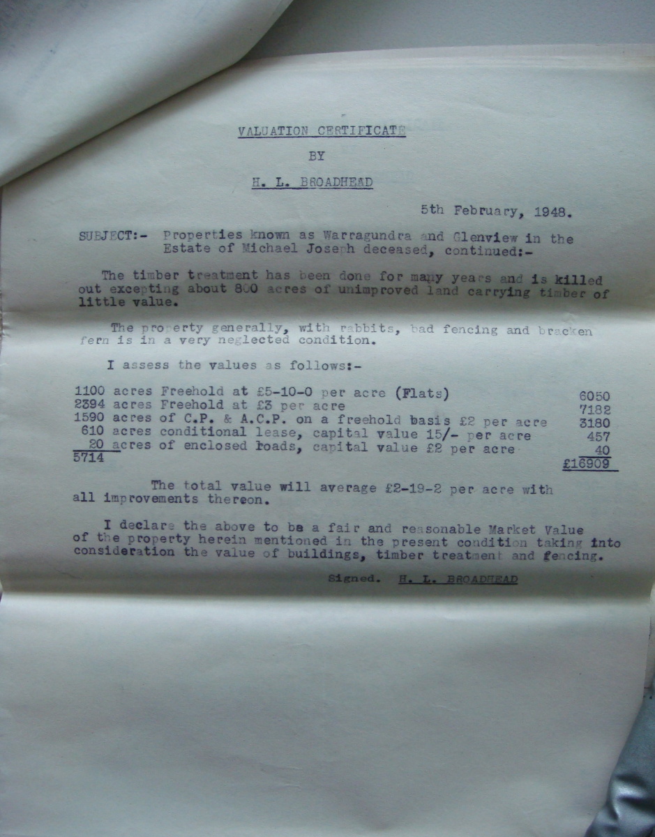
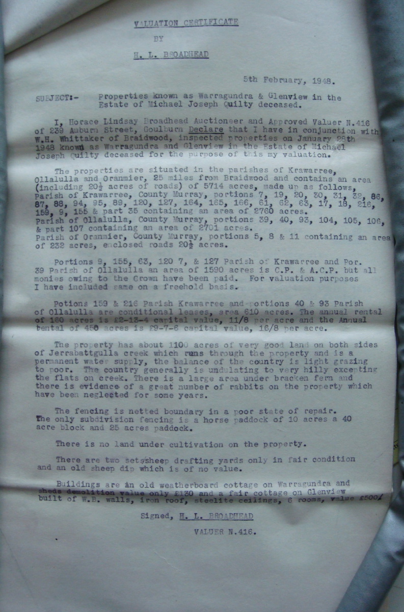
The Valuation Certificate of 5 February 1948 – p.1, p.2 – showed the two properties as comprising:
"The timber treatment has been done for many years and is killed out excepting about 800 acres of unimproved land carrying timber of little value" (presumably on the western side of Glenview).
"The property has about 1100 acres of very good land on both sides of Jerrabattgulla Creek which runs through the property and is a permanent water supply, the balance of the country is light grazing to poor. The country generally is undulating to very hilly excepting the flats on the creek. There is a large area under bracken fern and there is evidence of a great number of rabbits on the property which have been neglected for some years. ... There is no land under cultivation on the property. ... Buildings are an old weatherboard cottage on Warragandra and sheds demolition value only £130 and a fair cottage on Glenview built of W.B. walls, iron roof, steelite ceilings, 6 rooms, value £500".
The segment that includes what is now Bunhybee passed to the Dove siblings of Goulburn (Thomas Vincent, Desmond and Mary, spinster), on 27 February 1953.
Lot 7 appears to have been converted from a C.P. to freehold only on 5 September 1967 – Lot 7's Tenure Card.
Trish Downes invested a great deal of time and expertise in researching this matter, in discovering, accessing and copying the information, and in interpreting it. She did so in the context of her ANU History Honours work – for which she unsurprisingly was awarded First Class Honours – but we benefited enormously from her efforts!
This is a page within the Bunhybee Grasslands Web-Site, home-page here, and site-map here
Created: 8 October 2012; Last Amended: 3 December 2012